


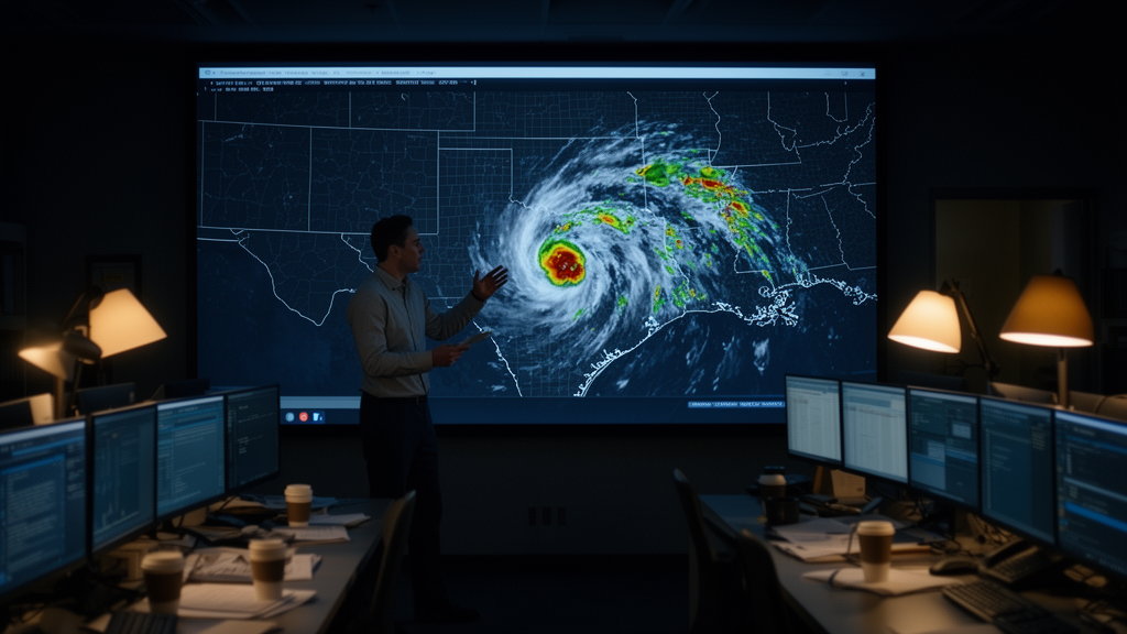
In the early hours of 4 July 2025, the Guadalupe River rose with terrifying speed through the Texas Hill Country, claiming at least 135 lives and inflicting property losses exceeding 20 billion dollars in one of the deadliest inland flood events in United States history. A new peer-reviewed analysis published in Natural Hazards and Earth System Sciences by Anupal Baruah of the University of Alabama and colleagues has now dissected, hour by hour, why the nation’s operational flood forecasting pipeline failed to signal the true magnitude of the catastrophe. The study is a sobering post-mortem of the National Oceanic and Atmospheric Administration’s forecasting chain, tracing the error from misplaced rainfall predictions in atmospheric models all the way down to flooded buildings that never appeared on official inundation maps.
The meteorological setup was extraordinary. Remnant moisture from Tropical Storm Barry, which had made landfall in Mexico days earlier, was drawn northward into a persistent mid-level trough, where a mesoscale convective vortex and a strengthening low-level jet fueled successive back-building thunderstorms over the Hill Country. Between 3 and 6 July, parts of the upper Guadalupe basin accumulated more than 500 millimeters of rain, with localized totals approaching 460 millimeters on 4 July alone. Radar-based estimates and rain gauges showed hourly rates reaching 100 millimeters per hour between 02:00 and 05:00, and rainfall intensities surpassed 100-year return period thresholds for durations from 3 to 24 hours when compared against NOAA Atlas 14 frequency curves.
The landscape itself amplified the danger. The region’s steep slopes and clay-rich soils, which have earned it the nickname Flash Flood Alley, convert intense rainfall into runoff with brutal efficiency. USGS stream gauges recorded hydrographs that defied belief: at Hunt, downstream of the confluence of the North Fork and South Fork of the Guadalupe River, flow reached roughly 8,261 cubic meters per second at 05:05, far exceeding the 500-year return period flow of about 4,161 cubic meters per second. At Kerrville, the peak of about 8,316 cubic meters per second crossed the 500-year threshold of 7,938. Most striking was the speed: both gauges climbed from ordinary conditions to the 500-year level within just one to one and a half hours.
Crucially, the evidence points to the ungauged South Fork Guadalupe River as the dominant contributor to the extreme peak at Hunt. The North Fork gauge never exceeded its 25-year return period flow, a difference that cannot be explained without a massive inflow from the South Fork, the catchment that drains the area around Camp Mystic, where many of the fatalities occurred. Because no operational USGS stream gauge existed on the South Fork at the time, this contribution cannot be directly verified from in-situ observations, but the timing of the peak and the spatial distribution of rainfall strongly support the conclusion.
To understand why forecasts missed the event, the team examined the National Water Model short-range streamflow forecasts, which provide hourly predictions out to an 18-hour range and are driven by the High-Resolution Rapid Refresh model’s 3-kilometer quantitative precipitation forecasts. Using the FIMserv tool, they generated 306 forecasted flood inundation maps between 3 and 4 July. The comparison with observations was stark. Early forecasts showed no flooding at North Fork, and only forecasts generated between 04:00 and 07:00 on 4 July jumped to flows of 120 to 600 cubic meters per second. At Hunt, the 04:00 forecast suggested flow crossing 500 cubic meters per second, while the observed peak was more than sixteen times larger. At Kerrville, no high-flow signal appeared at all until the 06:00 forecast, and at Comfort the first meaningful indication came only after 10:00.
The authors identify two primary sources of this failure. First, the HRRR model misplaced and underestimated the convective rainfall. Successive forecast cycles placed the convective core in different locations across the upper Guadalupe basin, a spatial inconsistency the researchers call a changing signal location, so the National Water Model produced runoff predictions that shifted from one basin to another with each update. This behavior is consistent with documented limitations of the HRRR in warm-season convection, including a tendency to dissipate nocturnal mesoscale convective systems too rapidly, displacement errors of intense precipitation cells on the order of 100 to 150 kilometers, and a two-to-four-hour lag in the diurnal evolution of convective available potential energy. For small basins under 1,000 square kilometers, which are precisely the ones prone to flash flooding, such errors translate directly into underpredicted and mistimed flood peaks.
The second failure was mechanical and equally consequential. The USGS gauge near Hunt failed during the fast-rising limb of the flood, and the peak of roughly 315,000 cubic feet per second, about 8,910 cubic meters per second, is recorded as an estimated rather than observed value, reconstructed after the event from surveyed high-water marks. The National Water Model constrains its forecasts through streamflow nudging in its analysis and assimilation cycle, adjusting simulated discharge toward gauge observations and propagating the correction downstream through Muskingum-Cunge routing. With the Hunt gauge offline, the incoming flood wave entered the routing network without observational constraint, allowing rainfall-driven errors to accumulate downstream and progressively degrade both discharge forecasts and the inundation maps derived from them.
To evaluate the maps themselves, the team built a benchmark flood extent from USGS high-water marks, filtering the survey data for quality, removing global and spatial outliers using interquartile range and Local Moran’s I statistics, and interpolating a continuous water surface with a hydrologically conditioned algorithm before subtracting a 10-meter digital elevation model. Against this benchmark, the forecast maps performed poorly until very close to the event. Near Camp Mystic, where the benchmark indicated 118 affected buildings, the 04:00 forecast captured only 18 and the 05:00 forecast 72. At Hunt, the benchmark showed 133 buildings impacted against just 2 in the 04:00 forecast. At Kerrville, the benchmark counted 140 flooded buildings while the 06:00 forecast showed one. At Comfort, 188 buildings were flooded according to the benchmark, but no buildings appeared in forecasts until 13:00, when 25 were predicted. Notably, two locations with similar categorical skill scores experienced very different levels of impact, underscoring the authors’ argument that skill metrics alone cannot convey flood consequences.
The study closes with concrete prescriptions. The authors call for complementary observations beyond the telemetered USGS network, including dense networks of low-cost water-level sensors, bridge-mounted radar or acoustic flood sensors, and camera-based discharge estimation, since no single alternative can match the sub-hourly resolution needed for a flood that exceeded the 500-year threshold in under 90 minutes. They see particular promise in taskable commercial satellite radar constellations, pre-configured to image flash-flood-prone basins when heavy rain outlooks are issued, and in probabilistic flood inundation mapping that replaces binary flood-or-no-flood outputs with exceedance probabilities tied to predefined emergency action triggers, such as precautionary road closures at moderate probability over campsites or evacuation preparation at high probability over residential zones. The authors also caution that forecast quality is only one component of an effective early warning system, with warning dissemination, interpretation, and evacuation timing all shaping outcomes. Their analysis stands as both a technical diagnosis and a blueprint for making the next flash flood in Flash Flood Alley less lethal.
Subject of Research: Post-event evaluation of operational flood forecasting performance during the 4 July 2025 Guadalupe River flash flood in Central Texas
Article Title: Brief communication: Rise of the Guadalupe River – a multifaceted post event analysis of 4 July 2025, flood in Central Texas
Article References: Baruah, A., Munasinghe, D., Cohen, S., Abdelkader, M., Devi, D., Chen, Y., Vergara, H., & McDermott, R. (2026). Brief communication: Rise of the Guadalupe River – a multifaceted post event analysis of 4 July 2025, flood in Central Texas. Natural Hazards and Earth System Sciences, 26(10), 4753-4762. https://doi.org/10.5194/nhess-26-4753-2026
Image Credits: AI Generated
DOI: 10.5194/nhess-26-4753-2026
Keywords: flash flood, Guadalupe River, Texas Hill Country, National Water Model, flood inundation mapping, HRRR, data assimilation, high-water marks, early warning systems, NOAA, USGS, probabilistic forecasting
Cite Scienmag News
Violet Maxwell. (October 9, 2026). Why the Forecasts Missed the Deadly Texas Flood of July 2025. Scienmag. https://scienmag.com/why-the-forecasts-missed-the-deadly-texas-flood-of-july-2025/
Violet Maxwell. "Why the Forecasts Missed the Deadly Texas Flood of July 2025." Scienmag, 9 October 2026, https://scienmag.com/why-the-forecasts-missed-the-deadly-texas-flood-of-july-2025/. Accessed 9 October 2026.
Violet Maxwell. "Why the Forecasts Missed the Deadly Texas Flood of July 2025." Scienmag. October 9, 2026. https://scienmag.com/why-the-forecasts-missed-the-deadly-texas-flood-of-july-2025/


