

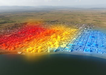
Geospatial models map urban growth and thermal conditions in Bahir Dar
A geospatial study found that built-up land expanded sharply in Bahir Dar between 1992 and 2022, while models projected further ...
A geospatial study found that built-up land expanded sharply in Bahir Dar between 1992 and 2022, while models projected further ...

A multiscale Landsat analysis found that Cooch Behar’s built-up area grew 180.36% from 1990 to 2022 while becoming more evenly ...
A three-decade satellite analysis of India's Suti River Basin shows fallow land collapsing from over half the catchment to a ...
A new study combining Landsat satellite analysis and household surveys finds that Burayu Town's built-up area grew by 31.85 percent ...
A new study finds that the conservation-managed zone of Nigeria's Ise Forest Reserve supports taller, more diverse forest than disturbed ...

Embark on a thrilling journey of discovery with Scienmag.com—your ultimate source for cutting-edge breakthroughs. Immerse yourself in a world where curiosity knows no limits and tomorrow’s possibilities become today’s reality!