As coastal populations burgeon and grapple with the relentless tide of rising sea levels, the urgency to safeguard these vulnerable zones intensifies. In a compelling new study emerging from the University of Illinois Urbana-Champaign, researchers reveal how a crucial hydrological principle, known as Hack’s law, can offer transformative insights into the management and restoration of river deltas worldwide. These dynamic landforms serve as natural buffers against oceanic encroachment, and understanding their growth mechanisms is paramount for designing resilient infrastructures and effective flood mitigation strategies.
Discovered in the mid-20th century, Hack’s law originally described a proportional relationship between the length of a river’s longest tributary and the overall size of its drainage basin. While this principle has long illuminated the architecture of river networks, its application to the deltaic landscapes—where rivers disperse sediment and build new land—has remained largely unexplored. The research team, led by civil and environmental engineering professor Hongbo Ma, bridges this gap by establishing that river deltas themselves follow analogous growth patterns dictated by Hack’s law, thereby unveiling predictive frameworks crucial for environmental engineering.
Rivers carve their way through the landscape by aggregating countless tributaries, which channel sediment-laden water from diverse catchments. At the river’s terminus, rather than converging, the flow diverges into distributary channels that deposit sediments, gradually constructing deltas. These landforms are essential for coastal habitat diversity, agriculture, and human settlements but face existential threats from subsidence and sea-level rise. Understanding the sedimentary growth and channel branching behavior within these deltas is therefore foundational to sustaining their protective functions.
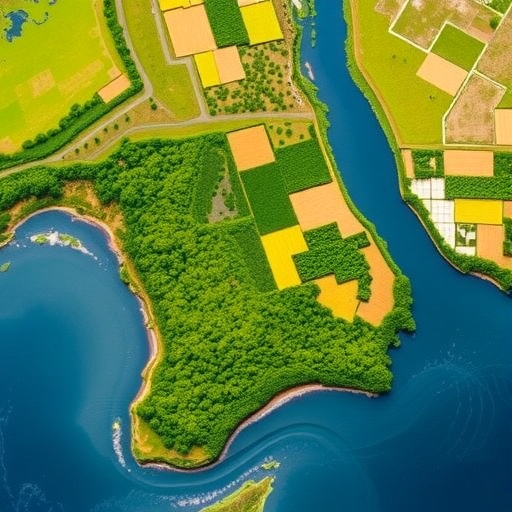
Utilizing advanced satellite imagery spanning decades, the multidisciplinary research team meticulously analyzed 29 globally distributed river deltas, ranging from the Wax Lake Delta in Louisiana to the Po River Delta in Italy. These detailed temporal and spatial observations uncovered two distinctive growth patterns: uniform and composite. Some deltas exhibited consistent expansion across multiple channels, aligning closely with the linear scaling predicted by Hack’s law, which suggests a balanced distribution of sediment flow and land accretion.
In contrast, other deltas showed composite growth behaviors characterized by an initial rapid expansion akin to the diffusion of ink in water, followed by a deceleration phase, where growth became concentrated along a few dominant channels. This dichotomy challenges previous simplistic assumptions about delta morphodynamics and introduces nuanced temporal dynamics into how sediment dispersal may vary as environmental conditions and channel networks evolve.
The tangible implications of these findings are immense for coastal management and engineering practices. By harnessing this understanding, planners can estimate potential land gain or loss simply by assessing channel lengths—a readily measurable parameter—thereby optimizing the placement and scope of restoration projects. This approach promises to increase the efficacy of human interventions intended to stabilize deltaic environments, funnel scarce resources toward high-impact zones, and improve community resilience against flooding and sea-level rise.
Moreover, the study underscores the interconnectedness of natural systems and human infrastructure, proposing a scientific basis for integrating empirical delta growth laws into predictive models. Such integration enhances decision-making processes aimed at maintaining land supply rates critical to sustaining agricultural productivity, protecting biodiversity, and supporting economic activities in low-lying regions globally. Given the accelerating threats posed by climate change, these insights arrive at a pivotal moment for adaptive water resource management.
The team’s methodological innovation in applying Hack’s law to deltaic systems is a testament to the power of satellite data synthesis in addition to classical geomorphological principles. This synergy enables unprecedented tracking of morphological changes at fine scales over extended periods, facilitating dynamic models that incorporate both physical processes and anthropogenic influences. Notably, this observational study sets a foundation for subsequent experimental and modeling work to explore feedbacks between hydrodynamics, sediment transport, and channel evolution under diverse environmental scenarios.
Supporting institutions for this research include the National Science Foundation, NASA, and the Agencia Española de Investigación, reflecting the global relevance and interdisciplinary collaboration underpinning these findings. Contributions from partner universities, including the University of Texas Rio Grande Valley, University of California Irvine, Universidad de Zaragoza, and the University of Texas at Austin, further highlight the international effort behind advancing geoscience and environmental engineering frontiers.
For coastal communities worldwide, this research provides a crucial tool: the ability to anticipate and influence deltaic land formation in quantifiable terms. Whether combating erosion, planning infrastructural defenses, or promoting ecological restoration, this framework offers a scientifically robust metric to guide interventions. The dual recognition of uniform and composite growth pathways enriches the strategic palette available to engineers and policymakers, making it possible to refine projections on protective land growth with greater confidence.
Beyond immediate practical applications, the study invigorates an age-old scientific curiosity about how complex natural landscapes organize themselves. Hack’s law, once confined to upland stream networks, now extends into the realm of delta morphology, illustrating a remarkable universality in fluvial processes. This conceptual leap bridges hydrology, sedimentology, and environmental design, inviting further exploration of how fractal and scaling principles manifest across Earth’s surface systems.
Professor Hongbo Ma’s team has effectively demonstrated how relatively simple mathematical relationships can unlock profound insights into natural forms that have long eluded precise description. Their work symbolizes the intersection of tradition and innovation—revitalizing mid-20th-century theory through the lens of modern remote sensing and computational analysis. It opens doors for future research that could refine regional models of sediment deposition under changing climate regimes, further empowering adaptive strategies for deltaic preservation.
As climate change continues to accelerate sea-level rise and intensify storms, protecting and restoring river deltas becomes ever more critical. This research provides a beacon of hope, illustrating that by understanding the fundamental laws controlling delta growth, we can enhance stewardship of these vital landscapes, ensuring they continue to shield millions of people and myriad ecosystems from the encroaching sea.
Subject of Research: River delta morphology and sediment deposition patterns
Article Title: Apparent Hack’s law in river deltas
News Publication Date: 30-Apr-2026
Web References:
https://www.science.org/doi/10.1126/science.ady6805
Image Credits: Image courtesy NASA and the U.S. Geological Survey
Keywords: River deltas, Hack’s law, sediment deposition, coastal restoration, flood protection, satellite imagery, environmental engineering, delta growth patterns, climate change adaptation
