


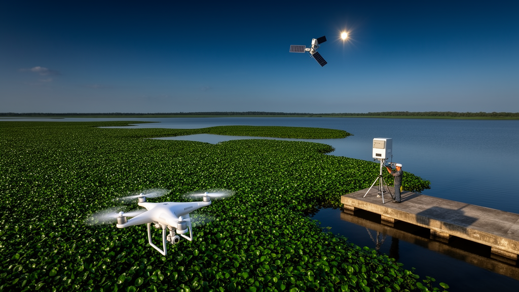
Water hyacinth, the floating plant with lavender flowers that has choked lakes and rivers from Lake Victoria to the Mekong Delta, is finally meeting its match in the sky. A sweeping new review published in Environmental Monitoring and Assessment synthesizes two decades of research on how satellites, drones, aircraft and radar can detect, map and ultimately outmaneuver one of the planet’s most aggressive invasive species. Drawing on 56 studies published between 2004 and 2025, the review charts a remarkable technological evolution: from labor-intensive airborne surveys over California’s delta to deep-learning pipelines that now identify individual plant species, growth stages and even pollution stress from orbit. The authors, led by Daniel H. C. Salim of the Universidade Federal de Minas Gerais in Brazil, argue that the field has reached an inflection point where remote sensing can move beyond simply spotting the weed to actively guiding its control.
The plant itself is a formidable adversary. Originating in the Amazon Basin, Eichhornia crassipes escaped its native range in the 1800s and has since earned a place on the International Union for Conservation of Nature’s list of the world’s 100 worst invasive species. Its secret is a buoyant architecture: swollen, air-filled petioles keep rosettes afloat while fibrous roots dangle below, and clonal growth through stolons allows populations to double with astonishing speed. In nutrient-rich, slow-moving waters, mats can reach biomass densities exceeding 60 kilograms per square meter. These floating carpets block sunlight, starve aquatic plants of photosynthesis, deplete oxygen and collapse native biodiversity. The socioeconomic toll is equally severe, as clogged waterways disrupt transport and fishing, and control campaigns drain local economies. Paradoxically, the same plant serves as a sensitive bioindicator, accumulating heavy metals and responding spectrally to pollutants such as endocrine disruptors and neonicotinoids, which makes it both a menace and a diagnostic tool.
The review traces how observation technology matured through distinct eras. In the mid-2000s, manned airborne campaigns using the HyMap hyperspectral sensor over the Sacramento–San Joaquin River Delta established the methodological baseline, proving that narrow spectral bands could separate water hyacinth from co-occurring vegetation. Handheld spectroradiometers such as the ASD FieldSpec Pro provided ground-truth precision, revealing in South African experiments that red-edge indices could detect chlorophyll changes caused by heavy metals and biocontrol weevils. The real transformation came with satellites. Early platforms like SPOT-5 and MODIS offered broad coverage but coarse resolution, while Landsat’s four-decade archive enabled retrospective analyses. The decisive turning point arrived in 2015 with Sentinel-2, whose 10-to-20-meter pixels, five-day revisit and red-edge bands made it the dominant platform in recent studies, appearing in 31 percent of the reviewed literature.
Each sensor family brings distinct strengths. Hyperspectral instruments, capturing hundreds of contiguous bands, excel at species-level discrimination and phenological tracking. Drone-mounted versions have pushed this capability to remarkable scales: a study using the Nano-Hyperspec sensor on a UAV achieved 94 percent overall accuracy in the California Delta, outperforming the 85 percent of an airborne HyMap survey, and successfully separated water hyacinth from structurally similar plants like Pontederia cordata and Trapa natans using indices built around near-infrared reflectance at 780 and 900 nanometers. Multispectral satellites trade spectral depth for scalability and continuity. Sentinel-2’s red-edge bands improved classification accuracy by nearly 10 percent compared with Landsat, and long NDVI archives have linked water hyacinth presence to urban wastewater inputs in small reservoirs worldwide.
Synthetic Aperture Radar adds an entirely different dimension: the ability to see through clouds, at night, in any season. This matters enormously in the tropics, where persistent cloud cover blinds optical sensors precisely when infestations explode. Studies in Vembanad Lake in India and the Winam Gulf of Lake Victoria in Kenya demonstrated that dense water hyacinth mats alter radar backscatter enough to be distinguished from open water, with true-positive rates of 90 to 98 percent over thick infestations. Five-year Sentinel-1 time series have mapped the weed’s expansion across Lake Victoria and tracked seasonal dynamics in Indian wetlands, where temporal variations in the VV polarization channel closely matched actual coverage. Yet radar has limits. Detection rates collapsed to 35 to 40 percent in low-density patches, exactly the regime that matters most for early warning, and wind-roughened water can mimic the volumetric scattering of vegetation.
On the analytical side, the field has climbed what the authors call an analytical ladder. Simple NDVI thresholds, such as values above 0.3 or 0.4 to flag floating vegetation, remain popular for their simplicity and compatibility with decades of Landsat data. NDVI values between 0.6 and 0.95 tracked seasonal biomass in Lake Tana, Ethiopia, and median reservoir NDVI correlated with water hyacinth cover with an R-squared of 0.91 in Portuguese studies. But where multiple floating species coexist, spectral confusion undermines thresholds. Machine learning classifiers, particularly Random Forest and Support Vector Machines, now routinely exceed 85 percent accuracy, and object-based image analysis that segments imagery into meaningful patches has pushed detection accuracies above 99 percent in some settings. Deep learning represents the frontier: U-Net segmentation of five-band drone imagery achieved a mean Intersection over Union of 97 percent, while a two-dimensional CNN trained on Sentinel-2 data reached 95.9 percent accuracy in detecting invasive aquatic plants along Spain’s Guadiana River.
The review also delivers a sobering reality check on accuracy claims. Overall accuracy figures above 95 percent are often inflated by the vast open-water background that dominates aquatic scenes. One study reported nearly 99 percent overall accuracy but only 67 percent user’s accuracy for water hyacinth itself, meaning a third of detections were false positives. Another recorded 85 percent overall accuracy yet just 70 percent producer’s accuracy for the target species, the worst among eight plants studied, owing to confusion with similar floating species. Validation design compounds the problem: when reference samples come from the same imagery being classified, systematic errors escape scrutiny entirely. The authors call for consistent reporting of class-specific metrics and spatially independent validation as prerequisites for credible cross-study comparison.
Perhaps the most actionable insight concerns timing. Chlorophyll-sensitive indices such as the Normalized Difference Chlorophyll Index consistently rise before NDVI signals canopy growth, and in Lake Tana, peaks in chlorophyll-a and suspended sediment preceded water hyacinth biomass peaks by about a month. This lead time of days to weeks offers a genuine early-warning window. Environmental correlations reinforce the predictive potential: lake levels, turbidity with a two-month lag, nutrient concentrations and surrounding urban land cover all statistically anticipate infestation expansion. In Sri Lanka, high-resolution Planet imagery has even been used to estimate recoverable biomass across 28 water bodies, converting invasion maps into circular-economy opportunities for biochar, compost and bioenergy production.
What distinguishes this review is its insistence that detection alone is not management. Since 2021, multi-platform studies combining drones with satellites have surged, with 37 percent of the analyzed research now using two or more platforms. Drone orthomosaics at 5-to-6-centimeter resolution calibrate Sentinel-2 classifications, replacing laborious ground-truthing, while satellite data guide UAV deployment to priority hotspots. The authors distill these practices into a decision-support framework built on five pillars: multi-scale sensor fusion anchored by weekly optical-radar time series; classification schemes that encode species identity, anchorage state and phenological stage rather than mere presence; a scalable analytical ladder matching algorithmic complexity to management urgency; early-warning indicators exploiting pre-emergence physiological signals; and feedback loops that feed monitoring results back into intervention planning and evaluation. Knowing whether a mat is flowering or senescent, free-floating or rooted, determines whether harvesters, netting or biological control is the right response.
The challenges that remain are as much institutional as technical. Data harmonization across platforms, model transferability between ecosystems, and the persistent gap between published methods and field operations all constrain progress. The review’s own limitations, including its restriction to English-language, DOI-traceable literature, mean that valuable operational knowledge from affected regions may be missing. Still, the trajectory is unmistakable. As climate variability and nutrient pollution intensify pressure on freshwater systems worldwide, the convergence of free satellite archives, cheap drones and increasingly accessible machine learning offers resource-strapped managers something they have never had: a responsive, scalable early-detection system for a weed that has historically outpaced every attempt to contain it. The lavender blooms may keep coming, but for the first time, the watchers above the water are seeing them coming first.
Subject of Research: Remote sensing methods and decision-support frameworks for monitoring and managing the invasive aquatic plant Eichhornia crassipes (water hyacinth)
Article Title: Remote sensing for monitoring and managing Eichhornia crassipes: a review of methods, applications, and decision-support frameworks
Article References: Salim, D. H. C., Mello, C. C. S., Pereira, G., Maretto, R. V., & Amorim, C. C. (2026). Remote sensing for monitoring and managing Eichhornia crassipes: a review of methods, applications, and decision-support frameworks. Environmental Monitoring and Assessment, 198(9), Article 1024. https://doi.org/10.1007/s10661-026-15788-y
Image Credits: AI Generated
DOI: 10.1007/s10661-026-15788-y
Keywords: water hyacinth, Eichhornia crassipes, remote sensing, invasive species, Sentinel-2, Sentinel-1 SAR, UAV monitoring, hyperspectral imaging, machine learning, deep learning, NDVI, freshwater ecosystems
Cite Scienmag News
Blake Davidson. (October 18, 2026). Satellites, Drones and Radar Join Forces to Track the World’s Worst Water Weed. Scienmag. https://scienmag.com/satellites-drones-and-radar-join-forces-to-track-the-worlds-worst-water-weed/
Blake Davidson. "Satellites, Drones and Radar Join Forces to Track the World’s Worst Water Weed." Scienmag, 18 October 2026, https://scienmag.com/satellites-drones-and-radar-join-forces-to-track-the-worlds-worst-water-weed/. Accessed 18 October 2026.
Blake Davidson. "Satellites, Drones and Radar Join Forces to Track the World’s Worst Water Weed." Scienmag. October 18, 2026. https://scienmag.com/satellites-drones-and-radar-join-forces-to-track-the-worlds-worst-water-weed/


