

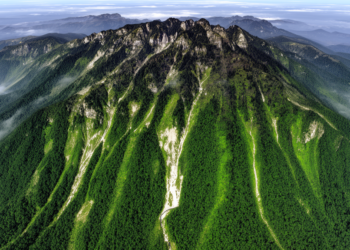
Google Earth Engine maps Fanjing Mountain vegetation change and zonation
A Google Earth Engine analysis found significant vegetation improvement across 41.65% of Fanjing Mountain from 1987 to 2022 and mapped ...
A Google Earth Engine analysis found significant vegetation improvement across 41.65% of Fanjing Mountain from 1987 to 2022 and mapped ...

A national satellite study estimated that Lebanon’s wheat area ranged from 27,212 to 69,194 hectares across 2017–2025, with sharp contractions ...
Object-based machine-learning models mapped burned forests from Sentinel-2 imagery, retaining overall accuracies above 83% in transfer tests at selected Mediterranean ...
A retrospective study of Spain’s 2025 Jarilla wildfire found that extreme atmospheric drying and continuous, water-stressed fuel drove widespread high ...
A study of 533 Italian schoolchildren combining satellite imagery with psychometric scales found that children in highly natural residential areas ...
Researchers turned tourist photos on Instagram into 1,238 ground truthing points to validate a satellite-based map of the lenga beech ...
A fifteen-year satellite analysis of Benin's inselberg landscapes reveals steep declines in forest and wooded savanna and shows that protected ...
A new review of 56 studies shows how satellites, drones and radar are transforming the fight against water hyacinth, one ...
A new national-scale mapping effort using high-resolution satellite imagery has produced Indonesia's first government-endorsed extent maps of coral reefs, seagrass ...
Using Sentinel-2 imagery, object-based image analysis and a random forest classifier, researchers produced the first high-accuracy map of Bai Tu ...

Embark on a thrilling journey of discovery with Scienmag.com—your ultimate source for cutting-edge breakthroughs. Immerse yourself in a world where curiosity knows no limits and tomorrow’s possibilities become today’s reality!