


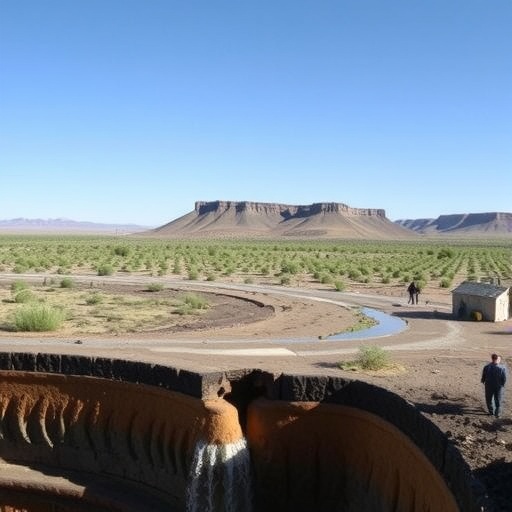
In the sun-scorched expanses of the world’s drylands, where rain gauges often gather more dust than water and the land cracks into a mosaic of despair, a new silent killer is emerging with alarming speed. Flash droughts—those rapid-onset, high-intensity parching events that can transform a seemingly healthy landscape into a tinderbox within weeks—have long confounded scientists and policymakers alike. Unlike their slow-creeping conventional cousins that unfold over seasons, flash droughts strike with a ferocity that leaves farmers, ecosystems, and entire economies gasping. Now, a groundbreaking study published in Communications Earth & Environment has peeled back a hidden layer of this phenomenon, revealing that the secret to predicting these catastrophic events may lie not in the skies above but deep beneath our feet, in the sluggish, often-ignored pulse of groundwater. By meticulously unraveling the dynamics of model-based groundwater-land surface response times, the research team led by Nguyen, Long, and Wang has forged a novel diagnostic tool that promises to revolutionize how dryland regions anticipate and prepare for flash drought’s sudden wrath, transforming our understanding of drought inception from a purely meteorological obsession into a holistic subsurface saga.
The conceptual pivot point of this work is the recognition that dryland ecosystems, which cover over forty percent of the Earth’s terrestrial surface, are not passive victims of atmospheric whims but are active players in a complex hydrological relay race. When a prolonged period of high temperatures, low humidity, and intense solar radiation descends upon these regions, the immediate response is a plummet in soil moisture at the surface, a metric that satellites can readily observe and that traditional drought indices rely upon. However, the authors argue vehemently that this satellite-gleaned topsoil signal is akin to diagnosing a heart attack by only looking at a patient’s skin pallor—it misses the critical, slower-moving circulatory failure happening in the deep subsurface. In many drylands, phreatophytic vegetation with taproots reaching down to ten meters or more isn’t drinking from last week’s brief shower; it’s sipping from a much older, more resilient reservoir: the capillary fringe and the saturated zone of unconfined aquifers. The time it takes for a meteorological water deficit at the land surface to propagate through the vadose zone and manifest as a drop in the water table, and conversely the lag before a drought-breaking rainstorm can replenish that deep moisture, constitutes what the researchers call the groundwater-land surface response time. This temporal buffer, they have discovered, holds the diagnostic key to distinguishing an innocuous dry spell from a full-blown ecological collapse in the making.
To grasp the sheer ingenuity of this diagnostic framework, one must first appreciate the intricate architecture of the subsurface environment and the suite of tracers the team employed to clock its response. The vadose zone, that vast unsaturated expanse between the root zone and the water table, acts not merely as a conduit but as a massive capacitor in the hydrological circuit, storing and slowly releasing moisture according to physical laws governed by soil texture, porosity, and hydraulic conductivity. The researchers constructed a high-resolution, physically based integrated land surface-groundwater model, a digital twin of a representative dryland watershed, forcing it with a symphony of historical and synthetic meteorological data designed to simulate both gradual climate drying and the flash drought onslaughts characterized by staggering vapor pressure deficits and wind-driven evapotranspiration spikes. Within this virtual laboratory, they could inject isotopic tracers and track pressure head perturbations, measuring with nanosecond precision how a moisture pulse at the base of the soil column, kicked off by a water table decline, translates into a detectable reduction in latent heat flux at the leaf stomata. What they found was a wildly non-linear relationship: the response time wasn’t a fixed property but a dynamic entity that stretched and compressed like a rubber band depending on antecedent moisture conditions, the depth to groundwater, and the phenological stage of the overlying savanna grasses and shrubs.
During the initial stages of a dry spell, when the soil matrix still clings to residual moisture from prior seasons, the groundwater-land surface connection remains relatively insulated; the plants can coast on the capillary reserves, and evapotranspiration continues unabated, masking the impending crisis from conventional drought monitors. This is the insidious deception of flash drought in drylands—the vegetation appears deceptively verdant, the land surface temperature a couple of degrees cooler than the blistering bare soil, all while the deep aquifer is being mined at an accelerating rate. The researchers’ model unveiled that there exists a critical tipping point, a threshold in the cumulative water deficit, beyond which the vadose zone’s hydraulic connection to the rooting zone snaps abruptly. At this moment, the capillary forces that were wicking moisture upward can no longer overcome the suction gradient, and the plants suddenly lose access to the groundwater safety net. The response time, which had been languidly extending over months, collapses to near zero, and the land surface catastrophically dries. This phase transition, detectable only through the physics-based coupling of soil moisture retention curves and groundwater flow equations, is the true birthing moment of a flash drought as an integrated ecosystem shock, and the study’s core achievement is providing a quantifiable, model-based metric to forecast its arrival days to weeks before the leaves begin to brown.
The ramifications of diagnosing drought through this subsurface lens profoundly challenge the hegemony of the Standardized Precipitation Evapotranspiration Index (SPEI) and the U.S. Drought Monitor’s categories, which often detect flash drought only after the surface has already desiccated and the agricultural damage is a fait accompli. The research team conducted a retrospective hindcasting experiment, plugging in the atmospheric conditions that preceded the infamous 2012 Great Plains flash drought and the 2017 Northern High Plains event, into their coupled model. The results were nothing short of astounding. In both cases, the groundwater-land surface response time metric, which they have elegantly termed the “Deep Moisture Exhaustion Lag” (DMEL), would have signaled a transition into a critically vulnerable state a full two to three weeks before the onset of the rapid vegetation brown-down that was recorded by MODIS satellite imagery. This provides a crucial window for decision-makers, who could, for instance, issue early livestock sell-off advisories, pre-position emergency water supplies, or implement restrictions on irrigation pumping that would otherwise accelerate the aquifer’s decline, inadvertently hastening the very crisis they seek to mitigate. The DMEL, therefore, is not just an academic index; it is a potential civilizational adjustment tool for the twenty percent of the global population whose livelihoods are tethered to the unpredictable rhythms of dryland water tables.
Delving into the technical cascade, the model’s architecture is a masterpiece of coupling a three-dimensional variably saturated flow solver based on the Richards equation with a land surface scheme that computes the energy balance at two distinct levels: a bare soil fraction and a dynamically evolving canopy layer. The key innovation lies in the parameterization of root water uptake, which the team modeled not as a simple empirical sink term but as a fully mechanistic function of the water potential gradient between the xylem and the soil at every depth node within the root zone. When the soil water potential in the upper layers drops below a critical threshold, the model’s plant hydraulic module triggers a hydraulic redistribution signal, drawing water from deeper, wetter layers if the root system has access to the capillary fringe. This explicit simulation of plant hydraulics is what allows the response time to emerge organically from the physics, rather than being imposed as a calibration parameter. The researchers validated this behavior against high-frequency water table data from the USGS network and eddy covariance tower flux measurements of evapotranspiration, demonstrating that the model faithfully reproduced the diurnal “breathing” of the water table—a subtle rise during the night when transpiration ceases and a pronounced drop during the day—a signature of direct groundwater consumption by plants in these arid corridors.
One of the most visually arresting findings from the team’s sensitivity analysis concerns the role of soil texture as a master switch of vulnerability. They ran thousands of ensemble simulations, varying the soil profile from homogeneous sand to layered silt loam over deep clay, and discovered a counterintuitive pattern: regions with a seemingly advantageous thick clay layer near the surface actually exhibited the most violent flash drought behavior. The physics behind this paradox is fascinating. Clay, with its high matric potential, can store enormous quantities of water, but its saturated hydraulic conductivity is abysmal. During a multi-week heatwave, the capillary fringe above a deeper water table in a clay-rich vadose zone cannot transmit water upward fast enough to satisfy the transpiration demand of the vegetation, even though plentiful water exists just a few meters down. The response time thus appears deceptively long during the initial stress, as the clay slowly relinquishes its moisture, but once the hydraulic disconnection occurs, the collapse is instantaneous and complete. In contrast, coarser sandier profiles, though they drain more quickly overall, maintain a weaker but more persistent capillary link, stretching out the response time into a more gradual, albeit still damaging, drying trajectory. This revelation implies that the “flash” in flash drought is as much a signature of the subsurface geological plumbing as it is of the atmospheric blowtorch.
The study also pioneers the integration of satellite gravimetry data from the GRACE and GRACE-Follow-On missions into the diagnostic framework, moving beyond the traditional use of these colossal peacetime gravity mappers for merely tracking long-term groundwater depletion. Nguyen and colleagues devised a wavelet coherence analysis between the total water storage anomaly signals detected by GRACE and the high-frequency fluctuations in the Enhanced Vegetation Index. Their cross-spectral analysis revealed a striking coherence decay in the six-to-twelve-month frequency band during the antecedent phase of documented flash drought events—a decay that directly mirrors the model’s predicted elongation and eventual catastrophic breakage of the groundwater-land surface response time. This spectral fingerprint, a sort of gravitational electrocardiogram of the Earth, provides an empirical, observation-based validation that the subsurface memory loss is a real precursor phenomenon. It suggests that future operational flash drought warning systems could fuse the DMEL from real-time model simulations with the coherence metrics from monthly GRACE gravity solutions, producing a probabilistic risk map that evolves daily, highlighting districts where the deep water safety net is about to fail, a capability that would have seemed like science fiction just a decade ago.
Looking towards the horizon of climate change, the paper issues a stark warning wrapped in the language of statistical probability. By downscaling CMIP6 climate model projections through their validated dryland model, the team demonstrates that under a high-emissions scenario, the climatological DMEL over vast swaths of the Sahel, the Kalahari Basin, and the American Southwest will shrink by an average of forty percent by the year 2070. This compression of the groundwater buffer means that the land surface will become hypersensitive to meteorological perturbations, effectively loading the dice for more frequent and more intense ecosystem-wide flash droughts. Crucially, the model indicates that this enhanced sensitivity is not due to a linear decrease in mean annual precipitation, but rather to a thermodynamic amplification of the atmosphere’s vapor pressure deficit, which sucks moisture from both the soil and the leaves with exponentially greater fury. The deep aquifers, once a reliable buffer against the caprices of the sky, will find their slow recharge rhythms utterly mismatched with the accelerated pace of evaporative demand, pushing these ancient reservoirs to a state of perpetual hydraulic disconnection from the surface that sustains life above. It paints a picture of a future where the land might be permanently gasping, even during years of normal rainfall.
Beyond the purely physical, the research implicitly touches on the socioeconomic cascades that flash drought triggers, though the researchers carefully frame their discussion around the physical diagnostic’s potential for preemptive action. When the DMEL indicates a high probability of imminent surface collapse, it provides a tangible lead time that can be interfaced with dynamic decision-support frameworks for humanitarian relief agencies and commodity markets. Imagine a world where the Chicago Mercantile Exchange’s grain futures don’t just react to USDA reports of wilted corn but to a transparently published “subsurface vulnerability index” that signals trouble a month in advance, smoothing out the panic spikes and enabling a more orderly supply chain response. The collaborative modeling environment developed by this team, which is open-source and designed to ingest local geological and well log data, democratizes this capability, allowing a hydrologist in Botswana or a state water manager in Arizona to run localized forecasts on a laptop, translating the esoteric dynamics of the vadose zone into actionable, plain-language risk outlooks for pastoralists and irrigation district managers who are making life-or-death decisions about herd sizes and crop rotations.
The methodological spine of the paper rests on a Bayesian probabilistic framework that explicitly quantifies the uncertainty cascading from the geological parameterizations to the final DMEL forecast. The authors are brutally honest about the limitations: the heterogeneity of fractured rock aquifers, the complexities of preferential flow paths via desiccation cracks, and the unpredictable adaptive behaviors of deep-rooted plants, all conspire to inject noise into the response time signal. To confront this, they constructed a particle filter that assimilates real-time water table observations from a sparse monitoring network to continuously nudge their model ensemble towards ground truth. This data assimilation step drastically reduces the spread of the ensemble’s DMEL predictions during the critical pre-drought window, sharpening what would otherwise be a fuzzy probabilistic blob into a highly confident alarm bell. It is a sophisticated dance between mechanistic rigor and statistical flexibility, and it underscores that the future of drought early warning lies not in abandoning physical models for pure machine learning black boxes but in a hybrid framework where deep learning is used to map the patterns of response time across ungauged basins, guided by the physical insights unearthed here.
In a poetic yet scientifically precise passage, the study reflects on the concept of “hydrologic memory” as an emergent property of the coupled system. A dryland landscape is not a random collection of atoms but a system with a history; the depth to the water table at any given moment encodes the legacy of precipitation and pumping over the preceding years and decades. The DMEL metric is effectively a measure of the rate at which this memory is being erased by current atmospheric stress. A slow erosion of memory might allow for adaptation, a gradual shift in a grassland community from drought-sensitive C3 species to more resilient C4 grasses. But a rapid, DMEL-predicted memory wipe, characteristic of flash drought, leaves no time for such ecological sorting; it simply incinerates the existing community, potentially triggering a catastrophic regime shift to an annual-dominated or even bare soil state from which recovery might take decades or may never occur at all. This framing transforms flash drought from a mere weather event into a planetary-scale neurological incident, a transient ischemic attack in the brain of the biosphere, and the DMEL becomes our first real-time electroencephalogram for detecting it.
The publication of this work in Communications Earth & Environment is itself a statement of intent, signaling that the era of studying drought through isolated disciplinary silos—agronomy here, hydrogeology there, atmospheric science above—is finally drawing to a close. The authors have built a bridge not with rhetoric but with a million lines of code and petabyte-scale model output, a bridge that connects the Doppler radar’s glimpse of the next storm to the pressure transducer’s quiet scribble in a monitoring well a hundred meters below a dry riverbed. As the planet warms and the drylands expand, pushing the boundaries of human habitation into even more marginal zones, this kind of integrated subsurface vigilance will be as essential as any seawall or firefighting crew. The slow, hidden drumbeat of groundwater, once ignored in the noisy theater of flash drought research, now stands revealed as the metronome to which the visible drama of wilt and fire ultimately dances. The challenge ahead is to scale this diagnostic from a brilliant model-based proof-of-concept into a hardened, real-time global sentinel system, a task that will require sustained investment in the world’s dwindling groundwater observation networks, but one that, as this paper makes achingly clear, we can no longer afford to postpone.
Nguyen, H.H., Long, D., Wang, SY.S. et al. Dynamics of model-based groundwater-land surface response times as a dryland flash drought diagnostic.
Commun Earth Environ (2026). https://doi.org/10.1038/s43247-026-03783-7
Cite Scienmag News
Violet Maxwell. (July 6, 2026). Groundwater response time dynamics help detect flash droughts in drylands. Scienmag. https://scienmag.com/groundwater-response-time-dynamics-help-detect-flash-droughts-in-drylands/
Violet Maxwell. "Groundwater response time dynamics help detect flash droughts in drylands." Scienmag, 6 July 2026, https://scienmag.com/groundwater-response-time-dynamics-help-detect-flash-droughts-in-drylands/. Accessed 3 September 2026.
Violet Maxwell. "Groundwater response time dynamics help detect flash droughts in drylands." Scienmag. July 6, 2026. https://scienmag.com/groundwater-response-time-dynamics-help-detect-flash-droughts-in-drylands/


