


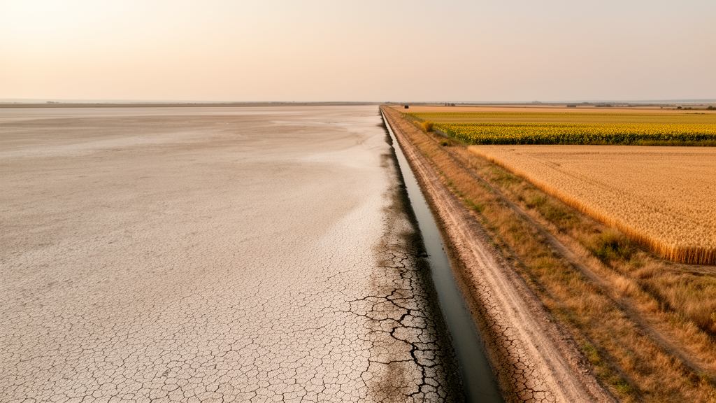
When the Kakhovka Dam collapsed on 6 June 2023, the immediate images were of floodwater surging downstream through Kherson. But the deeper agricultural catastrophe unfolded in slow motion on the dry side of the Dnipro River, where a Soviet-era reservoir had quietly sustained one of Ukraine’s most productive irrigation networks. A new study published in Frontiers in Remote Sensing has now quantified that collapse from orbit, showing that irrigated farmland in Kherson and Zaporizhzhia oblasts has shrunk by roughly 91 percent since before the war, and by 2025 had dwindled to a tiny fraction of its former extent.
The research, led by Sheila Baber of the University of Maryland College Park together with colleagues at Monash University and the University of Strasbourg, tackles a problem that has long frustrated satellite scientists: how do you measure something as subtle as irrigation in a territory you cannot enter? Ground surveys are impossible in occupied, front-line regions, and national statistics are too coarse and too slow to capture a rapidly evolving crisis. The team’s answer was a semi-supervised machine learning pipeline that blends multiple streams of satellite data into a single, field-scale picture of who still has water and who does not.
The technical core of the approach rests on a simple physical insight: irrigated fields look different from rainfed ones in measurable ways. They are cooler, because evaporating water carries away heat, a signal captured by the thermal infrared sensors aboard Landsat 8 and Landsat 9. They are greener and moister, which shows up in vegetation indices such as NDVI, NDMI, and the Green Chlorophyll Vegetation Index derived from Sentinel-2 imagery. And they consume more water than rainfall alone can supply, a discrepancy revealed by comparing actual evapotranspiration from the FAO WaPOR dataset against cumulative precipitation from the CHIRPS rainfall record. Each of these inputs was resampled to a uniform 30-meter resolution, matching the footprint of a Landsat pixel and the scale of the region’s large center-pivot fields.
Because no ground truth exists inside the war zone, the team had to bootstrap their own labels. For the years 2019 through 2022, they ran an unsupervised K-Means clustering algorithm across the multi-sensor feature stack, initially splitting the landscape into nine clusters to account for both crop type and water status. Analysts then assigned irrigation labels to each cluster by cross-checking against visible pivot irrigation systems, proximity to canals, and the behavior of vegetation, thermal, and evapotranspiration time series. These cluster-derived labels then trained a random forest model of 300 trees, which was applied to the uncertain years of 2023 through 2025, when the dam’s destruction meant that irrigation could no longer be assumed to follow historical patterns.
The transition year of 2023 posed particular challenges. Some fields showed early-season irrigation signatures before the dam failed and then dried out mid-season, creating an intermediate class the researchers called interrupted irrigation. Overgrown abandoned fields near the front lines also mimicked the wet, cool signatures of genuine irrigation. To handle these ambiguities, the team supplemented their automated pipeline with AlphaEarth embedding features, latent representations learned from global satellite data, and a small hand-labeled corpus of fewer than 500 reference points. For 2024 and 2025, they reverted to the original feature set, reasoning that fields still equipped for irrigation would be able to water their crops without interruption.
Validation relied on a stratified random sampling design, a statistical framework that corrects for the biases inherent in any classification map. The researchers drew 1,577 response points, stratified by how frequently each location had been mapped as irrigated between 2020 and 2023, and then photointerpreted each point using high-resolution Planet imagery and the same physical criteria used in classification. Because the strata were defined by irrigation frequency rather than by the map classes themselves, a post-stratification estimator was applied to produce bias-adjusted area figures with honest uncertainty bounds.
The numbers tell a stark story. Before the full-scale invasion, between 2019 and 2021, irrigated area in the two oblasts averaged 187.94 thousand hectares, with an uncertainty of plus or minus 14.43 thousand hectares, representing about 4 percent of baseline cropland and 8 percent of summer-season cropland. In 2022, as Russian occupation expanded, that figure fell to 140.04 thousand hectares. The dam’s destruction in 2023 cut it further to 74.97 thousand hectares, with fields showing a patchwork of outcomes: some lost irrigation entirely when the reservoir drained, while others briefly retained water in canal networks. By 2024, irrigated area had collapsed to 15.95 thousand hectares, roughly a 91 percent decline from the pre-war average, and by 2025 it stood at just 5.76 thousand hectares.
Equally revealing is what happened to the land itself. Fields that had been irrigated for water-hungry summer crops such as maize, soy, and sunflower were systematically abandoned or converted to winter crops like wheat, barley, and rapeseed, which require far less supplemental water. By 2024, more than half of the remaining irrigated extent was planted with winter crops, a clear signal of farmers adapting to a world without the Kakhovka reservoir. The accuracy assessment reflects the difficulty of the later years: user’s accuracy for the irrigation class dropped from above 93 percent in pre-war years to as low as 21 percent in 2024, when irrigation had become an extreme minority class covering less than 0.3 percent of cropland. The authors stress that their stratified area estimates remain statistically sound despite these map-level confusions, because the sampling design mathematically corrects for classification bias.
The findings carry weight beyond Ukraine. Irrigation accounts for roughly 70 percent of human freshwater withdrawals globally, and the methods developed here offer a template for monitoring water infrastructure failure in any conflict zone or inaccessible region. The World Bank has estimated that rebuilding the Kakhovka dam and its pumping stations would cost around 1.5 billion US dollars, work that cannot begin while fighting continues. Climate projections add urgency: CMIP models suggest southern Ukraine will grow hotter and drier, with the growing season lengthening by about a month by mid-century even as precipitation declines by roughly 26 millimeters. The study’s authors argue that whatever form reconstruction takes, decentralizing irrigation infrastructure away from single points of failure like the Kakhovka network will be essential, and that satellite-based monitoring capacity will be crucial for managing water in a changing climate.
Limitations remain. The evapotranspiration product is available only at 300-meter resolution and precipitation data at roughly 5.5 kilometers, which limits applicability to smaller fields, and a classifier trained in this semi-arid southern region may over-detect irrigation if transferred to cooler climates. The study also does not attempt to quantify the volume of water applied, only the extent of irrigated land. Still, the demonstration is powerful: a transferable, semi-supervised workflow that can be rapidly deployed to map crop water use where no ground crew can safely walk, providing an evidentiary foundation for reparations discussions, reconstruction planning, and the broader science of agriculture under conflict.
Subject of Research: Satellite mapping of irrigation loss in southern Ukraine following the Kakhovka Dam destruction
Article Title: A semi-supervised multi-sensor remote sensing pipeline for mapping irrigation dynamics in ground-truth deficient conflict zones: a case study of the Kakhovka Dam failure
Article References: A semi-supervised multi-sensor remote sensing pipeline for mapping irrigation dynamics in ground-truth deficient conflict zones: a case study of the Kakhovka Dam failure. (n.d.). https://doi.org/10.3389/frsen.2026.1920951
Image Credits: AI Generated
DOI: 10.3389/frsen.2026.1920951
Keywords: Ukraine, Kakhovka Dam, irrigation, remote sensing, satellite imagery, machine learning, evapotranspiration, food security, conflict zones, crop mapping, Sentinel-2, Landsat
Cite Scienmag News
Violet Maxwell. (October 16, 2026). Satellites Reveal Near-Total Collapse of Irrigation in Ukraine’s Kakhovka Dam Zone. Scienmag. https://scienmag.com/satellites-reveal-near-total-collapse-of-irrigation-in-ukraines-kakhovka-dam-zone/
Violet Maxwell. "Satellites Reveal Near-Total Collapse of Irrigation in Ukraine’s Kakhovka Dam Zone." Scienmag, 16 October 2026, https://scienmag.com/satellites-reveal-near-total-collapse-of-irrigation-in-ukraines-kakhovka-dam-zone/. Accessed 16 October 2026.
Violet Maxwell. "Satellites Reveal Near-Total Collapse of Irrigation in Ukraine’s Kakhovka Dam Zone." Scienmag. October 16, 2026. https://scienmag.com/satellites-reveal-near-total-collapse-of-irrigation-in-ukraines-kakhovka-dam-zone/


