


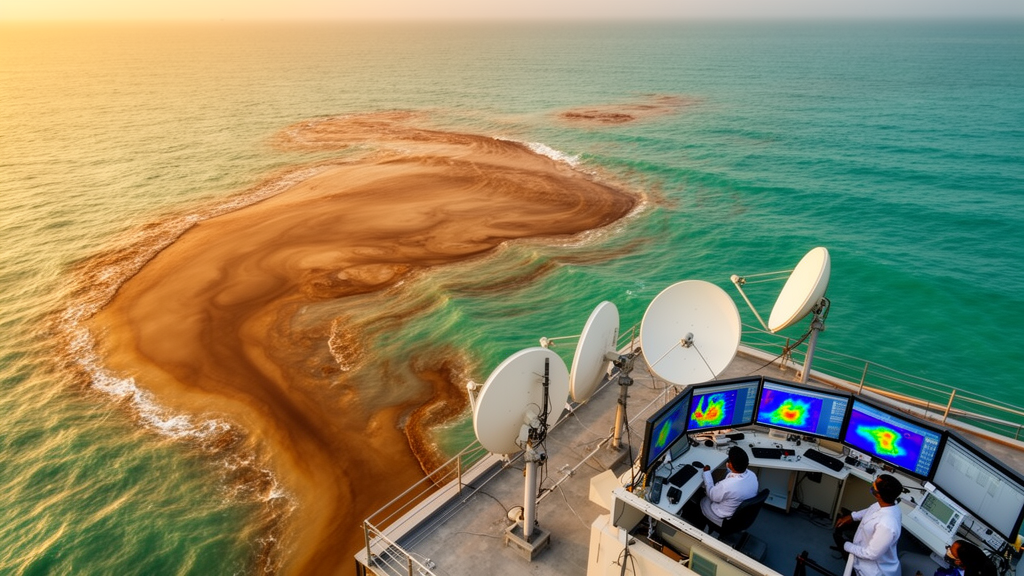
A three-year satellite record of one of Chennai’s most polluted waterways has been turned into an operational early-warning system for coastal pollution, using a combination of Sentinel-2 imagery, atmospheric correction algorithms and machine learning. The study, published in Anthropocene Coasts, focused on Ennore Creek and the adjacent coastal waters of the Bay of Bengal in southeast India, where the Kosasthalaiyar River and the Buckingham Canal deliver a persistent load of untreated domestic sewage and industrial effluent to the sea. By processing 36 monthly cloud-free satellite images from January 2023 to December 2025, researchers built a framework that maps turbid and suspected sewage plumes, quantifies their seasonal dynamics and classifies contaminated waters by their optical signatures.
The monitoring challenge the researchers set out to address is a familiar one in rapidly urbanizing coastal regions. Estuaries and creeks act as sinks for land-based pollution, and coastal discharge points transport those pollutants directly into the ocean, often as seasonal plumes rich in suspended sediments, nutrients, pathogens and organic matter. Field-based measurements alone cannot keep pace with the number of discharge points, the unpredictable timing of discharge events and the variability driven by rainfall and tides. Satellite remote sensing offers wide-area, repeat observations, but suspected sewage plumes pose a particular difficulty: unlike suspended sediments, they lack a distinct optical signature and are frequently masked by the turbidity of the surrounding coastal water.
The team drew on the Copernicus programme’s Sentinel-2 satellites, whose Multispectral Instrument provides 10 to 20 metre resolution imagery with a five-day revisit cycle. For each month in the three-year record, they selected a single cloud-free scene with less than 10 percent cloud cover over the study area, free of significant atmospheric artefacts and close to the middle of the month. Chlorophyll-a and total suspended matter were retrieved using the Case 2 Regional Coast Colour processor, an artificial neural network-based atmospheric correction scheme integrated into the Sentinel Application Platform, while turbidity was calculated with a semi-empirical algorithm that uses water-leaving reflectance in the red band at 665 nanometres. The algorithm’s coefficients were calibrated against field measurements from January 2024 and validated with a second campaign in March 2025.
That validation relied on two synchronised field campaigns timed to coincide with clear-sky satellite overpasses. Ten surface water samples were collected on 10 January 2024 from the creek, covering freshwater-dominated upstream areas and the confluences, and 22 samples were taken on 10 March 2025 from the upstream location, the creek mouth and offshore areas both inside and outside sewage-affected plumes. The comparison between satellite retrievals and laboratory measurements showed a strong positive correlation. For January 2024, satellite-derived total suspended matter matched in-situ values with a coefficient of determination of 0.952 and a root mean square error of 2.738 milligrams per cubic metre, while chlorophyll-a achieved a coefficient of 0.804. In March 2025 the corresponding values were 0.788 for suspended matter and 0.770 for chlorophyll-a. The authors note that the limited number of samples, between 10 and 22 per campaign across only two dates, restricts the statistical robustness of the validation for a three-year satellite record, and that the campaigns captured low to moderate pollution conditions but not peak monsoon conditions.
The time-series analysis revealed a pronounced seasonal cycle controlled by the Northeast Monsoon, which delivers roughly 60 percent of the region’s approximately 800 millimetres of annual rainfall between October and December. During the dry season, plumes remained largely confined to the creek interior and its mouth, with offshore coastal stations consistently recording turbidity below 5 NTU. During the monsoon, extensive brown plumes spread up to a maximum of 5 kilometres offshore, covering an average area of 12.5 square kilometres. Suspended matter concentrations over the study period ranged from 0 to 48.56 grams per cubic metre, and turbidity ranged from 0 to 48.40 NTU, both peaking on 15 November 2024. Stations near the Buckingham Canal discharge points reached 35 to 45 NTU during monsoon months, compared with 5 to 10 NTU in the dry season, a spatial gradient the authors link to sewage-laden discharge rather than natural sediment resuspension alone.
The second pillar of the framework is a hybrid machine-learning approach designed to distinguish suspected sewage-affected waters from naturally turbid ones. The researchers applied unsupervised K-means++ clustering to more than 80,000 remote sensing reflectance spectra, in total 84,843, drawn from a representative high-discharge event on 15 November 2024. Testing cluster numbers from 5 to 25 using the Davies-Bouldin index, Silhouette scores and within-cluster sum of squares, they settled on 14 spectrally distinct optical water types, ranging from clear marine waters to anomalously polluted types characterised by elevated reflectance in the red and near-infrared bands. These clustering-derived pseudo-labels then trained a Random Forest classifier, with the dataset split into 80 percent training and 20 percent validation subsets and an independent test set of 10,000 spectra from adjacent dates used to assess generalizability.
The trained classifier achieved an overall accuracy of 87.3 percent, a Kappa coefficient of 0.85 and an area under the receiver operating characteristic curve of 0.91, with independent validation showing 82.4 percent agreement with the K-means assignments. Class-wise accuracies ranged from 72.4 percent to 94.1 percent. Of the 14 optical water types, the first three represent clear coastal waters with minimal pollution influence, types 4 to 7 turbid waters dominated by suspended sediments, types 8 to 10 extremely turbid conditions, types 11 to 13 highly productive waters dominated by phytoplankton, and type 14 suspected sewage-influenced water. This last class shows broad, elevated reflectance across the visible spectrum with an enhanced red and near-infrared response, a signal the authors associate with high concentrations of suspended matter, coloured dissolved organic matter and chlorophyll from sewage-laden waters.
The identification of type 14 as suspected sewage water rests on multiple lines of evidence rather than optical data alone. In-situ measurements at the corresponding stations revealed ammonium concentrations of 410 to 438 micromolar, phosphate of 128 to 192 micromolar and dissolved organic carbon exceeding 1500 micromolar, values the study describes as more than 400 times higher than background oceanic levels and characteristic of untreated domestic sewage. The ammonium-to-phosphate ratio at these stations, between 3.2 and 3.4, falls within the typical range for domestic sewage. Field photographs showed dark brown to black water with visible surface scum, and the class was spatially confined to the Buckingham Canal and its confluence with the creek, known recipients of Chennai’s untreated sewage. The authors are careful to label the class as suspected rather than definitive sewage influence, acknowledging that optical similarity alone cannot confirm contamination, and they distinguish it from natural sediment plumes, which show stronger green-band reflectance, lower dissolved organic carbon and no elevated ammonium.
The biological consequences of the pollution are visible in the chlorophyll record. Elevated chlorophyll-a concentrations appeared in the inner creek and along plume fringes, with concentrations over the study period ranging from 0 to 13.47 milligrams per cubic metre and the maximum observed inside the creek on 24 January 2025. The authors interpret this as a two-phase plume structure: a core of highly turbid, sediment-rich water near the creek mouth, and a peripheral zone where declining turbidity improves light penetration and allows phytoplankton to exploit the nutrient-rich sewage and runoff. At the sewage-affected stations sampled in March 2025, chlorophyll-a reached 36 to 52 micrograms per litre, levels indicative of eutrophic conditions driven by nutrient enrichment.
The researchers frame the work as a research demonstration with a defined path toward operational use, while being explicit about its limitations. Only two field campaigns were possible, owing to the difficulty of synchronising fieldwork with clear-sky satellite overpasses, the inaccessibility of the creek during monsoon flooding and resource constraints, and they recommend seasonal sampling with more than four campaigns per year in future work. The five-day revisit time of Sentinel-2 may miss short-lived pollution events, the turbidity algorithm’s coefficients are site-specific and would need recalibration elsewhere, and the classification identifies suspected rather than confirmed sewage. Even so, the framework offers substantial cost savings compared with traditional field-based monitoring, provides spatial coverage that field campaigns cannot match, and, the authors argue, could be scaled through a phased approach from proof of concept to full operational integration, giving environmental agencies a tool to map pollution routinely, issue early warnings and evaluate whether management interventions are working.
Subject of Research: Satellite remote sensing and machine learning for monitoring turbid and suspected sewage plumes in urban coastal waters near Chennai, India
Article Title: Operational monitoring of urban coastal pollution: integrating satellite remote sensing and machine learning to manage turbid and suspected sewage plumes
Article References: Natarajan, L., Chandrasekaran, M., Shah, C., Vajravelu, M., Sivadas, S. K., Ramu, K., & Kankara, R. S. (2026). Operational monitoring of urban coastal pollution: integrating satellite remote sensing and machine learning to manage turbid and suspected sewage plumes. Anthropocene Coasts, 9(1), Article 45. https://doi.org/10.1007/s44218-026-00157-6
Image Credits: AI Generated
DOI: 10.1007/s44218-026-00157-6
Keywords: Ennore Creek, Chennai, Sentinel-2, sewage plumes, coastal pollution, remote sensing, machine learning, Random Forest, K-means++, turbidity, chlorophyll-a, Northeast Monsoon
Cite Scienmag News
Violet Maxwell. (October 27, 2026). Satellites and Machine Learning Track Sewage Plumes Off Chennai’s Coast. Scienmag. https://scienmag.com/satellites-and-machine-learning-track-sewage-plumes-off-chennais-coast/
Violet Maxwell. "Satellites and Machine Learning Track Sewage Plumes Off Chennai’s Coast." Scienmag, 27 October 2026, https://scienmag.com/satellites-and-machine-learning-track-sewage-plumes-off-chennais-coast/. Accessed 27 October 2026.
Violet Maxwell. "Satellites and Machine Learning Track Sewage Plumes Off Chennai’s Coast." Scienmag. October 27, 2026. https://scienmag.com/satellites-and-machine-learning-track-sewage-plumes-off-chennais-coast/


