


When a wildfire tears through a forest, the first maps that reach emergency managers, ecologists, and journalists are usually made from space. Satellites such as the European Space Agency’s Sentinel-2 pair can sketch the footprint of a burn within days, and standardized spectral indices translate raw reflectance measurements into burn severity ratings that guide everything from erosion control budgets to reforestation plans. Yet a new field study from a fire-scarred Turkish pine forest delivers a sobering message: the three most widely used satellite indices of post-fire conditions are not measuring the same thing on the ground, and treating them as interchangeable can quietly distort the ecological story that fire managers take away from a burn.
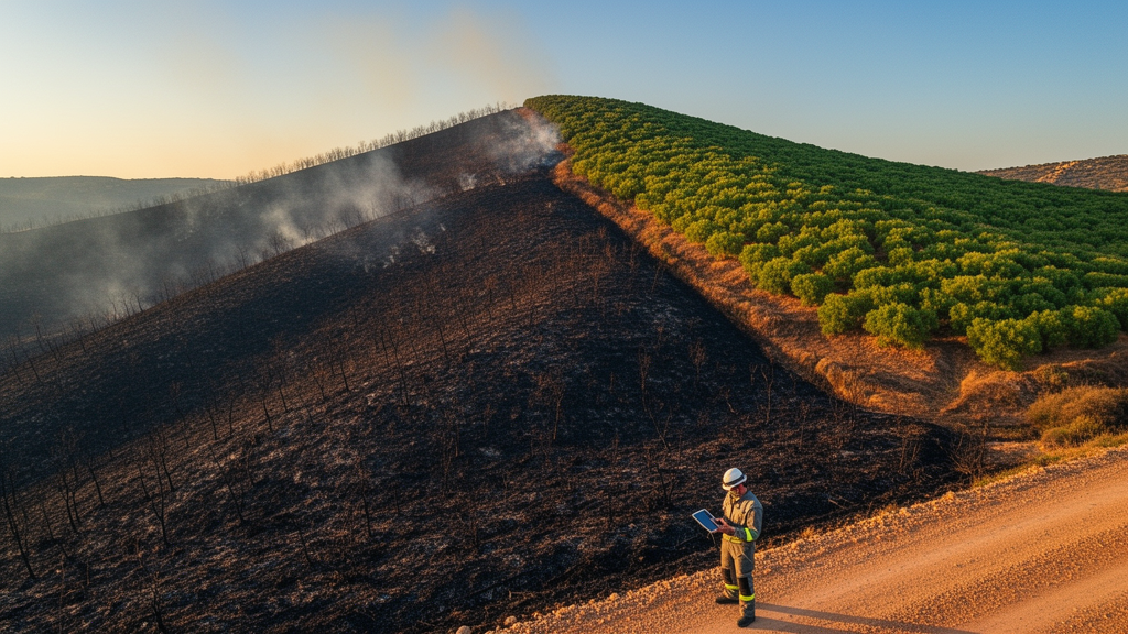
The research, published in Environmental Monitoring and Assessment, was conducted by Salih Malkoçoğlu of Muğla Sıtkı Koçman University and Ergün Kahveci of Tokat Gaziosmanpaşa University. Their study site could hardly be more timely or more representative of the Mediterranean’s fire problem. In 2025, the Köyceğiz-Akköprü fire swept through a forest dominated by Pinus brutia, the Turkish red pine, a species that anchors vast stretches of the eastern Mediterranean’s fire-adapted landscapes. Rather than relying solely on satellite pixels, the researchers walked the burned ground themselves, laying down a dense network of measurement transects that recorded what was actually covering the soil, point by point.
The field protocol was meticulous. In each of 73 sampling plots, the team established two orthogonal transects, each 10 meters long, and recorded surface conditions at every 1-meter interval. That effort produced 1,601 individual point observations, each assigned to one of seven mutually exclusive surface-cover categories. This kind of transect-based ground cover measurement is a standard technique in fire effects monitoring, but what makes the new study distinctive is how directly it confronts the satellite record. For every plot, the researchers computed three Sentinel-2-derived indices: the differenced normalized burn ratio, known as dNBR; its relativized cousin, RdNBR; and the normalized difference vegetation index, NDVI.
Each of these indices has a long pedigree. dNBR, formalized by Key and Benson for the U.S. Forest Service’s FIREMON program, compares pre-fire and post-fire reflectance in the near-infrared and shortwave-infrared bands, where healthy vegetation and charred ground diverge most sharply. RdNBR, introduced by Miller and Thode in 2007, rescales that difference by pre-fire vegetation density, in principle allowing severity to be compared across stands that were structurally different before the fire. NDVI, dating back to Tucker’s foundational work in 1979, tracks the red and near-infrared contrast that signals photosynthetically active green vegetation. All three are staples of post-fire assessment, and all three are routinely treated as proxies for burn severity.
The regression models built in the new study tell a very different story. NDVI emerged as the index most tightly coupled to what was actually on the ground after the fire: its model had the highest explanatory power, with an adjusted R-squared of 0.439, and it was positively associated with live cover, carrying a standardized coefficient of +0.369. In plain terms, the greener the ground cover measured along the transects, the higher the NDVI recorded from orbit. That is exactly what one would hope for from a vegetation index, and it confirms that NDVI is picking up genuine early recovery signals, the resprouting shrubs, herbaceous flushes, and surviving understory that appear in the first growing season after a Mediterranean fire.
dNBR, by contrast, refused to behave as a pure measure of burn severity. Its strongest associations were not with post-fire surface conditions at all, but with pre-fire tree cover and with slope. The index, in other words, was largely encoding the structural and topographic context that existed before the flames arrived. This finding resonates with a growing body of literature, including work by Viedma and colleagues in southeastern Spain, showing that pre-fire vegetation and terrain often dominate the spectral signal that dNBR registers. A satellite index that is supposed to describe what the fire did may, in heterogeneous Mediterranean terrain, be describing mostly what was there to burn and where it stood on the landscape.
Perhaps the most intriguing result concerns RdNBR, the relativized index designed specifically to correct for pre-fire conditions. Instead of cleanly isolating fire effects, RdNBR showed a negative association with needle litter. The researchers interpret this as evidence that relative fire severity indices remain sensitive to residual organic cover, the layers of needles, duff, and litter that survive or accumulate after a burn. Because RdNBR normalizes by pre-fire vegetation, patches that retained substantial organic ground cover can register as less severely burned even when the fire’s actual effects on soils and surviving biota were substantial. The very adjustment meant to make the index more comparable across sites appears to entangle it with the organic residue that Mediterranean pine forests characteristically leave behind.
The team did not stop at the first round of models. Because ecological measurements taken across a landscape are rarely statistically independent, nearby plots tend to resemble one another, the researchers ran spatial robustness analyses that accounted for residual spatial dependence in their data. The principal associations survived. NDVI remained tied to live cover, dNBR to pre-fire structure and topography, and RdNBR to residual organic components. This methodological rigor matters, because spatial autocorrelation is a well-known source of inflated confidence in landscape-scale regression studies, a point emphasized in the geographical ecology literature since Diniz-Filho and colleagues’ influential critique of so-called red herrings in spatial analysis.
The practical upshot is a reframing of how satellite indices should be used in post-fire assessment. Rather than treating dNBR, RdNBR, and NDVI as three interchangeable dials reading the same underlying quantity of burn severity, the study shows they are complementary instruments, each tuned to a different ecological component of the post-fire landscape. dNBR, in this Mediterranean setting, functions largely as a recorder of pre-fire structural and topographic context. NDVI functions as a genuine early-recovery monitor, responsive to the living cover that determines erosion resistance, seedling establishment, and habitat recovery. RdNBR sits in between, its relativization making it sensitive to the residual organic layer that governs soil protection and hydrological response. Managers who read a single index map and draw conclusions about ecological damage or recovery may therefore be reading one channel of a multi-channel signal and mistaking it for the whole broadcast.
The study also demonstrates a practical field-reference workflow that could be adopted widely. By pairing systematic transect-based ground cover measurements with freely available Sentinel-2 imagery, the researchers show that the ecological meaning of spectral indices can be calibrated cheaply and repeatably, without exotic instrumentation. As Mediterranean-type regions face longer fire seasons and larger, more severe burns, as argued in recent calls for a paradigm shift in wildfire management, the demand for rapid, ecologically honest post-fire assessments will only grow. This study’s message is both a caution and a gift: the satellites are telling the truth, but each index tells a different truth, and only by grounding them in measured ground cover can fire ecologists decode which one they are hearing.
Subject of Research: Ecological interpretation of Sentinel-2 spectral indices for post-fire assessment in a Mediterranean Pinus brutia forest
Article Title: Linking transect-based field observations with Sentinel-2 indices to characterize post-fire conditions in a Mediterranean Pinus brutia forest
Article References: Malkoçoğlu, S., & Kahveci, E. (2026). Linking transect-based field observations with Sentinel-2 indices to characterize post-fire conditions in a Mediterranean Pinus brutia forest. Environmental Monitoring and Assessment, 198(11), 1207. https://doi.org/10.1007/s10661-026-16023-4
Image Credits: AI Generated
DOI: 10.1007/s10661-026-16023-4
Keywords: Sentinel-2, dNBR, RdNBR, NDVI, burn severity, wildfire, Pinus brutia, Mediterranean forests, transect sampling, ground cover, remote sensing, fire ecology
Cite Scienmag News
Violet Maxwell. (October 16, 2026). Satellite Fire Maps Hide a Split Personality: New Study Decodes What Sentinel-2 Indices Really See After Wildfire. Scienmag. https://scienmag.com/satellite-fire-maps-hide-a-split-personality-new-study-decodes-what-sentinel-2-indices-really-see-after-wildfire/
Violet Maxwell. "Satellite Fire Maps Hide a Split Personality: New Study Decodes What Sentinel-2 Indices Really See After Wildfire." Scienmag, 16 October 2026, https://scienmag.com/satellite-fire-maps-hide-a-split-personality-new-study-decodes-what-sentinel-2-indices-really-see-after-wildfire/. Accessed 16 October 2026.
Violet Maxwell. "Satellite Fire Maps Hide a Split Personality: New Study Decodes What Sentinel-2 Indices Really See After Wildfire." Scienmag. October 16, 2026. https://scienmag.com/satellite-fire-maps-hide-a-split-personality-new-study-decodes-what-sentinel-2-indices-really-see-after-wildfire/


