More than two and a half centuries after it was deliberately drained, one of early modern Germany’s most ambitious water engineering projects has been brought back to life by science. Lake Lorsch, an artificial lake created in 1474 or 1479 in the floodplain of the River Weschnitz in the northeastern Upper Rhine Graben, vanished from the landscape when the Elector of Mainz ordered its final drainage in 1718, and today no visible trace of it remains. Yet a team of geomorphologists, geophysicists and historians led by Felix Henselowsky of Johannes Gutenberg University Mainz has now pieced together the physical legacy of this lost water body, showing that the sediments, channels and elevation patterns it left behind still shape the Weschnitz floodplain. The study, published in the E&G Quaternary Science Journal, demonstrates how humans have acted as river-shaping agents in this region for at least 500 years.
The lake was no natural accident. Historical documents record that the Burgrave of Starkenburg had already constructed a lake for fish farming before 1463, and a charter from 1474 officially marks the beginning of Lake Lorsch as an artificial fish pond. Its fish were destined for the tables of Friedrichsburg, later called Neuschloss, a hunting lodge in the Lorsch Forest, and for the electoral court in Heidelberg. The lake sat in a landscape already rich in water: the area south of Lorsch Abbey, founded in 763 to 764 CE and now a UNESCO World Heritage Site, had been a marshy wetland for centuries, mentioned in a 1265 document that describes a planned drainage of the so-called Palus Laurissensis, the Lorsch marsh. Fish farming in the floodplain may even predate the abbey itself, with early medieval sources hinting at ponds in the Weschnitz lowlands.
Because nothing of the lake survives at the surface, the researchers turned to a combination of high-resolution remote sensing and subsurface investigation. Using a LiDAR-based digital elevation model with one-meter resolution, they computed a relative elevation model that detrends the terrain along the courses of the old and new Weschnitz channels, revealing subtle height differences invisible to the naked eye. The lake’s maximum extent, confirmed by boundary stones mapped after a 1721 legal dispute, occupies a basin lying between 94.5 and 95.5 meters above sea level, wedged between two belts of late-glacial sand dunes, one rising up to 10 meters in the west and a smaller belt of up to 6 meters in the east. Crucially, the model shows the lake area sits as much as 1.8 meters below the water level of the old Weschnitz channel, while the Landgraben canal lies even lower.
That topographic relationship solved a centuries-old engineering puzzle. Because the lake basin lies below the old Weschnitz but above the Landgraben, water could only flow into the lake by gravity from the old Weschnitz, which historical maps confirm was the source. A 1700 map shows an artificial supply channel, the Renngraben, carrying water from the old Weschnitz into the lake and even crossing the Landgraben, built between 1535 and 1544, on a small water bridge. Since the lake predates the Landgraben by roughly sixty years, the crossing must have been added later, a striking example of layered infrastructure accumulating in a single floodplain. The researchers emphasize that such quantitative elevation relationships simply cannot be extracted from historical documents alone, just as the sediments cannot be interpreted without the historical record.
Groundwater emerged as the second protagonist of the story. Records from a Hessian observation well spanning 1974 to 2024 show modern water tables averaging 2.2 meters below the surface, but a hydrological map from April 1957, before large-scale water abstraction began, shows groundwater within half a meter of the ground surface across the lake area, with occasional flooding in the north. The team argues that these pre-extraction levels offer the best available analogue for historical conditions. Medieval western Europe, other research suggests, experienced generally higher groundwater tables during warm periods. A groundwater-fed wetland would explain the persistent marsh, the repeated but apparently unsuccessful drainage attempt of 1265, and the fish farming practiced by Lampertheim farmers in the Krähenbruch area in the fourteenth and fifteenth centuries.
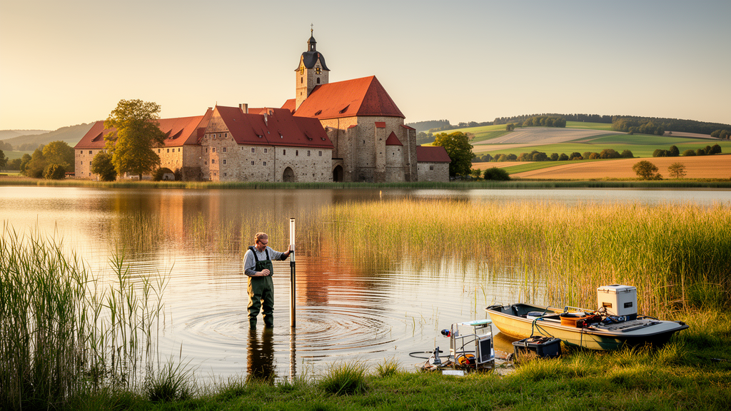
To test whether lake deposits actually survive, the researchers drilled four sediment cores along a transect through the central lake area, guided by the 1700 map showing the Renngraben. They supported the coring with electrical resistivity tomography along an 80-meter profile and with direct-push hydraulic profiling, which logs electrical conductivity and injection pressure at two-centimeter vertical resolution. Laboratory analyses included grain-size determination, loss-on-ignition measurements of organic content, magnetic susceptibility scanning, and portable X-ray fluorescence geochemistry, with element ratios such as log Ca/Ti, log K/Ti and log Rb/Sr used to track grain size, weathering and groundwater fluctuations through the profiles.
The cores delivered a clear verdict. Core LOR 21A contains a 26-centimeter-thick unit of silt and clay-rich sediment with a fining-upward trend, hydromorphic features, strong reducing conditions and a distinctive carbonate lens. The team interprets this unit as a genuine lake deposit. The thickness matches expectations remarkably well: natural lakes typically accumulate about one millimeter of sediment per year, and Lake Lorsch existed for roughly 250 years, predicting a deposit on the order of 25 centimeters. The carbonate lens, a feature known in the Upper Rhine Graben as Rheinweiss, marks a historical boundary of elevated groundwater, and secondary carbonate precipitation may also have been driven by aquatic plants such as stoneworts removing carbon dioxide from bicarbonate-rich water. Short cores LOSE 4 and LOSE 5 show a comparable clayey, organic-enriched unit, confirming the deposit’s lateral extent.
Core LOR 20A, drilled just 27 meters away, tells a different story. Its fine-grained, organic-rich unit sits at a lower absolute elevation than the lake deposits and is capped by a sharply bounded, mixed sandy layer. The electrical resistivity profile shows a high-resistivity anomaly exactly at this location, consistent with sand-filled sediments rather than clay-rich lake muds. The researchers interpret this core as the infill of the Renngraben itself, the anthropogenic supply channel, its high organic content reflecting dense vegetation along the waterway. The sharp overlying boundary likely records later leveling and backfilling associated with the drainage campaigns of the nineteenth and twentieth centuries. Without radiocarbon ages, a post-lake drainage channel cannot be entirely excluded, but the scale of the anomaly favors the Renngraben of the lake phase.
The lake’s biography was turbulent even in its working life. Historical sources record that it was not continuously filled: it was drained completely at intervals, variously reported as every three years or from time to time, both to maintain water quality and to convert the bed to pasture. It stood dry from 1595 to 1609 and was repeatedly drained in the following decades. From 1623, the electors of Mainz and the Palatinate fought a decades-long dispute over ownership and the lake’s exact size, and boundary stones from that conflict still dot the area. After the final drainage around 1718 to 1721, the land became the hamlet of Seehof, whose impoverished inhabitants emigrated to America between 1852 and 1855 before the Scipio family completed the modern drainage system in 1862.
Beyond its local interest, the study carries a broader message about the fluvial anthroposphere, the concept at the heart of a German priority program on how medieval and early modern societies transformed river landscapes. The creation of Lake Lorsch generated a new anthropogenic carbon sink within the floodplain, altered sediment routing, and left a palimpsest of channels, dikes and embankments whose path dependencies still constrain modern river restoration. Shallow, warm waters proved ideal for carp farming, and the engineered inflows allowed managers to regulate the lake despite natural groundwater variability, all without sealing the bottom. The authors caution that the relative weight of natural hydrological variability versus human intervention remains quantitatively unknown and call for future paleohydrological modeling. But the verdict on the past is firm: long before the industrial reshaping of Europe’s rivers around 1800, the people of the Weschnitz floodplain were already engineers of their waterscape, and the ground beneath the fields of Seehof still remembers it.
Subject of Research: Geomorphological and sedimentological reconstruction of the historical artificial Lake Lorsch in the Weschnitz floodplain, Upper Rhine Graben, Germany
Article Title: The geomorphological and sedimentological legacy of the historical Lake Lorsch within the Weschnitz floodplain (northeastern Upper Rhine Graben, Germany)
Article References: Henselowsky, F., Fischer, P., Appel, E., Jäger, B., Hillmus, N., Sandbrink, H., Becker, T., Prien, R., Schenk, G. J., Mächtle, B., Recker, U., Bubenzer, O., & Vött, A. (2026). The geomorphological and sedimentological legacy of the historical Lake Lorsch within the Weschnitz floodplain (northeastern Upper Rhine Graben, Germany). E&G Quaternary Science Journal, 75(1), 1-18. https://doi.org/10.5194/egqsj-75-1-2026
Image Credits: AI Generated
Keywords: Lake Lorsch, Weschnitz floodplain, Upper Rhine Graben, fluvial anthroposphere, medieval fish farming, groundwater, sediment cores, digital elevation model, electrical resistivity tomography, historical maps, floodplain geomorphology, water management
Cite Scienmag News
Violet Maxwell. (October 9, 2026). Lost Medieval Lake Lorsch Reconstructed From Sediments, Maps and Laser Data. Scienmag. https://scienmag.com/lost-medieval-lake-lorsch-reconstructed-from-sediments-maps-and-laser-data/
Violet Maxwell. "Lost Medieval Lake Lorsch Reconstructed From Sediments, Maps and Laser Data." Scienmag, 9 October 2026, https://scienmag.com/lost-medieval-lake-lorsch-reconstructed-from-sediments-maps-and-laser-data/. Accessed 9 October 2026.
Violet Maxwell. "Lost Medieval Lake Lorsch Reconstructed From Sediments, Maps and Laser Data." Scienmag. October 9, 2026. https://scienmag.com/lost-medieval-lake-lorsch-reconstructed-from-sediments-maps-and-laser-data/