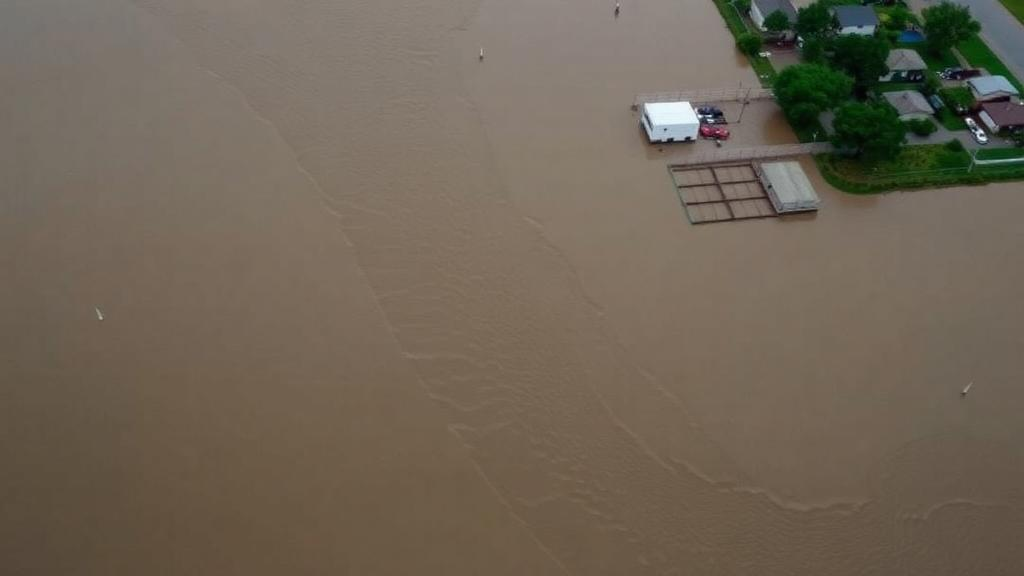
Floods are the most frequently recorded natural disasters on Earth, and a sweeping new systematic review argues that the biggest challenge in flood science is no longer inventing cleverer models, but making the ones we already have work in the real world. The review, published in Environmental Earth Sciences, synthesised 190 peer-reviewed studies published between 1985 and 2025, tracing how flood risk assessment has evolved from conventional hydrological analysis into integrated frameworks that fuse satellite Earth observation, meteorological data, hydraulic simulation and artificial intelligence. Its central message is sobering: methodological sophistication alone does not guarantee operational effectiveness, particularly in the data-scarce regions where flood exposure is rising fastest.
The scale of the problem is enormous. According to research cited in the review, approximately 1.81 billion people, or 23 percent of the global population, are exposed to substantial flood risk, with projections indicating increasing flood frequency and severity across Asia, Latin America and Africa. Records from the Emergency Events Database maintained by the Centre for Research on the Epidemiology of Disasters show that floods account for the largest proportion of recorded disasters between 1900 and 2024, ahead of storms. Climate change intensifies the hazard by increasing atmospheric moisture and heavy precipitation, while rapid urbanisation, land surface modification and inadequate drainage infrastructure alter runoff generation and place more people and assets in harm’s way.
To build its evidence base, the research team followed the PRISMA 2020 guidelines for systematic reviews, searching Web of Science and Google Scholar for studies combining flood-related terms with geospatial, meteorological, hydrological and artificial intelligence terminology. The initial search retrieved 2,150 records; after duplicate removal, 1,720 were screened, 500 full-text articles were assessed for eligibility, and 190 studies made the final thematic synthesis. Each eligible study was mined for publication year, geographical region, methodological approach, data sources, model type, validation metrics and reported limitations, allowing the authors to compare approaches across four decades of methodological development.
Four principal methodological domains emerged from the evidence. The first and most widely adopted is geospatial technology, particularly geographic information systems and remote sensing. Satellite observations provide consistent, large-area coverage that substantially improves flood monitoring, especially where ground-based hydrological observations are sparse or absent. Geographic information systems support terrain analysis, watershed delineation, multi-criteria evaluation and the spatial integration of environmental and socio-economic variables. Compared with physically based hydraulic models, these tools offer greater spatial scalability, rapid data acquisition and lower computational demands, although they represent flood processes only indirectly and work best as foundational components within integrated frameworks rather than as standalone solutions.
The second domain, hydrological and hydraulic modelling, remains indispensable for simulating runoff generation, channel routing and floodplain inundation. Three tools dominate the reviewed literature: the Hydrologic Engineering Centre’s River Analysis System, known as HEC-RAS, the LISFLOOD-FP model, and the Height Above Nearest Drainage terrain index. HEC-RAS delivers physically realistic one- and two-dimensional simulations suited to detailed local-scale inundation modelling, while LISFLOOD-FP balances computational efficiency with acceptable performance over extensive regional floodplains. HAND offers a computationally cheap terrain-based alternative for rapid floodplain delineation in ungauged catchments, though its simplified hydraulics limit its use for detailed analysis. The review stresses that these models are not interchangeable; selection should reflect the desired balance between hydraulic realism, computational cost, data availability and operational constraints.
Meteorological information forms the third domain and the primary driver of flood generation. Rainfall intensity, precipitation duration, antecedent soil moisture, atmospheric circulation patterns and climate variability consistently emerge as the principal hydroclimatic controls on flooding. High-resolution reanalysis products and satellite-derived precipitation datasets improve hydroclimatic representation where rain gauges are sparse, but their predictive value depends strongly on spatial resolution, temporal consistency, bias correction and successful coupling with hydrological models. The review concludes that meteorological data contribute most when embedded within coupled hydrometeorological modelling systems rather than analysed in isolation.
The fastest-growing domain is artificial intelligence. Machine learning methods including Random Forest, Support Vector Machines, Extreme Gradient Boosting, Convolutional Neural Networks and Long Short-Term Memory networks repeatedly demonstrate strong capability in modelling the nonlinear interactions among climatic, hydrological and environmental variables, and generally outperform conventional statistical approaches when extensive training datasets are available. Yet the review also flags persistent weaknesses: limited interpretability, uncertain transferability across regions, heavy data dependency and poorly quantified uncertainty. Hybrid frameworks that combine physically based hydrological understanding with data-driven prediction are increasingly seen as offering greater robustness and transparency than purely black-box approaches.
A crucial caveat runs through the entire synthesis: reported performance metrics such as AUC, accuracy and F1-score should be read as study-specific evidence rather than directly comparable measures of model superiority. Differences in datasets, sample sizes, spatial resolution, flood inventories, predictor variables, validation strategies and geographical conditions make direct quantitative comparison across studies unreliable. The authors also highlight stark regional disparities. In Africa, sparse hydrometeorological monitoring networks, fragmented observational records and constrained early warning systems restrict the operational use of advanced methods, even as changing precipitation regimes, sea level rise and rapid urbanisation drive risk upward. Satellite precipitation estimates from NASA’s Global Precipitation Measurement mission during the April 2022 floods in eastern South Africa illustrate how Earth observation can partially compensate where ground observations are limited.
From this evidence the authors derive a conceptual framework that explicitly connects methodological capability with operational readiness and decision support. Rather than proposing a new predictive algorithm, the framework links multisource data acquisition, preprocessing, modelling, validation and uncertainty assessment to practical applications such as early warning, hazard mapping, emergency planning and policy development, while incorporating continuous monitoring and adaptive feedback. It recognises that data availability, monitoring infrastructure, computational capacity, validation practices, model transferability and institutional capability all determine whether sophisticated science actually reaches the communities that need it.
Looking forward, the review identifies clear priorities: explainable artificial intelligence, hybrid physics-informed machine learning, interoperable Earth observation systems and cloud-native geospatial platforms, alongside expanded open-access datasets, FAIR data principles and strengthened hydrometeorological monitoring networks, especially in underrepresented and data-constrained regions. The authors acknowledge limitations, including their restriction to English-language literature and the rapid evolution of GeoAI technologies, but their conclusion is unambiguous. No single analytical approach can address the complexity of contemporary flood hazards. Effective flood risk assessment will depend on integrating complementary methodologies within scalable, transparent and operationally feasible systems capable of supporting climate adaptation and disaster risk reduction under increasingly uncertain hydroclimatic conditions.
Subject of Research: Systematic review of geospatial, meteorological, hydrological and AI-based methods for flood risk assessment and monitoring
Article Title: A systematic review of geospatial and meteorological approaches to flood risk assessment and monitoring
Article References: Sibandze, P., Kalumba, A. M., & Afuye, G. A. (2026). A systematic review of geospatial and meteorological approaches to flood risk assessment and monitoring. Environmental Earth Sciences, 85(16), Article 425. https://doi.org/10.1007/s12665-026-13155-1
Image Credits: AI Generated
DOI: 10.1007/s12665-026-13155-1
Keywords: flood risk assessment, remote sensing, GIS, machine learning, deep learning, GeoAI, hydrological modelling, HEC-RAS, meteorology, early warning systems, PRISMA, climate adaptation
Cite Scienmag News
Violet Maxwell. (October 12, 2026). From Satellites to Smart Algorithms: How Four Decades of Flood Science Are Being Rewritten. Scienmag. https://scienmag.com/from-satellites-to-smart-algorithms-how-four-decades-of-flood-science-are-being-rewritten/
Violet Maxwell. "From Satellites to Smart Algorithms: How Four Decades of Flood Science Are Being Rewritten." Scienmag, 12 October 2026, https://scienmag.com/from-satellites-to-smart-algorithms-how-four-decades-of-flood-science-are-being-rewritten/. Accessed 12 October 2026.
Violet Maxwell. "From Satellites to Smart Algorithms: How Four Decades of Flood Science Are Being Rewritten." Scienmag. October 12, 2026. https://scienmag.com/from-satellites-to-smart-algorithms-how-four-decades-of-flood-science-are-being-rewritten/