

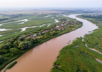
Flood hazard assessment in the Danube Delta using 2D hydraulic modeling
A new 2D hydraulic modeling study maps how 10-, 100- and 1,000-year floods could spread across the Danube Delta, revealing ...
A new 2D hydraulic modeling study maps how 10-, 100- and 1,000-year floods could spread across the Danube Delta, revealing ...

A systematic review of 190 studies finds that integrated geospatial, meteorological, hydrological and AI-based approaches are transforming flood risk assessment, ...
A new modelling study projects that climate-driven increases in flow energy could deepen pier scour at India's Kolaghat Bridge by ...
Satellite radar, optical imagery and flood modelling reveal that the repeatedly reactivating Kuwari landslide in Uttarakhand has formed an unstable ...
A new study integrates HEC-RAS hydraulic simulation, GIS mapping and expert-based AHP weighting to identify flood-vulnerable critical urban centers in ...
A new modeling study of China's Poyang Lake Basin shows that permeability-oriented green infrastructure outperforms storage-based designs under most flood ...

Embark on a thrilling journey of discovery with Scienmag.com—your ultimate source for cutting-edge breakthroughs. Immerse yourself in a world where curiosity knows no limits and tomorrow’s possibilities become today’s reality!