


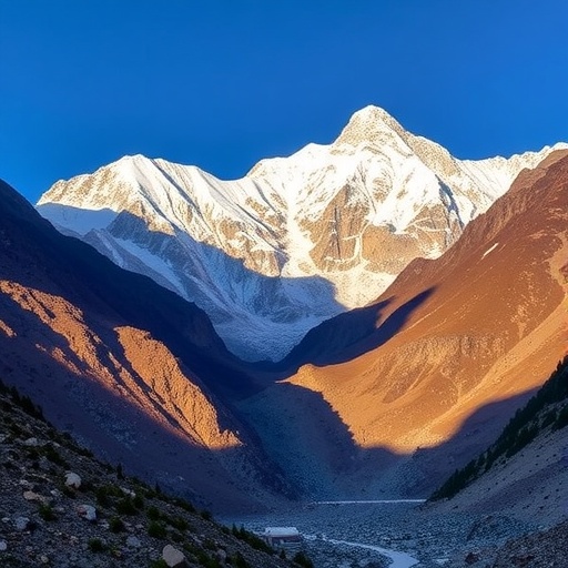
A warming climate is quietly reshaping the Himalayan slopes before the next major earthquake strikes, creating conditions in which a single seismic event could trigger a far more complex chain of disasters, according to a study by Gao, Liu, Zhuang and colleagues published in Communications Earth & Environment. The research highlights how rising temperatures are weakening the physical systems that hold mountain landscapes together, potentially turning earthquakes into starting points for landslides, debris flows, river blockages and sudden floods.
The Himalaya is one of the most tectonically active regions on Earth. The Indian Plate continues to push northward beneath the Eurasian Plate, storing enormous strain along major faults. When that strain is released, ground shaking can destabilize already-fragile slopes across vast distances. The new study focuses on an important shift in the hazard equation: climate warming may prepare mountain terrain for cascading impacts long before an earthquake occurs.
Warming affects Himalayan mountains through several interconnected processes. Higher temperatures can accelerate glacier retreat, melt snow and ice, thaw permanently frozen ground and alter the timing and intensity of water flow through steep valleys. These changes influence pore-water pressure inside soil and fractured rock. When water pressure rises, it reduces the friction that normally helps keep slopes stable, making landslides more likely when seismic waves suddenly shake the ground.
Permafrost degradation is another critical mechanism. In high-elevation regions, frozen ground acts like a natural cement, binding loose sediment and fractured rock together. As that frozen material thaws, the strength of the slope can decline. Ice-filled cracks may expand, while meltwater penetrates deeper into the mountain. The result is a landscape that may appear stable under ordinary conditions but is closer to failure when exposed to an earthquake’s intense and rapid acceleration.
Glacier retreat can also create new hazards. As glaciers shrink, they leave behind unstable piles of sediment and rock, known as moraines. These deposits can form natural dams around newly developing lakes. If an earthquake causes a moraine dam to collapse, the resulting glacial lake outburst flood can rush downstream with little warning, carrying boulders, mud and debris into settlements and infrastructure. Even without a dam failure, landslides entering a glacial lake can displace water and generate destructive waves.
The study’s central message is that earthquake risk cannot be assessed by looking only at fault lines or historic ground shaking. A modern hazard assessment must also account for environmental conditions that determine how slopes respond after an earthquake. These conditions include glacier volume, snow cover, soil moisture, permafrost distribution, river geometry and the presence of unstable lakes or landslide-dammed channels. Climate warming changes each of these variables, often in ways that are difficult to observe from the ground.
Cascading hazards are especially dangerous because they can multiply one another. An earthquake may trigger a landslide that blocks a river, creating a temporary lake. Water accumulating behind the blockage can later burst through it, producing a flood that erodes riverbanks and destabilizes additional slopes. In another sequence, shaking may fracture a glacier or mountain face, sending rock into a lake and generating a wave. The initial earthquake may last only minutes, but its consequences can continue for weeks, months or even years.
For communities across the Himalaya, this interaction between tectonic activity and climate change has practical consequences. Roads, bridges, hydropower facilities, pipelines and settlements are often concentrated along narrow valleys, precisely where landslides and floodwaters are funneled. A route that remains open during an earthquake may later be cut by debris flows or river diversion. Emergency response can become much more difficult when multiple valleys are isolated at the same time and familiar waterways suddenly change course.
The research points toward a need for integrated monitoring and early-warning systems. Satellite radar can detect slow ground movement, optical imagery can track glacier and lake changes, and seismic networks can identify earthquake-triggered instability. Sensors measuring rainfall, river discharge, soil moisture and permafrost temperature could help determine whether a slope is approaching failure. The most effective warning systems will need to connect these streams of information rather than treat earthquakes, landslides and floods as separate events.
The Himalayan landscape has always been dynamic, but climate warming is changing its starting conditions. The study warns that future earthquakes may strike mountains that are wetter, less frozen and more geomorphologically unstable than those of previous generations. That does not mean every earthquake will produce a regional catastrophe, but it does mean that conventional disaster planning may underestimate what happens after the shaking stops. In a warming Himalaya, the greatest threat may not be a single hazard, but the chain reaction that follows.
Cite Scienmag News
Violet Maxwell. (August 4, 2026). Climate warming primes Himalayan slopes for cascading hazards after earthquakes. Scienmag. https://scienmag.com/climate-warming-primes-himalayan-slopes-for-cascading-hazards-after-earthquakes/
Violet Maxwell. "Climate warming primes Himalayan slopes for cascading hazards after earthquakes." Scienmag, 4 August 2026, https://scienmag.com/climate-warming-primes-himalayan-slopes-for-cascading-hazards-after-earthquakes/. Accessed 4 September 2026.
Violet Maxwell. "Climate warming primes Himalayan slopes for cascading hazards after earthquakes." Scienmag. August 4, 2026. https://scienmag.com/climate-warming-primes-himalayan-slopes-for-cascading-hazards-after-earthquakes/


