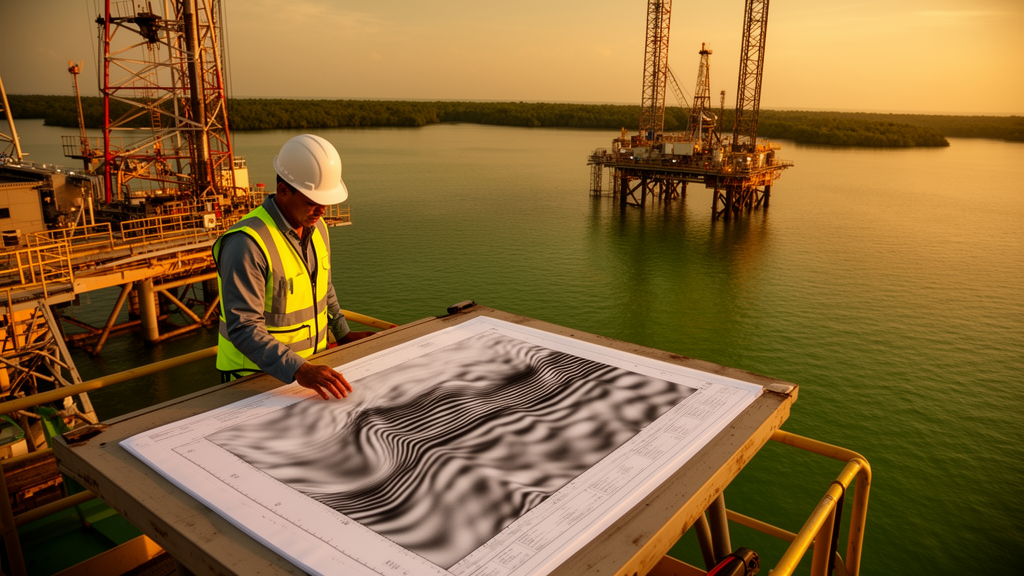
In the offshore waters of the western Niger Delta lies a field that was written off decades ago as non-commercial, based on just two wells and a handful of aging two-dimensional seismic lines. A new study argues that verdict may say far more about the quality of the images used to judge the field than about the geology beneath it. The research, published in Discover Geoscience by Bello M. Akpoku of Bayelsa Oil Company Limited and Godwin C. George of Covenant University, takes a forensic look at the Magna Field in license block OPL 240 and concludes that its non-commercial label is best understood as a data quality verdict rather than a geological one.
The Magna Field sits on the continental shelf roughly 25 to 35 kilometers southwest of the Forcados-Escravos coastal axis, in water depths of 30 to 80 meters. Structurally, it is a textbook example of the syn-sedimentary extensional systems that dominate the Niger Delta margin. A regional listric growth fault, designated Flt-A, detaches at depth within the overpressured Akata shales and divides the field. Differential compaction and fault-parallel extension of the hanging wall have built a northwest-southeast trending rollover anticline with a collapsed crest, the principal structural trap. An antithetic fault, Flt-E, dips southward toward Flt-A, while internal synthetic splays, including Fault B with an interpreted throw of about 800 feet, carve the hanging wall into fault-bounded compartments. Two wells, Magna-1 and Magna-2, penetrate the D-5 and E-1 reservoir horizons of the Agbada Formation, where wireline logs confirm hydrocarbon-bearing intervals.
By all structural appearances, this is the kind of setting that has produced prolific oil elsewhere in the delta. Yet the field was deemed non-commercial on the strength of two wells and sixteen 2D seismic lines shot between the late 1970s and early 1990s. Here lies the twist at the heart of the study: a 3D seismic survey was acquired over the field in late 1991 and early 1992, offering significantly better structural resolution than the 2D grid, but no appraisal well was ever drilled to test the structural targets visible in that dataset. The non-commercial classification predates the best available imaging and has never been revisited with it, a gap in appraisal history the authors describe as both significant and correctable.
The diagnostic assessment identifies four compounding imaging problems. The first and most spatially significant is degradation beneath the rollover crest, where within a zone of roughly two to three kilometers on either side of the Flt-A fault plane, reflection amplitudes drop sharply, lateral continuity collapses, and localized time-sagging distorts the picture. These are classic fault-shadow effects, driven by lateral velocity contrasts across the growth fault, differential compaction, and wavefield scattering from the densely faulted crestal rocks. The cruel irony is that the worst imaging occurs precisely where the trap definition matters most: the crest elevation, spill-point geometry, and areal extent of closure that any appraisal would hinge on are least well resolved in the structurally highest part of the field.
Second, along the major fault zones, reflector coherence is lost over short lateral distances, and amplitude diminution accompanies many of the internal synthetic and antithetic faults. This creates a genuinely thorny interpretational problem: distinguishing discontinuities caused by imaging artifacts from real faults, lithologic boundaries, or stratigraphic pinch-outs. The authors deployed a four-criterion diagnostic framework, checking whether discontinuities correlate spatially with known fault zones, whether they appear consistently across intersecting lines, whether well-log calibration supports a geological origin, and whether they are plausible within the regional extensional structural style. The framework works where wells provide calibration, but on the upthrown southeastern flank, where the main untested targets lie and no well control exists, the separation of artifact from geology simply cannot be made with certainty. Correlation of reflectors across the roughly 800-foot throw of Fault B is explicitly deemed speculative.
The third problem is velocity uncertainty. With no checkshot or vertical seismic profile data in either well, depth conversion relied on a second-order polynomial velocity function derived from the Magna-1 time-depth relationship. That function is geometrically stable and internally consistent, but it cannot capture the localized velocity anomalies that overpressure, shale compaction gradients, and fault-controlled sedimentation generate in growth-fault environments. Drawing on published assessments showing interval velocity errors of plus or minus 5 to 10 percent for log-derived velocity functions in comparable Niger Delta settings, the study calculates that crestal depths at the D-5 and E-1 horizons could be off by 345 to 567 feet at a 5 percent velocity error, and by as much as roughly 690 feet where errors reach 10 percent in fault-shadow and overpressure zones. Errors of that magnitude are enough to reshape perceived closure geometry, shift the apparent hydrocarbon column height, and materially alter any volumetric assessment.
Fourth, the legacy 2D data itself imposes resolution limits. Interbedded sand-shale successions of the Agbada Formation frequently lie at or below the tuning thickness of the seismic wavelet, so individual reservoir units and their lateral extents cannot be resolved seismically, forcing reservoir characterization to lean on well logs. Line spacing is also too wide to image subtle relay structures and compartment-bounding faults that could govern reservoir connectivity. The undrilled 3D survey of 1991 to 1992 stands as the single most important underutilized resource for closing these gaps.
What can the data actually support? The authors argue that relative structural geometry is far more trustworthy than absolute depth positioning. The consistency of D-5 and E-1 horizon picks across the 2D grid, and the coherent fault architecture visible on multiple lines, establish a credible structural framework even without checkshot calibration. But trap integrity is another matter. Reliable fault-seal assessment requires confidence in fault-plane geometry, sand-shale juxtaposition across the fault, and the lateral continuity of sealing lithologies, and the poor illumination of fault planes undermines all three. The honest conclusion, the study insists, is that the current data can neither confirm nor disprove trap integrity at the primary structural targets. Reading ambiguous fault-shadow responses as proof of either seal failure or seal integrity would both be methodologically wrong.
The authors propose a prioritized, cost-escalating workflow to resolve the uncertainty before any future appraisal commitment. Reprocessing the legacy 2D and 3D data with modern multiple suppression, noise attenuation, and pre-stack migration comes first, directly targeting the fault-shadow and reflector-continuity issues at the crest. Tomographic velocity inversion incorporating the existing well data follows, shrinking depth-conversion uncertainty without new drilling. A checkshot or vertical seismic profile at a proposed Magna-C site on the upthrown southeastern flank would supply the single most urgently missing calibration, anchoring the velocity model to the primary target. Selective full-waveform inversion of the fault-shadow zones could then refine the velocity model further, and only after those steps would new wide-azimuth acquisition be considered, if residual uncertainty still blocked an appraisal decision.
Beyond one field, the findings carry a warning for any basin where legacy seismic data still underpins commercial judgments. In growth-fault-dominated deltas, the geometry that creates the trap also degrades the image of it, so the most prospective structural positions are systematically the least well imaged. Magna Field’s rollover anticline, growth-faulted architecture, and wireline-confirmed hydrocarbons are consistent with productive deltaic settings, but they do not constitute evidence of commercial volumes, and the study is careful not to claim otherwise. What it does establish is that the non-commercial label was issued amid high, poorly characterized imaging uncertainty, and that no definitive geological verdict is possible until the data limitations are corrected. If the authors are right, one of the quietly important lessons of petroleum geoscience is on full display: sometimes a field is not dry, it is simply unseen.
Subject of Research: Seismic imaging constraints and structural ambiguity affecting the historical appraisal of the Magna Field, western Niger Delta
Article Title: Impact of seismic imaging constraints and structural ambiguity on the historical non-commercial categorization of the Magna Field western Niger Delta
Article References: Akpoku, B. M., & George, G. C. (2026). Impact of seismic imaging constraints and structural ambiguity on the historical non-commercial categorization of the Magna Field western Niger Delta. Discover Geoscience, 4(1), Article 285. https://doi.org/10.1007/s44288-026-00660-w
Image Credits: AI Generated
DOI: 10.1007/s44288-026-00660-w
Keywords: Niger Delta, seismic imaging, fault shadow, growth fault, rollover anticline, depth conversion, velocity uncertainty, legacy 2D seismic, 3D seismic survey, hydrocarbon appraisal, trap integrity, Magna Field
Cite Scienmag News
Violet Maxwell. (October 16, 2026). Bad Seismic Images, Not Bad Geology, May Have Doomed a Niger Delta Oil Field. Scienmag. https://scienmag.com/bad-seismic-images-not-bad-geology-may-have-doomed-a-niger-delta-oil-field/
Violet Maxwell. "Bad Seismic Images, Not Bad Geology, May Have Doomed a Niger Delta Oil Field." Scienmag, 16 October 2026, https://scienmag.com/bad-seismic-images-not-bad-geology-may-have-doomed-a-niger-delta-oil-field/. Accessed 16 October 2026.
Violet Maxwell. "Bad Seismic Images, Not Bad Geology, May Have Doomed a Niger Delta Oil Field." Scienmag. October 16, 2026. https://scienmag.com/bad-seismic-images-not-bad-geology-may-have-doomed-a-niger-delta-oil-field/