


In the low-lying wetlands of Bayelsa State, where the Niger Delta meets the Atlantic Ocean through a lattice of rivers, creeks, and swamps, flooding is not an occasional disaster but a recurring way of life. Every rainy season, water spills over embankments, isolates communities, destroys crops, and displaces thousands of people. Now, a team of Nigerian and British researchers has combined an old geomorphological technique with cutting-edge machine learning to produce some of the most detailed flood-susceptibility maps ever created for the region, revealing dangerous micro-zones that conventional mapping approaches have consistently missed.
The study, published in the International Journal of Data Science and Analytics, focuses on four river catchments in Bayelsa State: Forcados, Nun, Ekole, and Seibri. Led by Kehinde Chima Opara of the National Open University with a large multidisciplinary team spanning geology, computing, civil engineering, and microbiology at Niger Delta University and Bournemouth University, the research rests on a deceptively simple idea: the shape of the land itself, quantified through drainage-basin geometry, holds powerful clues about where water will accumulate and how quickly it will drain away.
That idea traces back to the quantitative geomorphology pioneered by Robert Horton in 1945 and Arthur Strahler in 1957, who showed that stream networks obey measurable statistical laws. The researchers extracted fourteen morphometric parameters from a 30-meter Shuttle Radar Topography Mission digital elevation model, computing measures such as drainage density, relief ratio, form factor, elongation ratio, and infiltration number for each catchment. Drainage density, the total length of streams per unit area, indicates how efficiently a basin sheds water; high values typically mean rapid runoff and flash-flood behavior. The infiltration number, a compound index combining drainage density with stream frequency, signals how much rainfall will soak into the ground versus race over the surface toward already-swollen channels.
The numbers told a stark story. The Forcados catchment recorded a drainage density of 3.57 kilometers per square kilometer and an infiltration number of 41.80, the highest hazard profile among the four basins, meaning its dense channel network funnels rainfall into streams with exceptional speed. Seibri and Ekole, while scoring lower on basin-wide rankings, were far from safe. The machine learning analysis later revealed that these moderate-risk basins contained sharply localized clusters of very high flood probability, hidden pockets of danger that a static morphometric ranking alone would never have flagged.
To capture that spatial heterogeneity, the team turned to supervised machine learning. They compiled approximately 1,200 labeled flood and non-flood sample points derived from Sentinel-1 synthetic aperture radar imagery spanning 2018 to 2024. SAR is uniquely suited to flood mapping in the tropics because its radar pulses penetrate cloud cover, which blankets the Niger Delta for much of the wet season, and it can distinguish smooth, inundated surfaces from vegetated dry land even at night. Three classifiers were trained on the data: Random Forest, Support Vector Machine, and XGBoost, using an 80:20 spatially disjoint train-test split, a validation strategy that prevents the model from simply memorizing conditions at locations it has already seen.
XGBoost, a gradient-boosted tree algorithm renowned for its performance on tabular geospatial data, emerged as the clear winner, achieving an accuracy of 93.1 percent and an area under the receiver operating characteristic curve of 0.95. Random Forest and Support Vector Machine performed respectably but trailed the boosted ensemble. The choice of a spatially disjoint split matters: in flood mapping, neighboring pixels share soil, elevation, and drainage characteristics, so random splits can inflate apparent skill. By testing on geographically separate areas, the researchers demonstrated that their model genuinely generalizes across the landscape rather than exploiting spatial autocorrelation.
Crucially, the team did not stop at prediction accuracy. They applied SHapley Additive exPlanations, a technique borrowed from cooperative game theory that quantifies each input variable’s marginal contribution to every individual prediction. The SHAP analysis confirmed that drainage density, relief ratio, and infiltration number were the dominant morphometric controls on flood probability, giving the black-box model a transparent physical interpretation. This interpretability matters enormously for practical adoption: planners and emergency managers are far more likely to trust a flood map when the model can explain, in terms of measurable basin properties, why a particular village sits in a high-risk zone.
The researchers were careful about what they left out. Dynamic drivers such as rainfall intensity, soil moisture, and tidal backwater effects were excluded as direct machine learning predictors, partly because reliable, high-resolution data on these variables are scarce across the delta. Instead, their influence is partially captured through morphometric proxies, since basin geometry shapes how a landscape responds to whatever rain falls on it. Rainfall was not ignored entirely: CHIRPS-derived mean rainfall rasters for 2018 through 2022, processed in Google Earth Engine, provided contextual spatial evidence that validated inter-annual variability in flood extent across the study area.
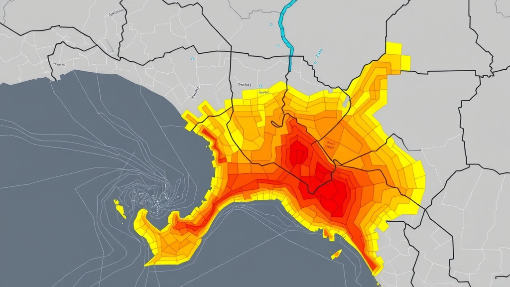
The resulting probability maps are the study’s most striking product. Rather than painting entire basins with a single risk class, the high-resolution maps expose flood micro-zones, tight clusters of elevated susceptibility embedded within otherwise moderate-risk landscapes. In Ekole, for example, communities clustered along specific low-lying drainage paths face sharply higher danger than nearby settlements just a few kilometers away. This level of granularity is exactly what local governments need for targeted interventions: prioritizing which embankments to reinforce, where to site evacuation routes, which neighborhoods deserve early-warning infrastructure first, and how to steer future land-use development away from the most hazardous ground.
Perhaps the most consequential claim of the study is its transferability. The entire pipeline, from digital elevation model preprocessing through morphometric feature computation, model training, hyperparameter optimization, and SHAP-based interpretation, relies almost exclusively on freely available data: SRTM topography from the USGS, Sentinel-1 radar from the European Space Agency’s Copernicus program, and CHIRPS rainfall from the Climate Hazards Group. The authors have committed to releasing all data and analysis scripts publicly on GitHub, including the complete implementation covering model training and evaluation. For the many tropical deltaic regions of South Asia, Southeast Asia, and Africa that share Bayelsa’s combination of flat terrain, intense monsoonal rainfall, and chronic data scarcity, the framework offers a template for building credible flood-susceptibility maps without expensive hydrodynamic modeling or dense gauge networks.
The timing could hardly be more urgent. Nigeria’s 2022 flood disaster, one of the worst in the country’s history, submerged vast areas of the delta and displaced well over a million people nationwide, and climate projections suggest that extreme rainfall events will intensify in West Africa’s coastal zones. Meanwhile, rapid land-use change around cities like Yenagoa, the Bayelsa State capital, keeps paving over the natural infiltration surfaces that once buffered communities against inundation. Tools that can identify precisely where the next flood will strike hardest, using satellite data that already exist and algorithms that run on ordinary hardware, represent a genuine step change in the region’s adaptive capacity.
There are, of course, limits. A susceptibility map describes where flooding is likely, not when it will occur; operational early warning still requires real-time rainfall and river-level monitoring that the delta largely lacks. The exclusion of tidal dynamics is a particular gap in a region where ocean surges can push floodwaters back up the rivers, and future work will need to integrate hydrodynamic modeling with the machine learning framework. Yet as a demonstration that century-old geomorphological insight and modern artificial intelligence can be fused into a practical, explainable, and reproducible planning tool, the Bayelsa study sets a compelling benchmark. For the residents of the Niger Delta’s most vulnerable micro-zones, better maps are not an academic luxury. They are, potentially, the difference between warning and catastrophe.
Subject of Research: Machine learning-enhanced flood-susceptibility mapping integrating morphometric basin analysis in Bayelsa State, Nigeria
Article Title: Integrating morphometric controls for runoff dynamics in Bayelsa State, Nigeria: enhancing flood-susceptibility mapping with machine learning
Article References: Opara, K. C., Imoni, O., Ohimain, E. I., Winston, A. G., Okeke, F. N., Eteh, D. R., William, T., Agbozu, E. N., Kalama, O. E., Amos, M. D., Joshua, J. I., Bamiekumo, B. P., Bright, B. J., & Ogidi, O. I. (2026). Integrating morphometric controls for runoff dynamics in Bayelsa State, Nigeria: enhancing flood-susceptibility mapping with machine learning. International Journal of Data Science and Analytics, 22(1), Article 301. https://doi.org/10.1007/s41060-026-01249-9
Image Credits: AI Generated
DOI: 10.1007/s41060-026-01249-9
Keywords: flood susceptibility, machine learning, XGBoost, morphometric analysis, Niger Delta, Bayelsa State, Sentinel-1 SAR, drainage density, SHAP, remote sensing, SRTM, flood-risk management
Cite Scienmag News
Violet Maxwell. (September 22, 2026). AI and River Geometry Reveal Hidden Flood Hotspots in Nigeria’s Niger Delta. Scienmag. https://scienmag.com/ai-and-river-geometry-reveal-hidden-flood-hotspots-in-nigerias-niger-delta/
Violet Maxwell. "AI and River Geometry Reveal Hidden Flood Hotspots in Nigeria’s Niger Delta." Scienmag, 22 September 2026, https://scienmag.com/ai-and-river-geometry-reveal-hidden-flood-hotspots-in-nigerias-niger-delta/. Accessed 5 October 2026.
Violet Maxwell. "AI and River Geometry Reveal Hidden Flood Hotspots in Nigeria’s Niger Delta." Scienmag. September 22, 2026. https://scienmag.com/ai-and-river-geometry-reveal-hidden-flood-hotspots-in-nigerias-niger-delta/


