

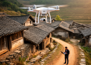
Drones and Deep Learning Race to Save China’s Vanishing Traditional Villages
A research team combined UAV photogrammetry with a YOLOv8-based deep learning model to build digital archives and automatically detect roof ...
A research team combined UAV photogrammetry with a YOLOv8-based deep learning model to build digital archives and automatically detect roof ...

A three-dimensional damage-mechanics simulation of China's Nanfen open-pit mine links historical underground voids and staged excavation to progressive slope deformation ...
A physics-based simulation of Quito's deadly 2022 La Gasca mudflow reveals that selectively reintroducing fences and buildings into elevation models ...
Chinese researchers fused drone orthophotos, ground-penetrating radar, and GOCAD 3D modeling in Hebei Province to locate shallow cave systems, with ...
A new critical review finds that drone-based photogrammetry reliably measures soil-surface geometry and topographic change, but turning those measurements into ...

Embark on a thrilling journey of discovery with Scienmag.com—your ultimate source for cutting-edge breakthroughs. Immerse yourself in a world where curiosity knows no limits and tomorrow’s possibilities become today’s reality!