


Drone surveys have transformed the way scientists watch soil disappear. With a few hundred overlapping photographs and a technique called structure from motion, a small unmanned aircraft can reconstruct a field surface in three dimensions at millimetre to centimetre resolution, revealing rills, gullies and subtle surface lowering that would once have required weeks of laborious field measurement. Yet a sweeping critical review published in Discover Soil argues that the erosion research community has too often confused beautiful surfaces with proven processes, and that the gap between what these surveys measure and what researchers claim they show is now the decisive scientific question.
The review, authored by Bernardo Cândido of the University of Missouri, synthesised peer-reviewed studies published since 2005, tracing the methodological lineage from close-range digital photogrammetry through to today’s UAV-based workflows. Its central conclusion is deceptively simple: structure-from-motion photogrammetry directly measures soil-surface geometry and, in repeated surveys evaluated against uncertainty, detectable net surface change. It does not directly measure detachment, soil loss, sediment flux, sediment delivery or conservation success. Those are interpretive claims, and they become defensible only when detectability, mechanism, storage context and scale are explicitly constrained.
The technical reasons for this caution lie in the measurement chain itself. Structure from motion estimates camera geometry and sparse scene structure from overlapping images, and multi-view stereo then densifies that solution into a point cloud from which elevation models are derived. Each stage introduces uncertainty. Weak image networks, particularly largely parallel acquisition geometries, can introduce systematic deformation even when models look visually plausible, as James and Robson demonstrated in foundational work. Bare agricultural surfaces compound the problem: they are often planar, weakly textured and repetitive, so they constrain camera self-calibration less effectively than rougher natural terrain. Bright illumination and homogeneous texture can further degrade keypoint matching and introduce broad-scale vertical noise.
Georeferencing decisions matter just as much. Ground-control-point-based orientation, direct georeferencing from RTK or PPK camera positions, and stable local coordinate frames each carry distinct strengths and weaknesses, and camera-center coordinates used in bundle adjustment are observations rather than independent validation data. The review stresses that RTK or PPK positioning does not eliminate the need for spatially distributed checkpoints, and that a single global RMSE can coexist with poorer local precision. For multitemporal analysis, the decisive requirement is a stable date-to-date reference frame accompanied by independent, spatially explicit uncertainty assessment, because detectability varies across the scene rather than behaving as one uniform number.
The evidential strength of drone photogrammetry also varies systematically across erosion processes, and the review organises this variation into a four-level inference ladder. At the base sits surface reconstruction: recovering microtopography, roughness, rill form and many exposed gully shapes. Here the method is already robust. Studies have shown that structure from motion can recover bare-soil microtopography with useful accuracy, that rill geometry can be measured rapidly and non-destructively at plot scale, and that automated rill mapping across agricultural fields can achieve accuracy statistics above eighty percent, although performance drops for shallow incisions and where vegetation or linear surface features resemble rills.
Gullies, with their large relief signals, are particularly well suited to the technique, and early studies demonstrated volumetric analysis of headcut erosion in exposed sections. But strong relief does not eliminate geometric blind spots. UAV-only surveys become restricted on steep gully walls above roughly fifty to sixty degrees and on overhangs, and additional terrestrial imagery substantially improves the resulting three-dimensional models. Vegetation imposes a harder limit still: agreement between photogrammetric surfaces and terrestrial laser scanning degrades as ground cover increases and is significantly affected beyond about fifty-three percent cover. When soil visibility changes, the review notes, the target of the measurement changes too, and elevation differences recorded over vegetation or standing water cannot automatically be read as soil loss.
Diffuse, sheet and interrill erosion is the most demanding domain, because the expected topographic signal is small, spatially dispersed and often close to the magnitude of non-erosional change. Controlled experiments have shown that compaction and settlement can exceed the volume attributed to diffuse erosion under some conditions, and that part of the mobilised material may remain stored within convergent features rather than leaving the plot. On cultivated hillslopes, repeated surveys captured rainfall-related surface lowering, yet inferred mass loss decreased once soil settlement was accounted for through bulk-density measurements. In other words, soils can lower without exporting sediment, and a negative elevation difference that exceeds local uncertainty should first be reported as surface lowering, not erosion.
The strongest studies are those that close the inferential loop with independent evidence. One benchmark combined UAV monitoring of bare erosion plots under natural rainfall with direct sediment collection and spatially variable levels of detection, reporting strong correspondence between photogrammetric soil-loss estimates and measured sediment yield. Another paired drone surveys with RFID soil-particle tracking, runoff and sediment measurements at the plot outlet, and a sediment-connectivity index, revealing that short particle travel distances could coexist with increasing connectivity and higher sediment discharge. A post-fire Mediterranean catchment study combined photogrammetry with terrestrial LiDAR, GNSS and georadar to quantify erosion and sedimentation around a retention dam over several years. In each case, topography gained explanatory power because it was embedded in a broader process-observation framework.
Management claims sit at the top of the ladder and are the sparsest of all. A comparative study using post-storm drone imagery found that cover-cropped plots showed lower soil loss, shallower rills and smaller rill surface area than bare plots, a genuinely comparative design that moves beyond description. But even that study acknowledges that its reconstructed-baseline approach is constrained by vegetation conditions and requires stronger ground validation for quantitative use. Demonstrating that an intervention reduced erosion requires showing a change relative to a credible counterfactual, and the review finds that validated conservation-effectiveness claims remain much rarer than claims of detectable net surface change.
The practical implications reach beyond academic terminology. For soil conservation, drone surveys excel at spatial diagnosis, identifying runoff pathways, erosional source areas and depositional zones at the scale where interventions are actually placed. For erosion modelling, repeated UAV surveys provide spatially distributed time series that field-scale models have long lacked; one study using nine surveys found that WEPP reproduced observed erosion more closely than USLE, which systematically overestimated soil loss at the site. But surface lowering alone should not be assumed to represent sediment yield. The review’s agenda is clear: shared benchmark datasets across surface states, explicit separation of erosional from non-erosional change, standardised validation protocols for diffuse erosion, nested event-based monitoring, and reporting standards that keep every claim proportional to the evidence that supports it. Detailed surfaces are no longer the hard part; proving what they mean is.
Subject of Research: UAV structure-from-motion photogrammetry for measuring soil surfaces and inferring soil erosion
Article Title: A critical review of UAV structure from motion photogrammetry for measuring soil surfaces and inferring soil loss
Article References: Cândido, B. (2026). A critical review of UAV structure from motion photogrammetry for measuring soil surfaces and inferring soil loss. Discover Soil, 3(1), Article 140. https://doi.org/10.1007/s44378-026-00298-7
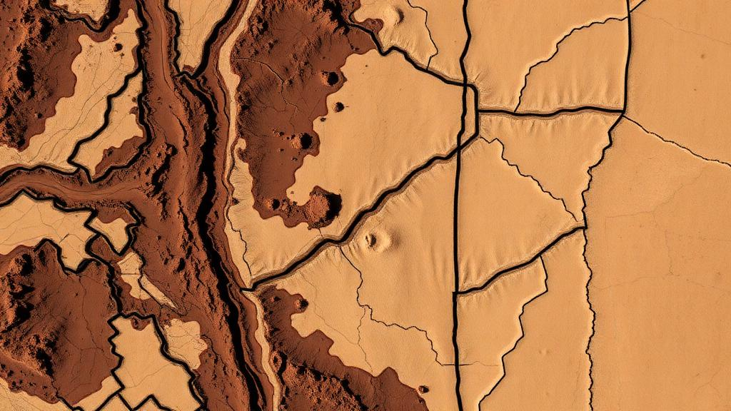
Image Credits: AI Generated
DOI: 10.1007/s44378-026-00298-7
Keywords: UAV photogrammetry, structure from motion, soil erosion, soil microtopography, rill erosion, gully erosion, diffuse erosion, DEM of difference, sediment redistribution, soil conservation, uncertainty, remote sensing
Cite Scienmag News
Alan Morgan. (October 1, 2026). Drones Map Soil Loss in Stunning Detail, But Erosion Claims Need Harder Proof. Scienmag. https://scienmag.com/drones-map-soil-loss-in-stunning-detail-but-erosion-claims-need-harder-proof/
Alan Morgan. "Drones Map Soil Loss in Stunning Detail, But Erosion Claims Need Harder Proof." Scienmag, 1 October 2026, https://scienmag.com/drones-map-soil-loss-in-stunning-detail-but-erosion-claims-need-harder-proof/. Accessed 4 October 2026.
Alan Morgan. "Drones Map Soil Loss in Stunning Detail, But Erosion Claims Need Harder Proof." Scienmag. October 1, 2026. https://scienmag.com/drones-map-soil-loss-in-stunning-detail-but-erosion-claims-need-harder-proof/


