


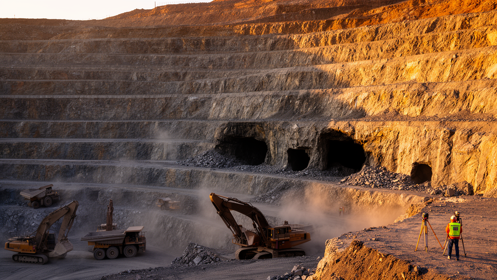
Beneath the terraced walls of one of China’s largest open-pit iron mines lies a hidden legacy of underground mining: a network of voids left behind by decades of subterranean extraction. A new study of the Nanfen open-pit mine in Liaoning Province shows how these buried cavities and the relentless advance of surface excavation together shape the three-dimensional mechanical response of a slope that has already experienced one of the largest landslide events in the mine’s history. By fusing drone-based surveying with a damage-mechanics model run across four successive mine geometries, the research offers a rare continuous portrait of progressive slope deterioration from 2024 through the planned end of 2027.
The Nanfen mine, located roughly 25 kilometers south of Benxi City, is a vast excavation: the pit stretches 3.41 kilometers north to south and 1.75 kilometers east to west, with a closed contour at 286 meters elevation and a pit bottom specified at 70 meters as of April 2025. The surrounding terrain is dominated by low mountains and hills, with natural relief of 300 to 400 meters and a maximum elevation of 963.7 meters. The east slope, the focus of the new analysis, sits above historical underground workings whose voids could interact with the open pit in ways that conventional two-dimensional stability charts cannot capture.
The stakes are not abstract. On 19 June 2021, extensive sliding and subsidence developed on the footwall slope, extending from an elevation of 710 meters near the crest down to 298 meters near the toe, a vertical span of roughly 410 meters. The deformation reached northward from a 2016 landslide area to exploration line 6, with an affected width of approximately 480 meters in the upper part and 550 meters in the lower part. It was the largest deformation event recorded during the mining period, and it underscored how quickly a slope under active excavation can transition from monitored stability to large-scale movement.
To model such a system realistically, the research team first rebuilt the mine in three dimensions. Surface topography was captured using unmanned aerial vehicle oblique photogrammetry and laser scanning, producing point clouds that were converted into a surface solid in Rhino, a three-dimensional modeling platform. Lithological interfaces were reconstructed from surveyed geological sections: contour lines for each rock type were matched between sections and lofted into continuous three-dimensional surfaces. The resulting model spans 1,500 meters by 900 meters in plan, with a nominal vertical extent of 800 meters that varies with the topographic profile, and it was built at a 1:1 scale with tolerances of 0.01 in absolute terms and 1 degree in angular terms.
Meshing such a heterogeneous model posed its own challenges. Boolean partitioning of the geology can leave duplicate surfaces along lithological contacts, and meshing without coplanar processing would create overlapping elements and misaligned nodes that compromise mesh continuity. The team made the duplicate surfaces coplanar so each contact was represented by a single interface, then generated a tetrahedral mesh with Rhino’s Griddle plug-in and imported it into COMSOL Multiphysics in BDF format. The final mesh contains 5,564,628 elements and 1,016,142 nodes, with a nominal element edge length of about 10 meters, fine enough to resolve both the slope geometry and the underground voids.
The mechanical heart of the study is an elasto-damage constitutive model, implemented in COMSOL with MATLAB-assisted customization. Rather than treating rock as a purely elastic-plastic material, the model introduces a scalar damage variable that degrades stiffness as microscopic defects initiate and coalesce under loading. Separate tensile and compressive strain thresholds govern damage initiation, and historical maximum strain variables record the largest equivalent strains each element has ever experienced. Because damage is irreversible, these historical maxima are inherited through unloading and subsequent excavation stages, so the calculation remembers every episode of deterioration even after the damaged rock itself is mined away. The maximum damage value is capped at 0.99, retaining one percent of the undamaged elastic stiffness to support numerical convergence.
Seven lithologies are represented in the model: mica schist, chlorite schist, green amphibolite, iron ore, mica quartz schist, quartz granulite, and granite, each with its own bulk modulus, shear modulus, cohesion, friction angle, tensile strength, and density. The east slope cutting area receives a separate, weaker parameter set, with a cohesion of 0.1 megapascals and a tensile strength of just 0.02 megapascals. These rock-mass parameters were supplied directly by the mine’s technical department, anchoring the simulation in site-specific engineering values rather than generic literature estimates.
The excavation sequence is what gives the study its unusual continuity. The team first established self-weight equilibrium with the underground void regions represented as solid rock, then excavated the voids and re-established equilibrium, resetting displacement to zero while retaining stress and damage histories. From that reference state, the model formed the actual 2024 open-pit geometry, then progressed continuously through the actual end-of-2025 configuration, which combined production excavation with slope cutting, and on to the planned end-of-2026 and end-of-2027 design geometries. At every stage, excavated elements were removed or deactivated without remeshing, and the retained material inherited stress, strain, displacement, damage, and historical strain states from the preceding step.
The results trace a striking evolution in slope behavior. In the 2024 baseline geometry, the maximum settlement magnitude on the slope surface reached 27.5 millimeters, concentrated in the middle and upper slope. By the actual end-of-2025 geometry, the mean settlement over the remaining slope surface was approximately 20 millimeters. The end-of-2026 design geometry showed a maximum below 7 millimeters and a mean near 5 millimeters, and by the end-of-2027 configuration the remaining slope surface exhibited sub-millimeter settlement magnitudes. The researchers caution that these statistics describe the slope surface retained at each stage, so the comparison reflects both changing mechanical response and the evolving sampled domain as material is removed.
Perhaps the most intriguing finding lies in the spatial organization of damage. Across all four configurations, the damage concentrations associated with the underground voids appear spatially separate from those associated with the slope itself, with an intervening region of lower displayed damage between them. In the end-of-2025 configuration, localized stress concentration appeared near the pit bottom as excavation approached the void roofs, a zone the authors flag for targeted monitoring and site-specific assessment of excavation increments and support. The team emphasizes that the separation remains a qualitative pattern observed in full-field plots with stage-specific color scales; quantifying the geometry and persistence of the intervening rock zone will require common-threshold connectivity analysis. They also note that independent field validation remains a priority because monitoring data were unavailable for this analysis, and that future work should incorporate groundwater, blasting vibration, long-term weathering, and mesh sensitivity studies. For now, the model offers mine planners a screening tool: a way to see, before the excavators arrive, where the rock beneath Nanfen’s slopes is quietly accumulating damage.
Subject of Research: Three-dimensional progressive damage and geohazard assessment of an open-pit mine slope affected by subsurface voids and staged excavation
Article Title: Three-dimensional progressive damage and geohazard assessment of an open-pit slope affected by subsurface voids and staged excavation: a case study of the Nanfen mine
Article References: Li, H., Gong, R., Jiao, S., Zhao, Y., Tian, Y., Yang, T., Deng, W., & Li, Y. (2026). Three-dimensional progressive damage and geohazard assessment of an open-pit slope affected by subsurface voids and staged excavation: a case study of the Nanfen mine. Frontiers in Earth Science, 14, Article 1964731. https://doi.org/10.3389/feart.2026.1964731
Image Credits: AI Generated
DOI: 10.3389/feart.2026.1964731
Keywords: open-pit mining, slope stability, underground voids, damage mechanics, 3D numerical modeling, UAV photogrammetry, Nanfen mine, geohazard assessment, excavation sequence, rock mechanics, landslide, COMSOL
Cite Scienmag News
Violet Maxwell. (October 16, 2026). Underground Voids and Staged Excavation Reshape Damage Patterns in a Giant Open-Pit Mine Slope. Scienmag. https://scienmag.com/underground-voids-and-staged-excavation-reshape-damage-patterns-in-a-giant-open-pit-mine-slope/
Violet Maxwell. "Underground Voids and Staged Excavation Reshape Damage Patterns in a Giant Open-Pit Mine Slope." Scienmag, 16 October 2026, https://scienmag.com/underground-voids-and-staged-excavation-reshape-damage-patterns-in-a-giant-open-pit-mine-slope/. Accessed 16 October 2026.
Violet Maxwell. "Underground Voids and Staged Excavation Reshape Damage Patterns in a Giant Open-Pit Mine Slope." Scienmag. October 16, 2026. https://scienmag.com/underground-voids-and-staged-excavation-reshape-damage-patterns-in-a-giant-open-pit-mine-slope/


