


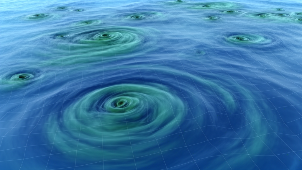
The ocean is not the smooth, layered fluid that satellite images of blue water might suggest. It is churned by tens of thousands of swirling vortices known as mesoscale eddies, rotating bodies of water spanning roughly 10 to 250 kilometers that persist for weeks to months. These features are the weather systems of the sea, ferrying heat, salt, nutrients, and momentum across entire ocean basins, modulating the growth of plankton, and even influencing the intensity of tropical cyclones by carrying reservoirs of warm water beneath storms. A new study published in the journal Ocean Science by Paolo Mauriello of Italy’s National Research Council of Marine Sciences and colleagues provides one of the most rigorous quantitative audits yet of how well computer reconstructions of the ocean actually capture these spinning structures, and the results carry a clear message: resolution matters, and a new generation of satellites is changing how we can prove it.
The team set out to evaluate two global ocean reanalysis products distributed through the Copernicus Marine Service, both built on the NEMO ocean model and constrained by data assimilation. The first, GLORYS2V4, runs at a horizontal resolution of one quarter of a degree, roughly 25 kilometers at mid-latitudes, which makes it eddy-permitting, meaning it can barely represent the larger eddies but smears out the smaller ones. The second, GLORYS12V1, developed by Mercator Ocean International, runs at one twelfth of a degree, about 8 kilometers, with 50 vertical levels, placing it firmly in the eddy-resolving regime. Both systems assimilate along-track satellite sea-level anomalies, sea-surface temperature, in-situ temperature and salinity profiles, and sea-ice concentration over the satellite altimetry era that began in 1993, producing a continuous, physically consistent four-dimensional picture of the ocean state.
Reanalyses are indispensable to ocean and climate science precisely because they blend sparse observations with model dynamics, filling gaps in space and time. But that blending raises an obvious question: how faithfully do they reproduce the real, turbulent ocean? To answer it, the researchers needed an independent benchmark, and they chose two satellite altimetry products, both mapped onto a one eighth of a degree grid. The first was the established AVISO DUACS product, derived from decades of multi-mission nadir altimeters that measure sea level along narrow ground tracks. The second was the experimental SWOT MIOST Science product, which incorporates observations from the Surface Water and Ocean Topography mission, launched in December 2022, whose wide-swath radar interferometer captures sea-surface height over broad strips of ocean at far finer spatial scales than conventional altimetry ever could.
The choice of reference data was itself a methodological statement. Previous work had shown that the effective resolution of mapped altimetry products is lower than their nominal grid spacing, because the optimal interpolation used to fill in the gaps between satellite tracks smooths away variability at wavelengths shorter than roughly 50 to 100 kilometers. Comparing an eddy-resolving model against a product that cannot see the smallest eddies would unfairly penalize the model. The SWOT-based product, while still a mapped Level-4 reconstruction rather than raw swath data, injects genuinely new fine-scale information that has not been directly assimilated into the reanalyses. The authors are careful to note that neither satellite product can be treated as absolute truth, since both share nadir-altimetry information with the reanalysis systems, so they used the two references as complementary yardsticks rather than oracles, comparing results over a common period from August 2023 to May 2025 across a North Atlantic domain spanning roughly 30 to 60 degrees north, a region dominated by the Gulf Stream and its famously energetic eddy field.
The verification machinery was built on the open-source py-eddy-tracker package, which identifies eddies as closed contours in sea-surface height fields that satisfy strict geometric criteria: a single extremum at the center, a roughly circular shape, and a minimum amplitude. Detection was performed on absolute dynamic topography rather than sea-level anomaly to avoid mistaking Gulf Stream meanders for eddies in this strongly sheared region. Each eddy was then tracked day by day using a cost function that weighs differences in amplitude, effective radius, and centroid position, with a minimum lifetime of four days to filter out transient noise. The crucial step came next: rather than merely counting eddies in each dataset independently, the team matched eddies between the reanalyses and the satellite references, classifying each detection as a hit, a miss, or a false alarm, and condensing those counts into two familiar verification scores borrowed from weather forecasting, the Probability of Detection and the False Alarm Ratio.
The headline result is unambiguous. GLORYS12V1 detected roughly 62 percent of the eddies observed by either satellite product, while GLORYS2V4 managed only about 46 percent, a relative improvement of more than 30 percent in the Probability of Detection. The price of that sensitivity was a higher False Alarm Ratio, rising from roughly 18 percent for the coarser model to about 24 percent for the eddy-resolving one, an increase of 22 to 26 percent depending on the reference dataset. That trade-off is not a flaw so much as a signature of resolution: the high-resolution model sees many more small eddies, and while many of them correspond to real features, a substantial fraction find no counterpart in the satellite maps, which struggle to resolve features below about 50 kilometers. A block-bootstrap statistical analysis with 95 percent confidence intervals confirmed that the detection advantage of GLORYS12V1 is robust and insensitive to the details of the resampling.
The study went beyond simply asking whether eddies were found, and examined how accurately the matched eddies were rendered. For eddies detected in both the model and the satellite data, GLORYS12V1 achieved a mean matching cost about 26 percent lower than GLORYS2V4 against both references. Its mean errors in amplitude, effective radius, and centroid distance were reduced by approximately 35, 32, and 13 percent respectively. In other words, when the eddy-resolving model gets an eddy right, it gets the eddy’s strength, size, and position substantially closer to what the satellites observe. Notably, the improvement was slightly more pronounced in the comparison against the SWOT-based product, hinting that wide-swath altimetry reveals fine-scale structure that only the high-resolution model can begin to reproduce.
The diagnostics also exposed where both systems still stumble. The overwhelming majority of misses and false alarms were concentrated among small eddies, those with radii below 50 kilometers and amplitudes below 4 to 5 centimeters. For large, strong eddies the agreement was striking: for features with radii above 100 kilometers, the Probability of Detection climbed to around 90 percent and the False Alarm Ratio fell to 10 to 15 percent in the DUACS comparison, while in the SWOT comparison the detection rate exceeded 80 to 95 percent for eddies with amplitudes greater than 10 centimeters. The authors caution that some of the smallest detections may be spurious artifacts of mapping, filtering, or noise rather than genuine dynamical features, and they argue that future verification studies should develop objective, scale-aware strategies for down-weighting these uncertain features rather than treating every closed contour as a physically meaningful eddy.
The broader implications extend well beyond model scorecards. Ocean reanalyses underpin climate monitoring, fisheries oceanography, marine safety, and seasonal prediction, and eddies are central to how the ocean stores and redistributes heat. Demonstrating quantitatively that eddy-resolving systems represent the mesoscale ocean markedly better gives the modeling community a concrete justification for the computational expense of high resolution, while the persistent false alarms among small features map out exactly where the next improvements are needed. Equally important, the study showcases SWOT wide-swath altimetry as a new verification tool of genuine power. Because its fine-scale observations are not assimilated into the reanalyses examined here, they provide a partially independent window on ocean variability that conventional nadir altimetry simply cannot offer. As the SWOT record lengthens and future work extends this framework to longer periods, other ocean basins, and more sophisticated eddy classifications that distinguish merged, split, and artefactual features, the combination of eddy-resolving models and wide-swath observations promises a far sharper view of the ocean’s restless, swirling interior.
Subject of Research: Evaluation of mesoscale eddy representation in North Atlantic ocean reanalyses using satellite altimetry
Article Title: Quantitative evaluation of mesoscale eddies in the North Atlantic using satellite altimetry and ocean reanalyses
Article References: Quantitative evaluation of mesoscale eddies in the North Atlantic using satellite altimetry and ocean reanalyses. (n.d.). https://doi.org/10.5194/os-22-2863-2026
Image Credits: AI Generated
Keywords: mesoscale eddies, ocean reanalysis, satellite altimetry, SWOT, North Atlantic, GLORYS12V1, GLORYS2V4, AVISO DUACS, py-eddy-tracker, data assimilation, ocean modeling, Gulf Stream
Cite Scienmag News
Violet Maxwell. (October 9, 2026). Sharper Ocean Models Catch More Eddies, New North Atlantic Study Shows. Scienmag. https://scienmag.com/sharper-ocean-models-catch-more-eddies-new-north-atlantic-study-shows/
Violet Maxwell. "Sharper Ocean Models Catch More Eddies, New North Atlantic Study Shows." Scienmag, 9 October 2026, https://scienmag.com/sharper-ocean-models-catch-more-eddies-new-north-atlantic-study-shows/. Accessed 9 October 2026.
Violet Maxwell. "Sharper Ocean Models Catch More Eddies, New North Atlantic Study Shows." Scienmag. October 9, 2026. https://scienmag.com/sharper-ocean-models-catch-more-eddies-new-north-atlantic-study-shows/


