


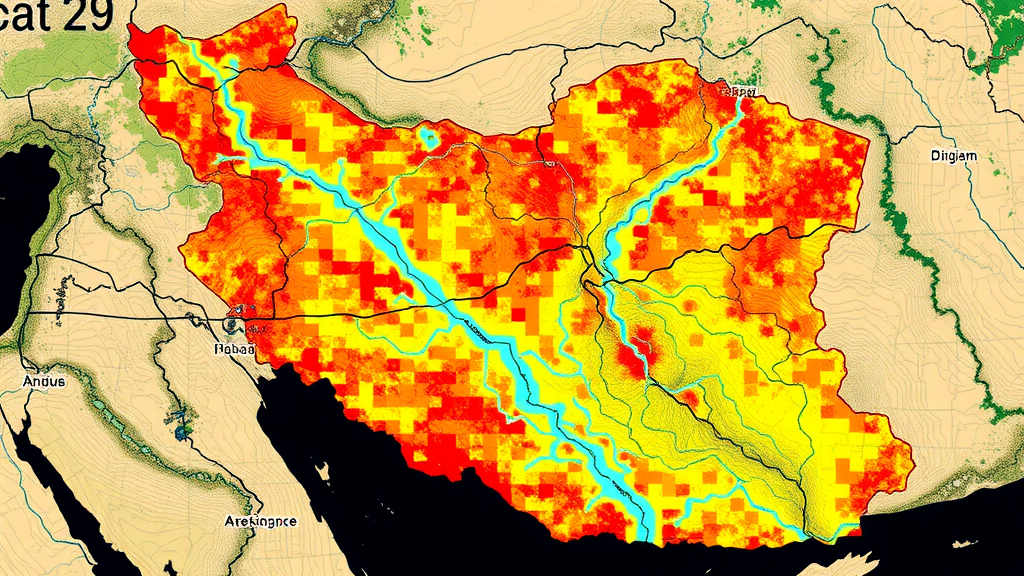
Floods are among the most destructive natural hazards on Earth, and the maps that predict where they will strike are only as good as the data that feed them. In a new study published in Water Resources Management, researchers at Sharif University of Technology in Tehran have demonstrated that swapping a conventional, pre-existing river network for one derived directly from satellite imagery can measurably improve the reliability of flood hazard maps, even in regions where ground-based hydrological data are scarce. Working in the flood-prone counties of Dasht-e Azadegan and Hoveyzeh in Khuzestan Province, Iran, the team combined the widely used Analytic Hierarchy Process with remote sensing products from the Copernicus Sentinel missions, and then rigorously tested the results against satellite observations of an actual flood event.
The Analytic Hierarchy Process, or AHP, is a structured multi-criteria decision-making technique introduced by Thomas Saaty in which complex problems are decomposed into a hierarchy of criteria, and pairwise comparisons convert expert judgment into numerical weights. In flood hazard mapping, AHP is typically applied by scoring a set of terrain and hydrological factors, weighting each according to its perceived influence on inundation, and combining the weighted layers into a single hazard index. The method is attractive because it is transparent, computationally inexpensive, and does not demand long historical flood records, which makes it a popular choice in developing regions where dense gauge networks are simply unavailable.
The research team, led by Sanaz Moghim together with Alireza Farmahini Farahani and Reza Rajabi, built their hazard maps using eight criteria: distance to river, slope, aspect, curvature, flow accumulation, drainage density, land use and land cover, and elevation. Each criterion was reclassified into classes ranked by relative flood influence, and the AHP weighting scheme assigned the overall importance of each layer. Two alternative maps were then produced. The first relied on a pre-existing stream network, the kind of digitized hydrography that is commonly available in national and international geospatial databases. The second replaced that network with one extracted from the Normalized Difference Water Index, a spectral index computed from optical satellite imagery that highlights surface water by contrasting near-infrared and visible reflectance.
The choice of river network matters because distance to river is one of the strongest controls on flood hazard in the AHP framework. Pixels close to a stream channel receive the highest hazard scores, and the scores decay with distance. If the underlying stream network is incomplete, generalized, or outdated, every downstream calculation inherits those errors. In flat, marshy lowlands such as those of Dasht-e Azadegan and Hoveyzeh, where subtle topographic differences and seasonal wetlands complicate conventional hydrographic mapping, a satellite-derived view of where water actually accumulates could plausibly represent flood dynamics better than a legacy database layer.
To find out whether this is true in practice, the researchers needed an independent benchmark, and they found it in the 2019 flood that inundated large parts of Khuzestan Province. The extent of that flood was mapped from Sentinel-1 synthetic aperture radar, or SAR, observations. SAR is uniquely valuable for flood mapping because its microwave signal penetrates cloud cover and can be acquired day or night, and because smooth open water reflects the radar energy away from the sensor, appearing dark in the imagery in sharp contrast to the rougher surrounding land. This made it possible to build an objective record of where floodwater actually stood, against which the modeled hazard maps could be judged.
The validation employed receiver operating characteristic analysis, a statistical technique that evaluates how well a continuous hazard index separates flooded from non-flooded locations. The area under the ROC curve, or AUC, ranges from 0.5, equivalent to random guessing, to 1.0, indicating perfect discrimination. The results were clear. The NDWI-derived hazard map achieved an AUC of 0.88, indicating strong agreement with the observed 2019 inundation, while the map built on the pre-existing stream network reached an AUC of 0.81. In practical terms, the satellite-derived river network pushed the model’s discriminatory power noticeably higher, suggesting that even a modest change in one input layer can cascade into a substantially more trustworthy hazard product.
Beyond the headline comparison, the team conducted a sensitivity analysis to determine which of the eight criteria actually drove the classification. Flow accumulation and slope emerged as the two features with the strongest effect on hazard classification, a finding consistent with the physical intuition that water converges in low-lying areas with gentle gradients. By contrast, aspect and curvature had minimal influence on the final hazard pattern. This kind of sensitivity information is valuable for practitioners because it indicates where investing in higher-quality data pays off and where simpler or coarser inputs are unlikely to compromise the result, an important consideration in data-limited settings where every dataset must be weighed against acquisition and processing costs.
The implications extend well beyond two counties in southwestern Iran. Rentschler and colleagues estimated in a 2022 Nature Communications analysis that flood exposure and poverty overlap extensively across 188 countries, and global assessments of future river flood risk have repeatedly identified data-poor regions as those where hazard information is weakest precisely where vulnerability is highest. The Iranian study offers a template for such settings: freely available Sentinel imagery, a transparent AHP weighting procedure, and validation against openly accessible SAR flood observations together produce a defensible hazard map without requiring expensive field campaigns or proprietary models. The data used in the study are publicly available from sources including the U.S. Geological Survey, the Copernicus Data Space Ecosystem, and Esri, underscoring the reproducibility of the approach.
There are, of course, caveats worth noting. The study validates against a single flood event, and the NDWI is sensitive to turbid water, aquatic vegetation, and cloud cover, which is precisely why SAR served as the reference rather than another optical product. AHP weights also retain a subjective element inherited from expert pairwise comparisons, although sensitivity analysis partially mitigates this by revealing which weights matter most. Future work could extend the validation to multiple flood events, test alternative water indices, or compare the enhanced AHP framework against machine learning classifiers that have shown strong performance in flood susceptibility studies. Nevertheless, the quantitative gain from 0.81 to 0.88 AUC provides concrete evidence that satellite-derived inputs can strengthen a decades-old decision-support method.
For flood managers and policymakers in Khuzestan and analogous lowland regions worldwide, the message is direct: hazard maps need not wait for perfect ground data. By letting satellites describe where water flows and pools, and by validating openly against observed floods, planners gain a more reliable basis for zoning, early warning, and infrastructure investment. As climate change intensifies the hydrological cycle and extreme rainfall events grow more frequent, the ability to update flood hazard information rapidly and cheaply from orbit may prove one of the most consequential tools in the disaster-risk-reduction toolkit, and this study shows exactly how such a workflow performs under real-world scrutiny.
Subject of Research: AHP-based flood hazard mapping enhanced by satellite remote sensing and validated against SAR-observed flood extent in Iran
Article Title: AHP-based Flood Hazard Mapping Enhanced by Remote Sensing
Article References: Moghim, S., Farmahini Farahani, A., & Rajabi, R. (2026). AHP-based Flood Hazard Mapping Enhanced by Remote Sensing. Water Resources Management, 40(11), Article 521. https://doi.org/10.1007/s11269-026-04879-7
Image Credits: AI Generated
DOI: 10.1007/s11269-026-04879-7
Keywords: flood hazard mapping, AHP, remote sensing, NDWI, Sentinel-1, SAR, ROC-AUC, Khuzestan Province, flow accumulation, drainage density, multi-criteria decision analysis, flood risk assessment
Cite Scienmag News
Violet Maxwell. (September 12, 2026). Satellite-Derived River Networks Sharpen AHP Flood Hazard Maps in Iran. Scienmag. https://scienmag.com/satellite-derived-river-networks-sharpen-ahp-flood-hazard-maps-in-iran/
Violet Maxwell. "Satellite-Derived River Networks Sharpen AHP Flood Hazard Maps in Iran." Scienmag, 12 September 2026, https://scienmag.com/satellite-derived-river-networks-sharpen-ahp-flood-hazard-maps-in-iran/. Accessed 4 October 2026.
Violet Maxwell. "Satellite-Derived River Networks Sharpen AHP Flood Hazard Maps in Iran." Scienmag. September 12, 2026. https://scienmag.com/satellite-derived-river-networks-sharpen-ahp-flood-hazard-maps-in-iran/


