


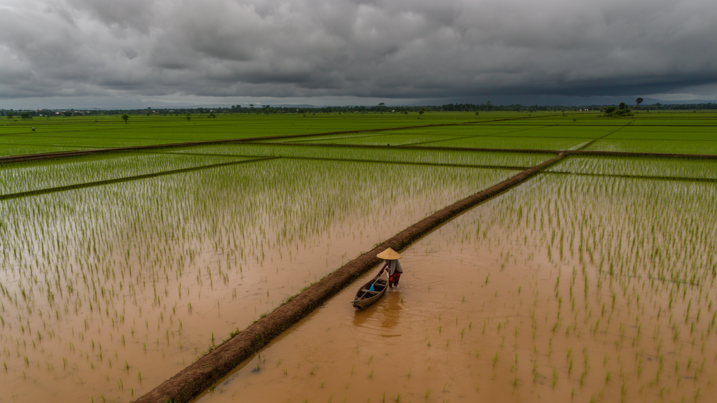
In November 2025, something extraordinary happened over the warm waters of the Strait of Malacca: a tropical cyclone formed almost directly on the equator. Tropical Cyclone Senyar, one of only a handful of near-equatorial cyclones ever documented in the region, unleashed exceptional rainfall across northwestern Sumatra, triggering catastrophic flooding in Aceh, North Sumatra, and West Sumatra. The disaster struck some of Indonesia’s most productive rice-growing regions, and the human toll was severe, with Indonesian authorities reporting hundreds of deaths and many more people missing. Now, a large team of Indonesian researchers has published the first comprehensive satellite-based accounting of what that floodwater did to the nation’s rice supply, and their numbers are sobering.
The study, conducted by scientists at Indonesia’s National Research and Innovation Agency (BRIN) together with colleagues from government agencies and universities, was published in Theoretical and Applied Climatology. Led by Anny Mulyani and Destika Cahyana, the team combined radar imagery from the European Sentinel-1 satellite with Indonesia’s official 2024 paddy field registry, known as the LBS dataset, to map exactly which rice fields were inundated and to estimate how much of the harvest was lost. Their conclusion: roughly 102,189 hectares of paddy fields were flooded, about 14.53 percent of all officially registered rice land in the affected study area.
The technical heart of the approach lies in synthetic aperture radar, or SAR. Unlike optical satellites, which are blinded by the thick storm clouds that accompany cyclones, SAR instruments bounce microwave pulses off the Earth’s surface and measure the reflected signal. Smooth, open water acts like a mirror, reflecting radar energy away from the satellite and appearing dark in the resulting image, while vegetated fields scatter the signal back brightly. This contrast makes SAR exceptionally well suited to flood mapping during active disasters. The researchers used pre-processed Sentinel-1 flood products supplied by UNOSAT, the United Nations’ operational satellite mapping service, and overlaid them on the official paddy field boundaries to isolate flooded cropland from flooded forest, villages, and roads.
Overlaying satellite flood maps on agricultural registers sounds simple, but the accuracy of the result depends entirely on the quality of both layers. The LBS dataset, produced by Indonesia’s Ministry of Agrarian Affairs and Spatial Planning, provides the authoritative footprint of where rice is legally and actually cultivated. By restricting the flood analysis to these verified boundaries, the team avoided the common pitfall of counting flooded scrubland or fish ponds as lost rice production. To check how well the satellite method performed on the ground, the researchers validated their maps against 150 field observation points collected by local agricultural officers in the three affected provinces.
The spatial pattern of destruction was strikingly uneven. Flood impacts concentrated in the lowland alluvial plains and the downstream reaches of river basins, particularly in eastern Aceh and eastern North Sumatra, where rivers swollen by Senyar’s rains spilled over their banks and spread across the flat coastal farmland. This geography is no accident: rice paddies are deliberately situated on flat, water-rich alluvial soils, the very terrain that cyclone-driven flooding inundates most thoroughly and most persistently. The study’s authors note that detection performance varied between provinces and was strongly influenced by topography, local hydrological conditions, and how long floodwater remained standing on the fields.
Field verification revealed an important bias in the satellite numbers. Ground assessments suggested the true flooded area reached approximately 139,040 hectares, meaning the Sentinel-1-based estimate of 102,189 hectares was conservative, undercounting the damage by more than a quarter. Several factors can explain this gap. Rapidly receding floodwater may dry out between satellite passes, leaving no radar signature by the time the next image is acquired. Dense rice canopy can mask standing water beneath it, since the radar signal scatters off the leaves rather than reaching the flooded soil below. And in areas of prolonged, deep inundation, the boundary between flooded field and saturated mud becomes spectrally ambiguous. The lesson, the authors argue, is that satellite emergency mapping captures the spatial distribution of damage very well but still needs field verification to pin down the total magnitude.
Flooded does not necessarily mean destroyed, and the team went a step further by classifying damage severity. Combining the satellite extent with field-based assessments of crop condition, they estimated that moderate to severe damage affected approximately 76,318 hectares of paddy fields. Translating that damaged area into lost harvest, they calculated a production loss of roughly 412,607 tons of dry unhusked paddy, the standard measure of Indonesian rice output. For a country that is the world’s largest rice importer by some measures and where rice price stability is a core political concern, a loss of that size from a single event in three provinces is economically and politically significant.
Senyar itself deserves attention as a meteorological rarity. Tropical cyclones generally require a minimum distance from the equator, because the Coriolis effect, the apparent deflection of moving air caused by Earth’s rotation, is what gives cyclones their spin. Within about five degrees of the equator, that effect nearly vanishes. Yet Senyar developed in the Strait of Malacca close to the equator, echoing Typhoon Vamei, which formed nearby in 2001 and remains the textbook example of a near-equatorial cyclone. Researchers have linked such events to unusual wind patterns and vorticity in the strait, and some climate scientists warn that warming seas and shifting circulation patterns could make rare cyclone tracks in Southeast Asia more consequential in the future. The cyclone’s extreme rainfall also interacted with the landscape: separate analyses by Indonesian academics have pointed to upstream forest degradation in Sumatra’s watersheds as a factor that amplified flash flooding downstream.
The wider scientific context makes the Sumatra case study more than a local disaster report. Global research has repeatedly identified rice as the crop most exposed to flood damage, and recent studies have documented that severe floods measurably reduce rice yields worldwide. Rice plants can survive submergence for only limited periods, and varieties bred with submergence-tolerance genes, such as the Sub1 lines developed for flood-prone South and Southeast Asia, offer partial protection but not immunity to week-long inundation. As climate change alters tropical cyclone trajectories and intensifies extreme rainfall across Southeast Asia, the authors argue that lowland rice systems, which feed hundreds of millions of people, are among the most vulnerable agricultural assets on the planet.
What the BRIN team has delivered, in effect, is a template for rapid agricultural damage assessment that any flood-prone nation could adopt. The workflow is deliberately operational: take freely available Sentinel-1 radar imagery, use a trusted emergency mapping product such as UNOSAT’s, intersect it with an official cropland registry, and validate with a modest number of ground-truth points. The whole analysis can be completed within days of a disaster, in time to inform decisions about seed distribution, replanting schedules, food imports, and compensation payments. The authors emphasize that the framework supports post-disaster recovery planning as much as it documents damage, and they credit the BRIN disaster task force and local agricultural officers for releasing data quickly enough to make the analysis possible. As extreme weather increasingly tests the world’s rice bowls, the ability to count the losses from orbit, and to know precisely when to trust and when to correct those orbital counts, may become as vital to food security as the harvest itself.
Subject of Research: Satellite-based rapid assessment of flood damage to paddy rice fields caused by Tropical Cyclone Senyar in Sumatra
Article Title: Rapid identification of tropical cyclone senyar-affected paddy fields in sumatra using Sentinel-1 and official paddy field area data
Article References: Mulyani, A., Hati, D. P., Manurung, E. D., Maswar, M., Sosiawan, H., Gani, R. A., Awaludin, A., Karolinoerita, V., Widodo, J., Vetrita, Y., Budhiman, S., Nugroho, U. C., Munawaroh, M., Zylshal, Z., Denaro, L. G., Ardha, M., Ibrahim, A., Sukarno, K. M., Handika, R., … Cahyana, D. (2026). Rapid identification of tropical cyclone senyar-affected paddy fields in sumatra using Sentinel-1 and official paddy field area data. Theoretical and Applied Climatology, 157(10), Article 615. https://doi.org/10.1007/s00704-026-06455-w
Image Credits: AI Generated
DOI: 10.1007/s00704-026-06455-w
Keywords: Tropical Cyclone Senyar, Sumatra, Sentinel-1, synthetic aperture radar, flood mapping, paddy fields, rice production loss, UNOSAT, Indonesia, food security, disaster assessment, near-equatorial cyclone
Cite Scienmag News
Alan Morgan. (October 8, 2026). Rare Equatorial Cyclone Senyar Flooded Over 100,000 Hectares of Sumatran Rice Fields, Satellite Analysis Reveals. Scienmag. https://scienmag.com/rare-equatorial-cyclone-senyar-flooded-over-100000-hectares-of-sumatran-rice-fields-satellite-analysis-reveals/
Alan Morgan. "Rare Equatorial Cyclone Senyar Flooded Over 100,000 Hectares of Sumatran Rice Fields, Satellite Analysis Reveals." Scienmag, 8 October 2026, https://scienmag.com/rare-equatorial-cyclone-senyar-flooded-over-100000-hectares-of-sumatran-rice-fields-satellite-analysis-reveals/. Accessed 8 October 2026.
Alan Morgan. "Rare Equatorial Cyclone Senyar Flooded Over 100,000 Hectares of Sumatran Rice Fields, Satellite Analysis Reveals." Scienmag. October 8, 2026. https://scienmag.com/rare-equatorial-cyclone-senyar-flooded-over-100000-hectares-of-sumatran-rice-fields-satellite-analysis-reveals/


