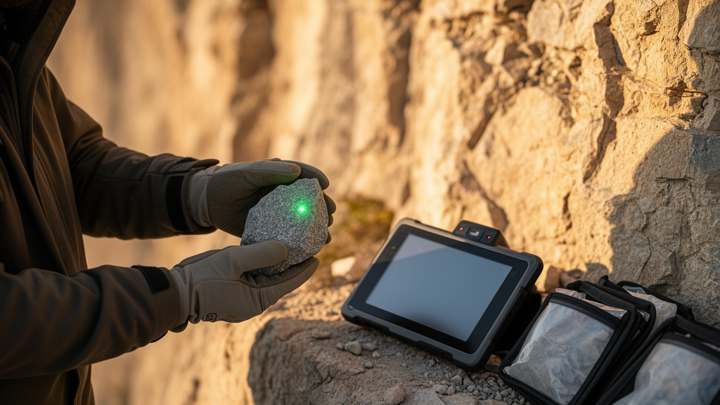
A rock face that has been stripped bare by a retreating glacier, a boulder flung into place by a catastrophic rock avalanche, a road cut opened by engineers decades ago — all of these surfaces carry a hidden clock in their outermost millimetres. Now a team of researchers at the Indian Institute of Technology Kanpur and the CSIR-National Geophysical Research Institute has released an open-source software package designed to read that clock with unprecedented consistency. The tool, called CoRSEER — the Calculator of Rock Surface Exposure Age and Erosion Rates — is described in a peer-reviewed paper published in the journal Geochronology, and it promises to standardise a young but rapidly growing dating technique known as luminescence rock surface exposure dating, or LRSED.
The principle behind LRSED is as elegant as it is surprising. Minerals such as quartz and feldspar, buried deep inside a rock, are bombarded for hundreds of thousands of years by ionising radiation from their surroundings. This radiation fills so-called electron traps in the crystal lattice, and the trapped electrons store energy that can be released as luminescence in the laboratory. The moment sunlight strikes the rock surface, however, photons begin to knock those electrons free — a process called bleaching. Because light penetrates only a short distance into rock, the bleaching is strongest at the surface and fades with depth, producing a characteristic sigmoidal profile of luminescence signal versus depth. The shape and position of that profile encode how long the surface has been exposed and how fast it has been wearing away.
Despite its promise, LRSED has struggled to spread beyond a handful of specialist laboratories. The mathematical analysis of luminescence depth profiles has been hampered by subjective choices: researchers traditionally picked the deep, saturated portion of a profile by eye to normalise their data, and different studies adopted different kinetic models and fitting strategies. The result was a patchwork of results that were difficult to compare and sometimes difficult to reproduce. CoRSEER, a MATLAB application released openly on Zenodo and GitHub, was built specifically to close these gaps by automating the entire workflow from raw luminescence measurements to exposure ages and erosion rates, complete with formal uncertainty estimates.
The software operates through three linked modules. The first, CoRSEER-I, tackles the normalisation problem head-on. Instead of relying on a human analyst to judge where the saturation plateau begins, it fits a weighted three-parameter logistic sigmoidal curve to the measured profile. The upper asymptote of that curve defines the saturation level objectively, and the inflection point — the depth at which half the saturation signal is reached — becomes a key diagnostic of exposure history. When the team reanalysed a published calibration profile from a road-cut sample with a known 57-year exposure history, the automated renormalisation revealed that the original manual processing had under-normalised the data by roughly 8.5 percent. Correcting for this raised the quality of the model fit, measured by the coefficient of determination, from 0.868 to 0.928, and dramatically tightened the uncertainty bounds on the fitted bleaching parameters.
Those bleaching parameters — the effective detrapping rate at the rock surface and the attenuation coefficient that governs how quickly light dies away with depth — are the linchpin of the whole method. They depend on rock type, mineralogy, surface orientation and even the accumulation of rock varnish, so they must be calibrated for each site and lithology using samples of known age. CoRSEER-I performs this calibration through a Monte Carlo inversion: it simulates thousands of candidate profiles across a broad parameter space, scores each against the measured data using a chi-square misfit, and retains the statistically plausible solutions. The second module, CoRSEER-II, then holds these calibration parameters fixed and inverts unknown profiles for exposure age, while the third, CoRSEER-III, searches for steady-state erosion histories that can explain profiles whose apparent ages fall far short of independently known ages.
The physics embedded in the forward model is what separates CoRSEER from earlier attempts. The governing equation tracks three simultaneous processes: the growth of the luminescence signal driven by ambient environmental radiation, the depth-dependent bleaching caused by attenuating sunlight, and the advection of the entire profile toward the surface as erosion removes material. Crucially, the model supports general-order kinetics rather than only first-order decay. This matters because feldspar infrared stimulated luminescence signals, widely used in the field, bleach more slowly and non-exponentially than first-order models assume. Previous work by the same research community has shown that assuming first-order kinetics can underestimate exposure ages and overestimate erosion rates, in some cases by up to an order of magnitude. CoRSEER solves the full equation numerically with a finite-difference scheme, using a second-order upwind method for the advection term.
To demonstrate that the platform works, the authors reanalysed published datasets from multiple regions, including 23 calibration samples. The results were encouraging on the most important metric. Apparent exposure ages computed by CoRSEER-II for 41 unknown samples clustered tightly around the one-to-one line relative to previously published values, spanning roughly one year to 8,500 years, with a correlation against the 1:1 line of 0.889. In a benchmark case — a rock-avalanche boulder independently dated to about 4,500 years old — CoRSEER-II returned an apparent age of only about nine years, correctly signalling that the boulder surface had been eroding. CoRSEER-III then estimated a steady-state erosion rate of about 0.107 millimetres per year, broadly consistent with the published value of 0.066 millimetres per year, and placed the onset of that erosion within decades of exposure.
The compilation also exposed honest limitations. Calibration parameters derived by CoRSEER-I sometimes shifted systematically from literature values, which the authors attribute mainly to differences in normalisation and fitting strategy rather than to any flaw in the underlying physics. Erosion-onset times showed larger departures than erosion rates themselves, reflecting the inherent difficulty of pinning down when erosion began from a single profile. The authors are candid that the tool’s performance depends heavily on data quality: profiles need dense millimetre-scale sampling, more than half of the measurement points should lie on the sigmoidal transition rather than the saturated plateau, and measurement scatter must be controlled. They also recommend using young, uneroded calibration surfaces wherever possible, because erosion on older calibration samples can bias the fitted parameters by large factors.
Why does this matter beyond the technical community? Exposure and erosion histories are the raw material of geomorphology, linking climate change, tectonics and the surface processes that sculpt mountains, coastlines and river valleys. The established alternative, terrestrial cosmogenic nuclide dating such as beryllium-10 measurement, works best on millennial timescales and suffers from a fundamental ambiguity: a single nuclide concentration can be explained by infinitely many combinations of exposure duration and erosion rate. LRSED offers an independent chronometer sensitive to decadal-to-millennial events — glacier retreat, coastal boulder transport, fault-scarp rupture, quarrying — and can be coupled with cosmogenic methods to break that ambiguity. By replacing subjective analyst choices with a transparent, standardised and openly available inversion framework, CoRSEER aims to make results from different laboratories genuinely comparable. If it succeeds, the quiet testimony written in light and depth on every sunlit rock surface will become a far more reliable archive of how our landscapes have changed — and how fast they are changing still.
Subject of Research: An open-source calculator for luminescence rock surface exposure dating that estimates rock exposure ages and erosion rates from luminescence depth profiles.
Article Title: CoRSEER: the calculator of rock surface exposure age and erosion rates for luminescence rock surface exposure dating
Article References: Pathan, A. N., Biswas, R. H., & Kumar, D. (2026). CoRSEER: the calculator of rock surface exposure age and erosion rates for luminescence rock surface exposure dating. Geochronology, 8(4), 607-625. https://doi.org/10.5194/gchron-8-607-2026
Image Credits: AI Generated
DOI: 10.5194/gchron-8-607-2026
Keywords: luminescence dating, rock surface exposure dating, erosion rates, geomorphology, geochronology, CoRSEER, open-source software, Monte Carlo inversion, feldspar IRSL, cosmogenic nuclide dating, landscape evolution, sigmoidal fitting
Cite Scienmag News
Violet Maxwell. (October 8, 2026). New Open-Source Tool Turns Rock Surfaces Into Climate and Erosion Timekeepers. Scienmag. https://scienmag.com/new-open-source-tool-turns-rock-surfaces-into-climate-and-erosion-timekeepers/
Violet Maxwell. "New Open-Source Tool Turns Rock Surfaces Into Climate and Erosion Timekeepers." Scienmag, 8 October 2026, https://scienmag.com/new-open-source-tool-turns-rock-surfaces-into-climate-and-erosion-timekeepers/. Accessed 8 October 2026.
Violet Maxwell. "New Open-Source Tool Turns Rock Surfaces Into Climate and Erosion Timekeepers." Scienmag. October 8, 2026. https://scienmag.com/new-open-source-tool-turns-rock-surfaces-into-climate-and-erosion-timekeepers/