


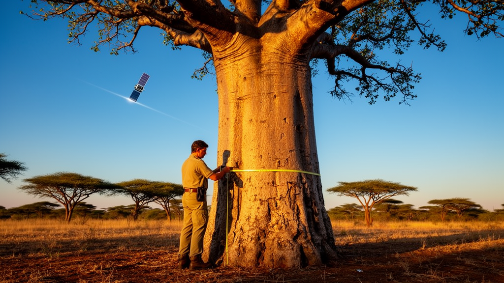
Across vast stretches of Africa, some of the most important trees are the hardest to count. They stand alone in farm fields, line dirt roads, cluster around villages, and dot grazing lands far from any formally designated forest. These scattered trees, known to scientists as trees outside forests, are central to Africa’s ambitious restoration agenda, yet they have long evaded the standard tools of forest measurement. Now a research team led by scientists at Michigan State University, working with partners in Kenya, Ghana, Rwanda, and Malawi, has released a dataset designed to close one of the most stubborn gaps in tropical carbon accounting: the disconnect between what satellites can see from orbit and what foresters must measure on the ground. The work, published as a preprint under review in the journal Earth System Science Data, documents 3,493 individual trees measured with a standardized field protocol across landscapes tied to projects of the African Forest Landscape Restoration Initiative, the continental effort better known as AFR100.
The core problem the dataset addresses is deceptively simple. Modern very high-resolution satellite imagery, combined with machine-learning image analysis, has become remarkably good at finding and outlining individual tree crowns from space. An analyst, or increasingly an algorithm, can delineate the shadowy green footprint of a single mango tree in a Malawian maize field or a lone acacia on Kenyan rangeland, and measure the area that crown projects onto the ground. But satellites cannot see through the canopy to the trunk. And the trunk, specifically the diameter at breast height, or DBH, is the single most important measurement in conventional forestry. Decades of research have produced well-established allometric equations that convert trunk diameter into estimates of aboveground biomass and, from there, into the carbon stored in wood. Without a trunk measurement, a remotely detected crown is just a shape; with one, it becomes a quantifiable store of carbon.
This measurement gap matters most precisely where Africa’s restoration future is unfolding. In landscapes dominated by trees outside forests, trees are spatially dispersed, which makes the conventional plot-based inventory approach expensive and difficult to scale. Walking transects to find and measure every scattered tree across thousands of hectares of farmland is simply not practical, and traditional national forest inventories were designed for closed-canopy forests, not mosaic agricultural landscapes. At the same time, ground datasets containing concurrent measurements of both crown dimensions and stem dimensions have remained scarce, particularly in Africa. That scarcity has left a methodological chasm: remote sensing scientists could map crowns, and foresters could measure trunks, but there was little empirical ground truth connecting the two for the kinds of trees that dominate African restoration landscapes.
The new dataset was built to be that bridge. Field teams working across restoration landscapes in all four countries measured each tree following a single standardized protocol, recording the diameter at breast height, two perpendicular crown diameters, total tree height, species identity, geographic location, and identifiers linking each tree to its plot and broader landscape. The sampled landscapes deliberately span the range of systems where trees outside forests occur, including agroforestry, reforestation plantings, assisted natural regeneration, and other restoration and land-management contexts. After quality control, the final dataset contains 3,493 individual trees, each carrying the full suite of concurrent crown and stem measurements. Crucially, the field measurements were designed from the outset for spatial linkage with individual tree crowns delineated from very high-resolution satellite imagery, so that each ground-measured tree can serve as a calibration point for translating remotely sensed crown projected area into an estimate of stem diameter.
To demonstrate the dataset’s power, the researchers fitted power-law transfer functions relating DBH to crown area and evaluated how well these models predicted trunk diameter across sites and countries. The results were statistically robust: every site-specific relationship was significant at the p < 0.001 level, with coefficients of determination, or R² values, ranging from 0.44 to 0.85 and generally small prediction bias. In practical terms, this means that a measurement of a tree’s crown area, obtainable from a satellite image, can be converted into a usable estimate of its trunk diameter, which can then be fed into established biomass equations. The chain of inference runs from pixels to crowns, from crowns to trunks, and from trunks to carbon, with each link anchored in field data rather than assumption.
Yet the study also delivers an important caution. The variation in model coefficients and predictive error among landscapes was substantial, revealing deep ecological and structural heterogeneity in how crown size relates to trunk size across Africa. A tree growing in the humid highlands of Rwanda may allocate its growth differently than a savanna species in Ghana or a farm-grown shade tree in Malawi, and those differences show up in the crown-to-stem relationship. The authors argue that this heterogeneity is precisely why geographically distributed calibration data are so valuable, and why relying on a single universal allometric relationship would be a mistake. A crown-to-stem equation fitted in one country cannot simply be exported to another without risking systematic error in carbon estimates, particularly when those estimates feed into carbon accounting and payment systems where accuracy carries financial consequences.
Beyond the site-specific models, the team demonstrated a hierarchical synthesis of 19 site-specific transfer functions, showing how the data can be used to derive a generalized crown-to-stem relationship while still retaining information about variation among landscapes. This hierarchical approach offers a template for how the field can move forward: rather than choosing between one global equation and dozens of disconnected local ones, researchers can build models that share strength across sites while honestly representing uncertainty. For monitoring programs, that means carbon estimates for scattered trees can improve as more calibration landscapes are added, without discarding what has already been learned elsewhere.
The implications extend well beyond the models demonstrated in the paper. The dataset provides a reusable observational resource for developing and validating alternative crown-to-stem and crown-to-biomass models, for analyzing structural and species-level variation in African trees, for ecological scaling studies, and for calibrating individual-tree remote-sensing products. It also maintains compatibility with established forest mensuration and biomass estimation methods, meaning that carbon estimates derived through this crown-based pathway remain legible to the national and international reporting frameworks that govern climate finance. For countries participating in AFR100, many of which have pledged to restore tens of millions of hectares, the ability to monitor progress and verify carbon storage in landscapes where trees are dispersed rather than clustered could transform what is reportable and, ultimately, what is fundable.
There is a broader scientific shift embedded in this work as well. The framework extends individual-tree allometric scaling from the field plot to the landscape-scale tree census, a transition made possible only recently by the combination of sub-meter satellite imagery and machine-learning crown delineation. Where earlier generations of carbon mapping relied on coarse pixels and forest-area multipliers, the emerging paradigm treats every detectable tree as an individual entry in a landscape-wide inventory. Datasets like this one supply the empirical calibration that makes such censuses scientifically defensible. As the authors note, the approach extends monitoring, reporting, and verification capacity across African landscapes while keeping one foot firmly planted in the proven methods of traditional forestry.
For a continent racing to meet restoration commitments under climate pressure, the timing could hardly be better. The dataset, which the authors have also deposited in a public repository for reuse, turns a fundamental limitation of satellite remote sensing into a solvable calibration problem. Satellites will keep seeing crowns; with this new empirical bridge, scientists can now estimate what those crowns conceal, tree by tree, across the farms, rangelands, and regenerating landscapes where Africa’s restoration story is actually being written.
Subject of Research: Crown–stem allometry of African trees outside forests for satellite-based biomass and restoration monitoring
Article Title: An African Tree Crown–Stem Allometry Dataset for Monitoring Trees Outside Forests and Landscape Restoration
Article References: Alimo, T., Skole, D., Samek, J., Ndalowa, D., Oeba, V., Kamoto, J., Chioza, A., Papa, C., Spore, J., Levin, D., Brandt, J., & Tumeo, T. (2026). An African Tree Crown–Stem Allometry Dataset for Monitoring Trees Outside Forests and Landscape Restoration. https://doi.org/10.5194/essd-2026-756
Image Credits: AI Generated
Keywords: trees outside forests, allometry, remote sensing, carbon accounting, AFR100, forest landscape restoration, crown diameter, DBH, satellite imagery, Africa, biomass estimation, dataset
Cite Scienmag News
Violet Maxwell. (October 9, 2026). Measuring 3,493 African Trees From Space to Trunk: New Dataset Bridges Crowns and Carbon. Scienmag. https://scienmag.com/measuring-3493-african-trees-from-space-to-trunk-new-dataset-bridges-crowns-and-carbon/
Violet Maxwell. "Measuring 3,493 African Trees From Space to Trunk: New Dataset Bridges Crowns and Carbon." Scienmag, 9 October 2026, https://scienmag.com/measuring-3493-african-trees-from-space-to-trunk-new-dataset-bridges-crowns-and-carbon/. Accessed 9 October 2026.
Violet Maxwell. "Measuring 3,493 African Trees From Space to Trunk: New Dataset Bridges Crowns and Carbon." Scienmag. October 9, 2026. https://scienmag.com/measuring-3493-african-trees-from-space-to-trunk-new-dataset-bridges-crowns-and-carbon/


