


A rare tropical conifer in Bangladesh could be forced into a dramatic reshuffling of its habitat as the climate warms, according to a new study that uses artificial intelligence-style ecological modelling to map where the species may survive. The brown pine, Podocarpus neriifolius, is already classified as Critically Endangered in Bangladesh, where it persists in scattered, specialized environments rather than across continuous forest. Researchers now estimate that only about 3,530 square kilometres of the country currently offers highly suitable conditions for the tree—just 2.46 percent of Bangladesh’s landmass. Their projections suggest that climate change may expand the total area that appears environmentally suitable in some regions, while simultaneously shrinking the pockets of habitat considered optimal. That apparent paradox could make the tree’s future more precarious, not less, because a larger map of “possible” habitat does not guarantee that forests, soils, pollinators, seed sources or migration routes will remain available. The study identifies the southeastern hill forests, including Chattogram, the Chittagong Hill Tracts and Cox’s Bazar, along with parts of Sylhet, as the most consistent potential climate refuges.
Brown pine is a living remnant of the ancient podocarp lineage, a group of conifers that once occupied a much wider portion of South and Southeast Asia. In Bangladesh, however, P. neriifolius is associated with moist tropical and subtropical hill forests, especially shaded slopes, damp valleys and other microhabitats where temperature and moisture remain within a narrow biological range. The tree’s significance extends beyond its rarity. It contributes to forest succession and biodiversity, and its leaves contain compounds that have shown antibacterial and antioxidant activity in laboratory studies. Yet its persistence is threatened by more than rising temperatures. Deforestation, fragmentation, urban expansion, changing land use and difficulties in propagating the species can all isolate populations and prevent natural regeneration. A tree may theoretically find a cooler or wetter location several kilometres away, but that does not mean its seeds can reach it or that the intervening landscape is suitable for establishment. For a slow-growing, habitat-specialist conifer, climate-driven change can therefore turn a collection of isolated stresses into a single, accelerating conservation crisis.
To estimate how the tree’s environmental niche might shift, researchers from the Institute of Forestry and Environmental Sciences at the University of Chittagong combined field observations with a presence-only species-distribution model known as MaxEnt, short for maximum entropy. The team searched published sources and then surveyed potential sites between November 2023 and October 2024, recording 19 confirmed locations with GPS. MaxEnt is designed for cases in which researchers know where a species has been observed but do not have reliable records of where it is genuinely absent. It compares the environmental conditions at known presence points with conditions across a broader background landscape, then produces a probability-like suitability surface. In this study, the researchers initially considered 19 climate variables, together with topographic and soil measurements at roughly one-kilometre resolution. They removed predictors that contributed nothing and filtered out strongly correlated variables, retaining nine that were judged ecologically informative. The final set included elevation, aspect, soil type, temperature measures and seasonal precipitation.
The model’s most influential variable was elevation, which accounted for 47.6 percent of the model’s contribution. The minimum temperature during the coldest period contributed 10.5 percent, while annual mean temperature contributed 9.5 percent and precipitation during the warmest quarter contributed 11.6 percent. Isothermality, a measure of how much day-to-night temperature variation compares with the annual temperature range, contributed 4.8 percent. These results point to a species whose distribution is shaped not by a single climate threshold but by an interlocking set of conditions. The model associated the highest likelihood of occurrence with elevations from sea level to about 813 metres, annual mean temperatures between 21.65 and 26.59 degrees Celsius, and minimum temperatures during the coldest period between 9.5 and 15.5 degrees Celsius. Suitable locations generally had loam to sandy-loam soils, precipitation of 349 to 1,995 millimetres during the warmest quarter, and relatively limited rainfall during the driest period. In practical terms, the tree appears to need warm forests that nevertheless retain cool, moist refuges and stable seasonal conditions.
The researchers also optimized the model rather than relying on MaxEnt’s default settings, a step intended to reduce overfitting—when a model reproduces the limited training data too closely and performs poorly elsewhere. They tested 48 combinations of regularization multipliers and feature classes, which control how smooth or flexible the relationship between environmental conditions and suitability can be. The selected model was evaluated using the area under the receiver operating characteristic curve, or AUC, and the true skill statistic, or TSS. AUC measures how well a model separates observed presences from background conditions, while TSS assesses the success of binary predictions after a threshold is applied. The resulting mean AUC was 0.980 and the TSS was 0.854, values the researchers categorized as excellent. The analysis used 75 percent of occurrence points for training and 25 percent for testing, with 10,000 background points, 1,000 iterations and 10 replicates. Those settings helped stabilize predictions, but the exceptional scores should not be mistaken for certainty: with only 19 observations, even a carefully tuned model cannot capture every biological and human factor affecting the tree’s survival.
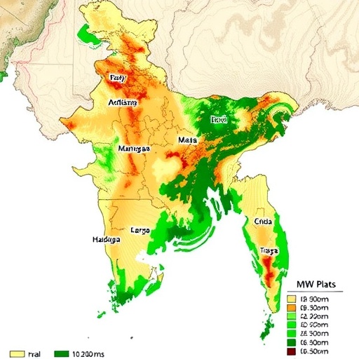
Under current conditions, the model estimated 3,530 square kilometres of highly suitable habitat, 5,290 square kilometres of moderately suitable habitat and 19,980 square kilometres of low suitability. Together, those categories covered about 28,800 square kilometres, or 20.12 percent of Bangladesh’s land area, while approximately 79.88 percent was classified as unsuitable. The highest suitability was concentrated in southeastern Bangladesh, particularly across Chattogram, the Chittagong Hill Tracts and Cox’s Bazar, with smaller areas near Dhaka. Moderate suitability extended through much of the southeastern hills and into Sylhet. This predicted environmental potential is considerably broader than the species’ known distribution, a finding that could encourage restoration and reintroduction. But it also carries a warning. A map showing suitable climate does not demonstrate that a mature forest exists there today. It does not account fully for roads, farms, settlements, competing vegetation, illegal logging, soil moisture, soil acidity or the availability of genetically viable seeds. The difference between potential habitat and occupied habitat is therefore central to interpreting the study.
For the future, the researchers used projections from the HadGEM3-GC31-LL climate model under three Shared Socioeconomic Pathways, or SSPs. SSP126 represents a low-emissions trajectory intended to keep warming below 2 degrees Celsius by 2100; SSP245 represents an intermediate pathway; and SSP585 describes a high-emissions future associated with very high fossil-fuel use and warming approaching 4.7 to 5.1 degrees Celsius. The projections examined the 2050s and 2070s. Across scenarios, total suitable habitat did not simply collapse. Under SSP126, the projected suitable area was about 27,270 square kilometres in the 2050s and 29,490 square kilometres in the 2070s. Under SSP245, low-suitability areas expanded substantially, reaching about 32,010 square kilometres in the 2050s before contracting somewhat later. Under SSP585, the total was projected at 26,520 square kilometres in the 2050s and 31,400 square kilometres in the 2070s. Yet the most suitable zones generally declined: under the high-emissions pathway, highly suitable habitat fell to roughly 3,160 square kilometres in the 2050s and 3,040 square kilometres in the 2070s, compared with 3,530 square kilometres today.
The map of change revealed a shifting mosaic rather than a uniform national loss. Under SSP126 in the 2050s, about 18,770 square kilometres of currently suitable habitat was retained, while 8,510 square kilometres became newly suitable and 10,020 square kilometres was lost. By the 2070s, the retained area declined to about 16,940 square kilometres, while potential gains increased to 12,550 square kilometres. Under SSP245, the model projected 21,330 square kilometres of retained suitability in the 2050s, 19,150 square kilometres of potential gain and 7,470 square kilometres of loss. By the 2070s, 21,870 square kilometres remained suitable, with gains and losses both approaching 19,400 square kilometres. Under SSP585, the 2050s brought an estimated 18,750 square kilometres of retained habitat, 7,760 square kilometres of gain and 10,040 square kilometres of loss. The 2070s showed a modest rebound in retained and gained areas, but highly suitable habitat remained under pressure. The model’s overall message is that climatic suitability may move into new areas while deteriorating in the places where the tree currently has its best chances.
The study also calculated the geographic centre, or centroid, of the predicted suitable area to visualize the direction of change. The present-day centroid falls in West Tripura, India, near the Bangladesh border. Under SSP126, it shifts first toward South Tripura in the 2050s and then toward Bangladesh’s Noakhali region in the 2070s. Under SSP245, it moves northwest to Cumilla in the 2050s before shifting southeast toward West Tripura by the 2070s. Under SSP585, it moves southwest toward Cumilla and then only slightly farther southwest later in the century. These movements do not mean that individual trees will march across the landscape. Rather, they indicate where the concentration of modelled climatic suitability is expected to move. Whether the species can follow that shift will depend on seed dispersal, forest connectivity, land ownership, disturbance and the ability of seedlings to establish. The authors therefore recommend treating Chattogram, the Chittagong Hill Tracts, Cox’s Bazar and Sylhet as priority areas for protection, restoration and monitoring, while using predictive maps to guide land-use planning and conservation corridors.
The researchers emphasize that their projections are a foundation for action, not a final forecast. The analysis excluded potentially important factors such as soil pH, soil moisture, land cover, competition and direct human disturbance, and the four suitability categories depend on thresholds that are partly subjective. Randomly selected background points can also bias a presence-only model when observations are clustered around accessible locations. Future studies using larger occurrence datasets, field-validated thresholds, spatial cross-validation, bias-corrected background sampling and ensemble approaches could refine the picture. Even with those limitations, the work provides the first climate-informed, spatially explicit assessment of P. neriifolius in Bangladesh. Its central warning is visually simple but ecologically profound: the country may retain broad areas with some climatic potential for brown pine while losing the cooler, wetter and more stable refuges that support healthy populations. Protecting those refuges now, and incorporating the species into restoration and reforestation programmes, could determine whether this ancient tropical conifer remains a living part of Bangladesh’s forests or survives only in records and collections.
Cite Scienmag News
Margaret Porter. (August 27, 2026). MaxEnt Maps Climate-Suitable Habitat for Bangladesh’s Brown Pine. Scienmag. https://scienmag.com/maxent-maps-climate-suitable-habitat-for-bangladeshs-brown-pine/
Margaret Porter. "MaxEnt Maps Climate-Suitable Habitat for Bangladesh’s Brown Pine." Scienmag, 27 August 2026, https://scienmag.com/maxent-maps-climate-suitable-habitat-for-bangladeshs-brown-pine/. Accessed 4 September 2026.
Margaret Porter. "MaxEnt Maps Climate-Suitable Habitat for Bangladesh’s Brown Pine." Scienmag. August 27, 2026. https://scienmag.com/maxent-maps-climate-suitable-habitat-for-bangladeshs-brown-pine/


