


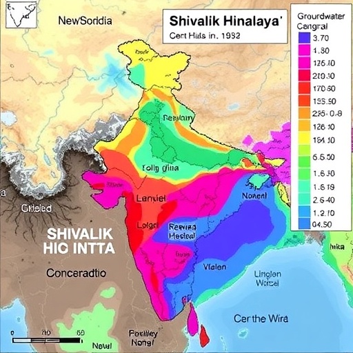
The groundwater beneath the Shivalik foothills of Himachal Pradesh has quietly been absorbing the cost of India’s rapid industrial and agricultural expansion, and a new study suggests the price may be far higher than previously understood. Researchers from Sardar Patel University in Mandi, working with a colleague at the Indian Institute of Technology Mandi, conducted one of the most comprehensive geospatial assessments of groundwater quality ever attempted in the Una district, a rapidly industrializing corridor in the western Himalaya. Their findings, published in Environmental Geochemistry and Health, reveal that nearly three quarters of the water samples collected from sixty sites across the district fall into poor to very poor quality categories, rendering them unsuitable for direct human consumption without treatment.
The study area occupies a strategically important position in the Shivalik Himalaya, where alluvial aquifers fed by seasonal rivers and rainfall have historically provided clean drinking water to rural and semi-urban communities. Over the past two decades, however, Una district has transformed into a magnet for industrial investment, with manufacturing units, pharmaceutical facilities and agro-processing plants proliferating alongside intensively cultivated farmland. This dual pressure from industry and agriculture created the ideal conditions for contamination, yet until now no systematic effort had been made to quantify the full extent of the problem or to trace it back to its geochemical and anthropogenic roots.
To build a complete picture, the research team collected samples from sixty carefully selected sites distributed across the district, chosen to capture variation in land use, geology and proximity to industrial and agricultural activity. Each sample was analyzed for a full suite of physicochemical parameters including electrical conductivity, total dissolved solids, pH, hardness, and major cations and anions such as calcium, magnesium, potassium, bicarbonate, fluoride and nitrate. In addition, the researchers measured concentrations of eight heavy metals, including arsenic, cadmium, manganese, zinc, lead and nickel, using standard analytical protocols that conform to the guidelines of the American Public Health Association and the Bureau of Indian Standards.
The results paint a sobering portrait of an aquifer under stress. The sampled groundwater ranged from acidic to alkaline in character, and multiple samples exceeded permissible limits for electrical conductivity, total dissolved solids, magnesium, total hardness, potassium, bicarbonate, fluoride, nitrate and several heavy metals including arsenic, cadmium, manganese, zinc and lead. The Water Quality Index, a composite measure that distills multiple parameters into a single score, ranged from 58.03 to 218.13 across the sampling network, with values above 100 indicating water unsuitable for drinking. Nearly seventy five percent of the samples fell into the poor to very poor categories, meaning that a large majority of the population drawing water from these aquifers is likely consuming water that fails basic safety standards.
Perhaps even more alarming were the results of the Heavy Metal Pollution Index, which specifically evaluates the cumulative burden of toxic metals. Values ranged from 0.2090 at the cleanest site to 222.74 at the most contaminated, with an average of 93.56 across the district. Nearly forty seven percent of samples exceeded the critical pollution threshold of 100, a level that signals serious heavy metal enrichment requiring immediate intervention. The spatial distribution of these high values clustered in areas of intense industrial activity and agricultural runoff, providing strong circumstantial evidence that the contamination is not merely a natural geochemical artifact but reflects the direct influence of human land use.
To understand the underlying hydrogeochemical processes, the researchers employed a Piper diagram, a classical graphical tool that classifies water types according to the relative dominance of major ions. The results revealed a strong predominance of the calcium magnesium bicarbonate hydrochemical facies, indicating that in its natural state the groundwater chemistry is governed primarily by carbonate weathering and rock water interaction, processes that reflect the dissolution of limestone and dolomite within the Shivalik geological formations. This baseline natural signature provided a crucial reference point against which anthropogenic contamination could be clearly distinguished.
Multivariate statistical techniques, including principal component analysis, hierarchical cluster analysis and correlation analysis, were then applied to identify the dominant sources of contamination. The analysis revealed that groundwater geochemistry in the district is shaped by a combination of geogenic and anthropogenic factors. The geogenic contribution includes natural mineral dissolution and ion exchange within the aquifer matrix, while the human driven contributions include agricultural runoff carrying fertilizers and pesticides, industrial discharges releasing heavy metals and organic pollutants, and sewage infiltration from expanding urban settlements. Principal component analysis extracted components that correlated strongly with nitrate, potassium and heavy metal concentrations, consistent with mixed agricultural and industrial contamination pathways.
The health implications of this contamination were quantified through a formal risk assessment framework following United States Environmental Protection Agency guidelines, which calculate both non-carcinogenic hazard quotients and lifetime cancer risk based on estimated daily intake through drinking water ingestion. The results showed that children face substantially higher risks than adults for both categories of harm, a finding that reflects their lower body weight, higher water consumption relative to body mass and developing physiological systems. Nitrate emerged as the primary driver of non-carcinogenic risk, with hazard quotients exceeding safe thresholds at numerous sites. Nitrate contamination is typically associated with fertilizer application, animal waste and septic leakage, all of which are pervasive in the agriculturally dominated parts of Una district.
Among the heavy metals, arsenic and nickel contributed most significantly to lifetime cancer risk, with calculated LTCR values suggesting genuine carcinogenic concern for populations consuming untreated groundwater over extended periods. Arsenic is a well documented carcinogen associated with skin, lung and bladder cancers, and its presence in Himalayan groundwater adds this region to the growing list of arsenic affected areas across South Asia. Nickel, while less extensively studied, has also been classified as a probable human carcinogen, and its elevated concentrations point to possible industrial sources such as metal plating, alloy manufacturing and battery production. Lead and cadmium, though present at concerning levels in some samples, contributed less to total cancer risk but remain problematic from a neurotoxicological and nephrotoxicological standpoint, particularly for children.
The spatial mapping component of the study adds considerable practical value, as the geospatial analysis identified specific contamination hotspots where poor water quality and elevated heavy metal concentrations converge. These hotspots correspond closely with industrial clusters and intensively farmed zones, suggesting that targeted interventions such as effluent treatment enforcement, controlled fertilizer application and the installation of community level treatment systems could deliver the greatest public health benefit if prioritized at these locations. The authors argue that their findings provide a scientific foundation for groundwater management policy in rapidly urbanizing Himalayan regions, where infrastructure development has historically outpaced environmental safeguards.
What makes this study particularly significant is its integrated methodology, which combines classical hydrogeochemical interpretation with modern geospatial analysis and formal health risk quantification within a single framework. By triangulating evidence from multiple analytical approaches, the researchers have produced a robust and internally consistent picture of contamination that cannot easily be dismissed as an artifact of sampling variability or analytical error. The work also contributes to a growing body of literature documenting water quality deterioration across the Indian Himalayan region, including previous studies in the Baddi Barotiwala Nalagarh industrial belt and the Nalagarh Valley, suggesting that the problem is systemic rather than localized.
For the communities of Una district, the immediate implications are clear. Groundwater in most of the study area should not be consumed without appropriate treatment, and vulnerable populations including children and pregnant women face the greatest health risks from continued exposure. The researchers emphasize that remediation will require coordinated action spanning industrial regulation, agricultural best practices, sewage infrastructure investment and public health monitoring. Given the pace of industrialization in the Shivalik region and the critical dependence of local populations on groundwater resources, the study serves as both a warning and a call to action, documenting in rigorous scientific detail the environmental consequences of unregulated growth in one of India’s most ecologically sensitive and rapidly transforming landscapes.
Cite Scienmag News
Sloane Callahan. (September 8, 2026). Mapping groundwater pollution and health risks in India’s Shivalik Himalaya. Scienmag. https://scienmag.com/mapping-groundwater-pollution-and-health-risks-in-indias-shivalik-himalaya/
Sloane Callahan. "Mapping groundwater pollution and health risks in India’s Shivalik Himalaya." Scienmag, 8 September 2026, https://scienmag.com/mapping-groundwater-pollution-and-health-risks-in-indias-shivalik-himalaya/. Accessed 8 September 2026.
Sloane Callahan. "Mapping groundwater pollution and health risks in India’s Shivalik Himalaya." Scienmag. September 8, 2026. https://scienmag.com/mapping-groundwater-pollution-and-health-risks-in-indias-shivalik-himalaya/


