


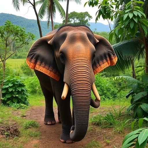
In the forested hills of Nagaland, a remote state in Northeast India nestled within the Eastern Himalayan biodiversity hotspot, scientists have completed the first comprehensive field-based assessment of elephant corridors—and their findings reveal a landscape in the midst of quiet ecological upheaval. A research team led by Imnawapang Jamir, Moanungsang Imchen and Shri Kant Tripathi has documented eleven interstate elephant corridors linking Nagaland’s forests with adjoining reserve forests and protected areas in Assam, and in doing so has uncovered a sobering truth: satellite images showing greener landscapes do not necessarily mean healthier habitats for elephants.
The study, published in the journal Environmental and Sustainability Indicators, represents a milestone for conservation science in a region where elephant corridors had never before been scientifically delineated. Between 2021 and 2025, the researchers conducted systematic field surveys across all elephant-inhabited districts of Nagaland, georeferencing direct and indirect evidence of elephant presence—dung piles, footprints, feeding marks, trails, sightings and crop-raiding paths—using GPS units, and complementing these observations with structured interviews of Forest Department staff and community members whose families have coexisted with elephants for generations.
Of the eleven corridors identified, nine remain functionally active, while two—the Baghty Valley–Nambor Wildlife Sanctuary corridor and the Sitap Range–Geleki Reserve Forest corridor—have been classified as inactive, with no confirmed elephant movement since the late 1980s and 2015, respectively. The functioning corridors vary enormously in their ecological character. The Intangki National Park–Dhansiri Reserve Forest corridor and the Singphan Wildlife Sanctuary–Abhyapur Reserve Forest corridor support resident elephant populations that move year-round, whereas others serve primarily as seasonal migratory routes, with peak use coinciding with the monsoon (May to August) and winter (October to January) crop-maturation periods. The number of elephants using individual corridors ranges from as few as ten seasonal migrants to between 80 and 100 animals traversing the Longtho Range–Changdang Beat–Hollongpar Gibbon Sanctuary route.
What makes the study particularly compelling is its methodological rigor. To characterize land use around each corridor, the team established a two-kilometer buffer and analyzed the 2024 Land Use/Land Cover dataset derived from high-resolution LISS-IV satellite imagery processed through supervised Maximum Likelihood Classification. To track vegetation change over time, they computed the Normalised Difference Vegetation Index, or NDVI—a remote sensing metric that measures photosynthetically active biomass by comparing near-infrared and red light reflectance—using Landsat 4-5 imagery for 1994 and 2009 and Landsat 8-9 imagery for 2024. Multi-temporal change detection was then performed for three periods: 1994–2009, 2009–2024, and the full 1994–2024 span.
The NDVI results tell a deceptively optimistic story. Between 1994 and 2009, approximately 65 percent of the study area experienced declining vegetation greenness, with 11.8 percent showing strong decline and 53.6 percent moderate decline. But between 2009 and 2024, the trend reversed dramatically: about 53.9 percent of the area showed moderate increases in greenness and 36.7 percent strong increases. Taken at face value, the landscape appears to be recovering. Field verification, however, revealed otherwise. Much of the observed greening corresponds to the expansion and maturation of commercial plantations—rubber, areca nut, teak, tea and agar—rather than the restoration of structurally intact native forests. NDVI, the authors caution, cannot distinguish between a biodiverse tropical forest and a monoculture rubber estate, even though the two offer vastly different ecological value to elephants.
This distinction matters profoundly. Asian elephants are large-bodied mammals with substantial daily foraging requirements, depending on structurally complex forests that provide diverse browse species, seasonal forage and movement cover. Traditional jhum cultivation—the shifting agriculture practiced for centuries by Naga communities—maintained heterogeneous landscape mosaics with fallow cycles that allowed secondary forest regeneration and preserved habitat permeability. The conversion of jhum lands into permanent commercial plantations has fundamentally transformed vegetation structure, diminishing both palatable forage and habitat heterogeneity. Many corridors now consist of structurally simplified, plantation-dominated forests that, despite retaining vegetative cover, offer reduced ecological value for elephant movement.
The consequences of connectivity loss are perhaps starkest in the Baghty Valley. Historically, between 100 and 130 elephants moved through this corridor connecting Wokha district with Nambor Wildlife Sanctuary. Encroachment of Rengma Reserve Forest, rural and urban expansion, high-tension power lines, village roads and small industries severed the route entirely, isolating what is now a resident population of approximately 180 elephants. Trapped within a constrained landscape, these animals have expanded their range into human settlements, generating the region’s most severe human-elephant conflict—affecting 90 villages in Wokha, 11 in Zunheboto, five in Tseminyu and 15 in Mokokchung. The conflict toll there includes 12 human casualties and 21 unofficially recorded elephant deaths over three decades.
Community interviews conducted across the corridor landscapes revealed that the true scale of elephant mortality far exceeds official records. Most deaths were attributed to retaliatory shootings following repeated crop depredation and property damage, with fewer incidents from electrocution and accidental drowning. Because such events often went unreported, official statistics dramatically underestimate both the intensity of conflict and the number of elephants killed. Crop damage emerged as the most prevalent conflict type throughout the network, followed by destruction of plantations and homes, with paddy, rubber, areca nut and banana among the most frequently damaged assets.
Yet the study is not simply a chronicle of decline. In a finding that surprised the researchers, two corridors—Kuhuboto–Bokajan and Doyapur–Daldali—experienced renewed elephant movement in 2023 and 2024 after prolonged inactivity, demonstrating that partially degraded corridors can recover when sufficient structural connectivity persists. Local ecological knowledge offers a possible explanation: elephants appear to maintain culturally transmitted “memory paths” across generations. As one captive elephant owner from the Tuli range told the researchers, “These elephants, like humans, pass down the knowledge… even if the elephants don’t come today, their next kin… will at least come once in the traditional route their forefather once roamed.”
The governance context of Nagaland adds a distinctive dimension to the conservation challenge. Under Article 371(A) of the Indian Constitution, approximately 88 percent of the state’s land is owned by communities, clans or individuals rather than the government. Statutory protection is therefore largely irrelevant to corridor conservation; everything depends on community stewardship. Encouragingly, village councils and community leaders expressed general willingness to designate degraded or conflict-prone forest patches as community conserved areas or reserves—provided the government delivers sustained support through livelihood assistance, timely compensation and long-term conservation incentives. Resistance to elephant conservation, the authors conclude, stems less from opposition to wildlife than from the socio-economic costs of coexistence.
The researchers propose corridor-specific interventions rather than uniform strategies. Recovering corridors such as Kuhuboto–Bokajan and Doyapur–Daldali should be proactively protected before further degradation occurs. Severely fragmented corridors, including Baghty Valley–Nambor and Sitap–Geleki, require active ecological restoration through assisted natural regeneration and enrichment planting of indigenous forage species. The planned reclamation of roughly 1,980 hectares of encroached forest within Rengma Reserve Forest offers a critical opportunity to restore transboundary connectivity for the isolated Baghty elephant population. Regulating coal mining, quarrying and other extractive industries within corridor buffers—currently concentrated in Mon, Longleng, Mokokchung and Wokha districts—constitutes another immediate priority.
Because every identified corridor crosses the Nagaland–Assam boundary, the authors emphasize that coordinated, transboundary governance is essential; conservation efforts implemented independently by either state are unlikely to succeed. Ultimately, the study reframes elephant corridors not as static lines on a map but as dynamic socio-ecological systems where ecological connectivity, indigenous governance and rural livelihoods are inseparably intertwined. With community-led conservation, equitable compensation and landscape-scale planning, Nagaland may yet establish a nationally significant model of decentralised corridor management—one that secures the future of its elephants while sustaining the people who share their forests.
Cite Scienmag News
Margaret Porter. (September 8, 2026). Community efforts to protect elephant corridors in Nagaland, India. Scienmag. https://scienmag.com/community-efforts-to-protect-elephant-corridors-in-nagaland-india/
Margaret Porter. "Community efforts to protect elephant corridors in Nagaland, India." Scienmag, 8 September 2026, https://scienmag.com/community-efforts-to-protect-elephant-corridors-in-nagaland-india/. Accessed 8 September 2026.
Margaret Porter. "Community efforts to protect elephant corridors in Nagaland, India." Scienmag. September 8, 2026. https://scienmag.com/community-efforts-to-protect-elephant-corridors-in-nagaland-india/


