


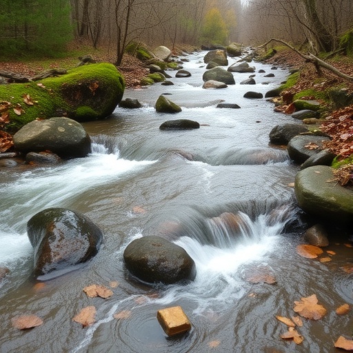
Hydropower is often celebrated as a cornerstone of the renewable energy transition, providing electricity on demand when solar panels fall quiet and wind turbines stand still. But beneath the surface of rivers downstream of hydroelectric plants, a hidden ecological crisis unfolds several times a day. A new study published in the journal Environmental Management has developed an unprecedentedly detailed way to watch that crisis play out, patch by patch, on the riverbed itself, revealing how the tiny creatures that underpin river food webs are battered by waves of artificially manipulated water. The research offers the first process-based framework capable of quantifying exactly where and when the riverbed becomes uninhabitable for benthic macroinvertebrates—the insects, snails, worms, and mussels that keep freshwater ecosystems running.
The phenomenon at the heart of the study is called hydropeaking: the rapid, repeated fluctuation of river discharge caused when hydropower plants switch turbines on and off to match electricity demand. In alpine rivers, where the practice is most intense, flow can swing from a trickle to a torrent and back again three to five times per day, particularly in winter when natural flows are low and stable. For fish, these pulses are stressful but often survivable. For macroinvertebrates, which are small, slow-moving, and attached to or living among the stones of the riverbed, the consequences can be catastrophic. Sudden surges in current velocity sweep larvae downstream in what ecologists call passive drift, while abrupt shutdowns strand eggs and juveniles on exposed gravel, where they dry out and die. As flexible hydropower expands to balance intermittent wind and solar generation, researchers warn that the frequency and severity of these ecological shocks will only increase.
Led by Aude Lecrivain of the Swiss Federal Institute of Aquatic Science and Technology, together with Giovanni De Cesare of EPFL, Christine Weber, and Nico Bätz, the research team set out to solve a stubborn methodological problem. Existing tools for assessing hydropeaking damage have focused overwhelmingly on fish, and they tend to describe habitat in static terms—as a snapshot of where suitable conditions exist at a given moment. What has been missing is a way to capture habitat dynamics: how the living conditions in a specific square half-meter of riverbed change hour by hour, minute by minute, across days of relentless flow manipulation. The team’s answer was to build a computational workflow that stitches together high-resolution terrain data, hydrodynamic simulation, and ecological knowledge into a single, moving picture of the riverbed.
The demonstration site was a one-kilometer stretch of the Ticino River in the Swiss Alps, located immediately downstream of a hydropower plant outlet. To map the riverbed’s architecture, the team deployed a drone flying at roughly 35 meters of altitude with more than 80 percent image overlap, capturing photographs that were processed using Structure-from-Motion reconstruction to produce a digital terrain model with a pixel resolution of just 1.3 centimeters. The survey was anchored by 32 ground control points measured with differential GNSS to centimeter accuracy. From this terrain model, the researchers calculated a measure of structural complexity—the standard deviation of bed elevation within moving windows of about 6.25 square meters—capturing the topographic roughness created by boulders, lateral shelters, and channel widenings that have been installed along the reach as restoration measures.
With the riverbed mapped, the team turned to hydraulics. Using the two-dimensional hydrodynamic model BASEMENT v4.0, built on an unstructured mesh with elements no larger than half a meter, they simulated steady-state flow conditions at 13 different discharges, ranging from 1 cubic meter per second to 29.2 cubic meters per second—spanning the full range a hydropeaking river experiences. The model was calibrated and validated against 415 field measurements of water depth and current velocity collected under seven different flow conditions. Performance was solid: the Kling–Gupta Efficiency, a metric combining correlation, bias, and variability, reached 0.79 for water depth and 0.47 for velocity, the latter reflecting the notoriously difficult task of simulating local currents in a complex channel.
The real innovation came in combining these pieces. The researchers reconstructed a representative winter week of hydropeaking operation at 10-minute temporal resolution, based on real gauging-station data with baseflows around 3 cubic meters per second and peaks reaching 25. Each moment of that week was then linked to the corresponding simulated habitat map, producing what the team calls a habitat time-series: a spatially explicit record of which patches of the riverbed offered which living conditions, minute by minute, over seven days. From this record, four complementary metrics were extracted. Habitat probability measures how long each patch remains suitable. Habitat shifts count how many times per day a patch flips between different habitat types. Drift risk estimates the likelihood that resident invertebrates will be swept away by sudden velocity increases. Desiccation risk records the longest uninterrupted dry period a patch endures, a critical number given evidence that even a single drying event can drastically reduce egg survival.
When the framework was applied to the Ticino data, the results were sobering. Hydropeaking dramatically amplified habitat dynamics across the entire reach, and—perhaps most strikingly—even patches with the very highest habitat probabilities experienced frequent shifts between habitat types. In other words, there was no truly stable refuge: places that looked excellent on average were still being repeatedly transformed by each passing surge of water. For organisms whose life cycles evolved under far gentler natural flow pulses, this level of instability pushes habitat conditions beyond anything their survival and recolonization strategies were designed to handle.
The interplay between the four metrics also revealed an important ecological trade-off. Structurally complex areas of the riverbed—the rough, heterogeneous patches created by boulders and channel widening—generally offered higher habitat probability and lower drift risk, apparently confirming the value of such restoration measures. But complexity could not shield these patches from desiccation. When the turbines shut down and the water dropped, even the most topographically rich habitats were exposed to drying. This finding carries a blunt message for river managers: engineering a riverbed to be physically diverse is not, by itself, enough to protect macroinvertebrates from hydropeaking. The hydraulic stress imposed by flow fluctuation operates on channels of its own, and mitigation strategies must address the flow regime directly rather than relying on morphological fixes alone.
To make sense of the complex, interacting patterns, the team applied K-means clustering to the standardized metric values, grouping patches with similar combinations of habitat probability, shift frequency, drift exposure, and drying duration into a small number of interpretable habitat–risk regimes. The optimal number of clusters was selected using silhouette scores, and differences in structural complexity among clusters were tested with the Kruskal–Wallis test. This multimetric synthesis allowed the researchers to boil thousands of unique patch histories down to a handful of recurring ecological scenarios—maps of where the riverbed functions as a low-stress refuge, where it acts as a drift trap, and where it becomes a mortality zone at low flow.
Crucially, the entire workflow has been released as an open-source Python toolbox, HaDy_MZB, complete with source code, documentation, and a worked example, so that researchers and river managers elsewhere can apply it to their own systems. Because the metrics are grounded in hydraulic processes rather than in species-specific preference curves, the framework can be transferred across rivers and regions without extensive reparameterization, addressing a long-standing obstacle to broadly applicable hydropeaking assessment. The authors emphasize that the patch—represented in the model as a half-meter grid cell, matching the spatial scale at which macroinvertebrate communities actually perceive their environment—is the ecological unit that matters, and the one that conventional assessment tools have consistently ignored.
The implications reach well beyond the Alps. As electricity grids worldwide lean on hydropower for flexibility, and as legally binding ecological mitigation requirements spread through countries that regulate hydropeaking, tools like this one arrive at an opportune moment. By explicitly linking the mechanics of hydraulic stress to habitat dynamics and to the morphological context of the riverbed, the framework supports what the authors call process-based river management: decisions grounded not in coarse averages, but in a quantified understanding of what actually happens to living habitat on the river floor when the turbines roar to life. For the small creatures that recycle nutrients, decompose organic matter, and feed the fish upstream of our dinner plates, that understanding may be the difference between persistence and quiet, repeated loss.
Cite Scienmag News
Gavin Prescott. (September 8, 2026). Frequent hydropeaking flows reshape riverbed habitats for macroinvertebrates. Scienmag. https://scienmag.com/frequent-hydropeaking-flows-reshape-riverbed-habitats-for-macroinvertebrates/
Gavin Prescott. "Frequent hydropeaking flows reshape riverbed habitats for macroinvertebrates." Scienmag, 8 September 2026, https://scienmag.com/frequent-hydropeaking-flows-reshape-riverbed-habitats-for-macroinvertebrates/. Accessed 8 September 2026.
Gavin Prescott. "Frequent hydropeaking flows reshape riverbed habitats for macroinvertebrates." Scienmag. September 8, 2026. https://scienmag.com/frequent-hydropeaking-flows-reshape-riverbed-habitats-for-macroinvertebrates/


