


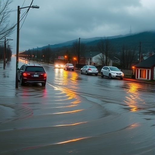
The catastrophic floods that swept through western Germany and Belgium in July 2021 killed more than 200 people, and according to a new analysis, most of them died in places that official flood hazard maps had never identified as being at risk. The finding, published by an international team of researchers from the University of Potsdam, the Helmholtz Centre for Geosciences, the University of Louvain and Johns Hopkins University, delivers a sobering verdict on the state of European flood risk management: the maps and warning systems meant to protect communities failed to reflect the true scale of the danger, and the consequences were measured in human lives.
When the low-pressure system known as “Bernd” stalled over the region in mid-July 2021, it unleashed torrential rainfall on the German states of North Rhine-Westphalia and Rhineland-Palatinate and on Belgium’s Walloon Region. Small rivers that normally flowed quietly through narrow valleys were transformed into violent torrents within hours. The Ahr valley, a tributary of the Rhine, became the epicenter of the disaster: more than half of the 224 recorded fatalities occurred in Ahrweiler county alone. Entire villages were inundated, bridges collapsed, and houses were torn from their foundations as floodwaters surged faster than many residents could react.
To understand precisely why so many people died, the researchers undertook a painstaking reconstruction of the disaster. Drawing on official records, media reports and, in some cases, interviews with the relatives of victims, they documented the locations and specific circumstances of each of the 224 deaths. This fatality-level approach, rather than a broad statistical overview, allowed the team to identify patterns that conventional post-disaster assessments often miss — including where victims were when the water hit, what they were doing, and whether they had received or heeded warnings.
The most striking result concerns the geography of the deaths. In North Rhine-Westphalia, roughly 50 percent of the 224 locations where victims died or were found lay outside the officially mapped flood hazard zone for an extreme flood scenario. In Rhineland-Palatinate, the figure was even higher: 75 percent of these locations were outside the mapped hazard zone. In other words, the majority of people who perished were living or acting in areas that official cartography had classified as safe, or at least as not requiring urgent protective measures. “Consequently, the available flood hazard maps were not sufficient to adequately illustrate the risks to the public,” says lead author Prof. Annegret Thieken of the Institute of Environmental Science and Geography at the University of Potsdam.
The technical explanation for this failure lies in how flood hazard zones are constructed. Hazard maps typically depict inundation extents for defined return periods, such as a flood expected once in 100 years, and an extreme scenario of more limited probability. But these modeled scenarios rely on historical discharge data and hydraulic assumptions that may not capture the true worst case — particularly in steep, fast-responding river valleys like the Ahr, where extreme convective rainfall can produce discharges far exceeding anything in the instrumental record. The researchers argue that future mapping must explicitly incorporate historical floods, including events from centuries past recorded in archives and flood marks, and must display worst-case scenarios rather than relying on statistical extrapolations alone. Only then, they contend, can residents living in a valley understand the full range of what nature is capable of delivering.
The circumstances of individual deaths reveal a second, equally troubling layer of the problem: widespread misunderstanding of what constitutes safe behavior during a flood. In North Rhine-Westphalia, 14 people died while attempting to reduce damage — checking pumps, moving valuables, or starting cleanup operations in flooded basements. Basements are among the deadliest spaces in a flood because water entering under pressure can make doors impossible to open, and because it can surge in with almost no warning. These deaths, the authors stress, point to serious deficiencies in communicating which actions are safe and which are lethal. Standard advice that encourages residents to protect their property may inadvertently send people into harm’s way at precisely the moment they should be fleeing upward.
Across all three regions, a total of 81 people died on the ground or upper floors of their own homes, and many of the documented circumstances suggest they were caught entirely by surprise — that the water rose faster than they expected, or that warnings reached them too late or not at all. Under the right conditions, staying inside a building and moving to higher floors can save lives, but only if the decision is made in time and if the building can withstand the forces involved. The researchers note that these houses should have been evacuated before the flood arrived, because once water fills a valley, being outdoors is even more dangerous. The deaths associated with flooded or collapsed bridges and with vehicles swept away or stranded by the current are stark evidence of that fact: attempting to move through a flooded landscape on foot or by car exposes people to fast-moving water capable of toppling even healthy adults in shallow depths.
This is why the study’s authors place risk and crisis communication at the center of their recommendations. They argue that public messaging must draw a clear, explicit distinction between damage-reducing behavior and life-saving behavior — two categories that have too often been conflated in official warnings. “Warning messages must clearly and timely communicate when evacuation from flood-prone areas is still possible, and when it is no longer advisable,” Thieken says. In other words, there is a critical temporal window: early enough, leaving the area entirely is the safest option; once the water is rising and escape routes are compromised, vertical self-evacuation — moving to the highest possible floor — becomes the only viable survival strategy. Communicating that switch point clearly, in advance and in real time, could save many lives in future events.
The analysis also exposed systemic gaps in how vulnerable populations were protected. Across the three regions studied, people over the age of 60 were significantly overrepresented among the victims, accounting for 72 percent of all fatalities. Older residents are disproportionately at risk in flash floods for a combination of reasons: reduced mobility makes rapid evacuation harder, many live alone and lack social networks that could relay warnings, and some may be less likely to receive or respond to digital alert systems. In Rhineland-Palatinate, the disaster took an especially heartbreaking form when twelve people died in a flooded residential home for adults with mental disabilities — an institutional setting where specialized evacuation planning was evidently absent or failed under the pressure of the event.
The researchers conclude that evacuation strategies need far more attention, particularly to protect older people, those with mobility impairments, and individuals with pre-existing health conditions. They call for a revision of the European Floods Directive — the legislative framework that obliges member states to assess and map flood risks — to better address worst-case scenarios in hazard mapping, risk management, and communication. Such a revision would represent more than a technical adjustment: it would require governments to plan for floods that exceed the boundaries of existing maps and to prepare communities, care facilities and infrastructure for events that most residents currently believe could not happen to them.
The July 2021 disaster was, by almost every measure, an extreme event — rainfall intensities in some catchments had return periods estimated in the hundreds or even thousands of years. But the study’s central message is that extremity does not excuse unpreparedness. Hazard maps exist precisely so that society does not have to rediscover the limits of safety through tragedy. When three-quarters of the victims in a region die outside the officially recognized danger zone, the mapping system itself must be rethought. Combined with honest, unambiguous warning messages that tell people not just that a flood is coming but exactly what to do and when, the researchers argue, a rebuilt risk framework could ensure that the next catastrophic rainfall along a small European river does not cost more than 200 lives. The findings stand as both an indictment of current practice and a practical roadmap for what must change before the next “Bernd” arrives.
Cite Scienmag News
Violet Maxwell. (September 7, 2026). Lessons from the deadly 2021 floods for better risk management. Scienmag. https://scienmag.com/lessons-from-the-deadly-2021-floods-for-better-risk-management/
Violet Maxwell. "Lessons from the deadly 2021 floods for better risk management." Scienmag, 7 September 2026, https://scienmag.com/lessons-from-the-deadly-2021-floods-for-better-risk-management/. Accessed 7 September 2026.
Violet Maxwell. "Lessons from the deadly 2021 floods for better risk management." Scienmag. September 7, 2026. https://scienmag.com/lessons-from-the-deadly-2021-floods-for-better-risk-management/


