


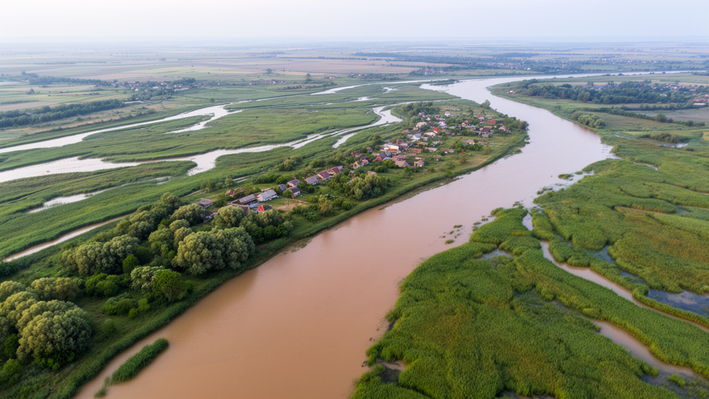
The Danube Delta, Europe’s second largest delta and one of its most fragile wetland ecosystems, is facing a growing threat from flooding as climate change intensifies extreme hydrological events. A new study published in the Scientific Annals of the Danube Delta Institute has applied two-dimensional hydraulic modeling to map how far floodwaters could spread across the delta under different scenarios, revealing that rare but severe floods could inundate more than 2,200 square kilometers of the region. The findings offer a detailed picture of vulnerability in a landscape where natural processes and human interventions have long been intertwined.
Deltas occupy only about one percent of the Earth’s land surface, yet they are home to more than seven percent of the global population. These low-lying coastal zones, favored for their fertile soils and abundant water, host intensive agriculture and dense human settlement, which makes them particularly exposed when rivers swell. Since 2000, roughly 85 percent of the world’s coastal deltas have experienced severe flooding linked to shifting precipitation patterns, and research suggests that about half of all deltaic areas are vulnerable to inundation driven by rising sea levels. As projected sea level rise in the twenty-first century exceeds the inundation thresholds of many deltas, the urgency of accurate flood hazard assessment has never been greater.
The Danube Delta covers approximately 5,640 square kilometers where the Danube River meets the Black Sea, splitting into three main branches: Chilia, Sulina and Sfântu Gheorghe. The delta evolved under a natural regime until 1860, but the twentieth century brought profound changes. The Sulina branch was straightened for navigation, navigation channels were cut through the interior, and large areas were removed from the natural floodplain. These interventions altered the delta’s hydrological dynamics and increased its susceptibility to flooding. Major floods struck in 1942, 1970, 1975, 1981, 1988, 2005, 2006 and 2010, and the frequency of such events has risen in recent decades, a trend the study attributes to the region’s geography, its hydrological specificity and the intensification of extreme meteorological phenomena under climate change.
To quantify this vulnerability, the research team turned to HEC-RAS, the River Analysis System developed by the US Army Corps of Engineers, in its two-dimensional configuration. Unlike earlier approaches in the delta, which relied on hydrograde analysis, satellite imagery or one-dimensional hydraulic models, this study is the first to apply 2D hydraulic modeling across an extended area of the Danube Delta. The model solves the equations describing the conservation of mass and momentum in a plane, capturing how water velocity and depth evolve across the landscape under the forces of gravity, friction at the riverbed, surface stress and even the Coriolis effect. The finite volume method used in the software is valued for its conservative nature, geometric flexibility and conceptual simplicity, making it well suited to the delta’s complex mosaic of channels, lakes and marshes.
The foundation of the model is a high-resolution digital terrain model built from LiDAR flight data. Sectors between the Sfântu Gheorghe and Sulina branches were mapped at 2-meter resolution, while areas between Sulina and Chilia, bounded by the Romanian-Ukrainian border, were captured at 5-meter resolution. Gaps were filled with 25-meter EU-DEM data, producing a terrain model covering the entire delta, including the Chilia Arm on Ukrainian territory. Because water reflects LiDAR pulses poorly, the researchers corrected the riverbed elevations using bathymetric measurements and refined the thalwegs of major lakes and channels with 1:25,000 topographic maps. Terrain roughness, expressed through the Manning coefficient, was assigned at an average of 0.0035 for the main branches, with higher values over lake and marsh surfaces, which slows water spread outside the main channels.
The flood scenarios were anchored in the hydrology of the 2006 event, the largest flood on record at the Ceatal Izmail station, where discharge reached 15,900 cubic meters per second, corresponding to a return period of roughly 200 years. Following European Commission recommendations for flood hazard mapping, the team simulated three probability scenarios: a 10-year return period flood with discharges above 13,250 cubic meters per second, a 100-year event at 15,055 cubic meters per second, and a rare 1,000-year flood at 16,160 cubic meters per second. The durations of these discharges during the 2006 flood, roughly two months, twenty days and one day respectively, were replicated in the model runs. The computational mesh covered approximately 3,509 square kilometers with a base resolution of 400 meters, refined to 50 or even 25 meters near levees, yielding around 186,000 computation points.
The simulations revealed a stark escalation of flood exposure as the return period lengthens. Under the 10-year scenario, flooding covered about 1,792 square kilometers of the modeled area. The 100-year flood expanded this to roughly 2,102 square kilometers, while the 1,000-year event pushed the inundated surface to approximately 2,203 square kilometers. For the 100-year scenario, often the benchmark in hazard analysis, the flooded area during the reference period from 1971 to 2005 stood at around 2,100 square kilometers, a figure the authors describe as a significant increase in the area covered by water. These numbers confirm that rarer events do not merely deepen existing floods but extend them across substantially larger portions of the delta.
The depth analysis adds a crucial layer of insight. Shallow flooding between 0 and 0.1 meters dominated the 10-year scenario, accounting for 19.3 percent of the modeled area, but its share fell steadily to 4.3 percent under the 1,000-year flood, suggesting that marginal zones are exposed frequently but with limited intensity. In contrast, the intermediate depth class of 0.2 to 0.5 meters was the most affected by 100-year events, covering 38.5 percent of the area, or about 809 square kilometers. Rare 1,000-year floods shifted the impact toward greater depths, with the 0.5 to 0.75 meter class jumping from 7.7 percent under the 10-year scenario to 21.1 percent under the 1,000-year event, and the 0.75 to 1 meter class rising from 5.0 to 8.6 percent. Even deeper classes expanded, with the 2 to 3 meter range growing from 5.0 to 7.9 percent, indicating that severe flooding reaches into areas normally spared.
The hazard maps generated by the study are more than academic outputs; they are practical tools for flood risk management, enabling authorities to identify critical areas and prioritize adaptation strategies. Among the solutions the researchers propose are the ecological reconstruction of wetlands, which can absorb and slow floodwaters, the implementation of effective climate change adaptation policies, and improved water management strategies across the basin. These measures, the study argues, are vital for protecting both local communities and the delta’s exceptional biodiversity, which depends on the delicate balance between river flow and marine influence.
The authors are candid about the limitations of their approach. The simulations excluded the influence of Black Sea level, which can compound riverine flooding through backwater effects, and the variable resolution of the terrain model introduces uncertainty in some sectors. Future work, they suggest, should integrate sea level variations, climate projections and socio-economic analyses to refine risk anticipation and optimize protective measures. Even so, the study demonstrates that two-dimensional hydraulic modeling in HEC-RAS is an efficient and powerful instrument for hydrological hazard assessment, providing a solid scientific basis for policy decisions and the sustainable protection of one of Europe’s most iconic and imperiled landscapes.
Subject of Research: Flood hazard assessment in the Danube Delta using two-dimensional HEC-RAS hydraulic modeling
Article Title: Flood hazard assessment in the Danube Delta using 2D hydraulic modeling
Article References: Flood hazard assessment in the Danube Delta using 2D hydraulic modeling. (n.d.). https://doi.org/10.3897/saddi.30.160526
Image Credits: AI Generated
Keywords: Danube Delta, flood hazard, 2D hydraulic modeling, HEC-RAS, climate change, return period, floodplain, Black Sea, wetland restoration, risk management, LiDAR terrain model, hydrology
Cite Scienmag News
Violet Maxwell. (October 16, 2026). Flood hazard assessment in the Danube Delta using 2D hydraulic modeling. Scienmag. https://scienmag.com/flood-hazard-assessment-in-the-danube-delta-using-2d-hydraulic-modeling/
Violet Maxwell. "Flood hazard assessment in the Danube Delta using 2D hydraulic modeling." Scienmag, 16 October 2026, https://scienmag.com/flood-hazard-assessment-in-the-danube-delta-using-2d-hydraulic-modeling/. Accessed 16 October 2026.
Violet Maxwell. "Flood hazard assessment in the Danube Delta using 2D hydraulic modeling." Scienmag. October 16, 2026. https://scienmag.com/flood-hazard-assessment-in-the-danube-delta-using-2d-hydraulic-modeling/


