


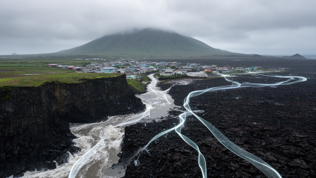
On South Korea’s largest island, floods keep arriving in ways that conventional rainfall-based warning systems struggle to anticipate. Jeju Island receives far more precipitation than the Korean national average, yet much of that water vanishes almost immediately into a sponge-like volcanic subsurface of basaltic lava flows, volcanic cones, and sinkholes. The island has virtually no perennial rivers, and surface runoff generation is sporadic, highly nonlinear, and only weakly coupled with rainfall intensity. Despite sustained investment in structural flood-control measures, repeated typhoon-driven flood damage has exposed a fundamental gap: warning thresholds calibrated for inland basins systematically miss the local infiltration-runoff dynamics that actually govern inundation on a volcanic island.
A new study published in the journal Natural Hazards tackles this puzzle with a grid-based, explainable machine learning framework designed to diagnose the dominant flood-influencing factors under hydrologically heterogeneous conditions. Hyeontae Moon and Gilho Kim of the Korea Institute of Civil Engineering and Building Technology, together with Kyung-Tak Kim of Kyungpook National University, integrated historical flood-trace maps with multi-layer spatial datasets to classify flooded and non-flooded grid cells across Jeju Island at a 100-meter resolution. Their central finding is striking: the dominance of flood-influencing factors varies dramatically across spatial contexts, with hydrometeorological conditions acting as the primary drivers while spatial exposure and proximity-based factors contribute in a distinctly region-specific manner.
The methodological architecture is as important as the results. The researchers discretized the entire island into 100-meter by 100-meter grid cells, which served as the fundamental spatial units for flood labeling and predictor extraction. The target variable was constructed from official flood-trace records for 23 rainfall-induced flood events that occurred between 2006 and 2022, obtained from Korea’s Public Data Portal. Original inundation-depth and flood-extent layers were matched using the reported disaster name and recorded starting and ending dates, then separated into event-specific vector maps. Each event-specific flood-trace map was independently rasterized onto the common grid system, with grid cells satisfying the adopted flood-overlap criterion labeled as flooded and the remaining cells labeled as not flooded for that event. Crucially, the dataset was organized at the event-grid level rather than from a temporally aggregated multi-event flood map, meaning the same geographical cell could appear as a separate observation in multiple events with event-specific flood labels and time-varying predictors.
To represent the physical, hydrological, and socio-economic conditions of Jeju Island, the team selected 30 flood-influencing factors categorized into five functional groups: hazard factors such as rainfall, runoff, groundwater, and wind conditions; hydrogeological factors including elevation, slope, curvature, and land cover; exposure factors such as building counts, population, and property value; vulnerability factors like old buildings and dependent populations; and capacity and proximity-based factors including road and river density, reservoir capacity, and distances to hydrological or infrastructural features. Rainfall variables were calculated separately for each of the 23 events, comprising the 3-hour maximum rainfall, the 12-hour maximum rainfall, and the 5-day antecedent rainfall, with durations selected in accordance with the Korea Meteorological Administration’s heavy-rain advisory criteria. Event-specific rainfall values from 40 observation stations were spatially interpolated using kriging to generate 100-meter gridded rainfall layers matched to the flood labels of the corresponding event.
Five tree-based machine learning classifiers were trained on the gridded dataset: a single Decision Tree as a transparent baseline, Random Forest as a bagging-based ensemble, and XGBoost, LightGBM, and CatBoost as alternative gradient-boosting implementations with different tree-construction, boosting, and regularization strategies. The use of multiple algorithms was intended not to identify a single optimal predictor but to assess the robustness and consistency of inferred flood-influencing factors across different learning architectures. Recursive Feature Elimination was incorporated into the training protocol to examine changes in model performance and feature-importance stability as less informative predictors were progressively removed. Because flooded records accounted for only approximately 0.23 percent of the complete dataset, overall accuracy could be dominated by the majority non-flooded class, so the researchers emphasized recall, F2-score, balanced accuracy, the Matthews correlation coefficient, and the area under the precision-recall curve alongside precision and F1-score.
The Random Forest classifier emerged as the most stable performer, achieving recall and F1-score values of 0.86 and 0.78 respectively for the island-wide dataset, with higher recall values in some sub-basins. Notably, Random Forest performance stabilized with a reduced subset of approximately nine predictors, suggesting that a limited number of hydrometeorological and hydro-geomorphological variables can retain substantial discriminatory power for flood occurrence. CatBoost and XGBoost demonstrated comparable predictive behavior in several sub-basins, though their performance exhibited greater variability across feature-elimination iterations, while the Decision Tree showed moderate and more variable performance and LightGBM displayed unstable patterns in certain sub-basins, possibly reflecting sensitivity to hyperparameter settings or data imbalance under strong spatial heterogeneity.
To directly quantify the incremental value of non-rainfall predictors, the researchers evaluated an island-wide rainfall-only baseline using just the three rainfall variables. At the recall-oriented operational threshold of 0.2, the rainfall-only model achieved precision, recall, F1-score, and F2-score values of 0.605, 0.691, 0.645, and 0.672 respectively, while the multivariate model achieved corresponding values of 0.693, 0.807, 0.746, and 0.781. Threshold-independent discrimination improved as well, with the area under the receiver operating characteristic curve increasing from 0.941 to 0.978 and the precision-recall area from 0.666 to 0.819. These controlled comparisons indicate that the additional predictors provided meaningful incremental discriminatory information beyond rainfall alone, representing atmospheric conditions, subsurface states, topographic settings, and hydrological connectivity that rainfall descriptors cannot fully capture.
The explainability analysis, conducted using XGBoost with SHAP (SHapley Additive exPlanations) attribution, revealed pronounced spatial heterogeneity across the island’s four official watershed units. At the island-wide scale, rainfall-related predictors dominated, collectively accounting for approximately 50 to 60 percent of total mean absolute SHAP importance, with groundwater level and proximity-based connectivity indicators contributing an additional 20 to 25 percent. In the Western Basin, longer-duration rainfall and antecedent accumulation together accounted for roughly 30 to 40 percent of cumulative SHAP importance, reflecting the sensitivity of low-lying coastal zones to sustained precipitation. In the Northern Basin, which encompasses the dense urban core of Jeju City, short-duration high-intensity rainfall alone contributed approximately 25 to 35 percent of total SHAP importance, with an indicative transition range around 60 to 80 millimeters of 3-hour rainfall within which flood probability tends to increase more rapidly. The model also identified a subsurface threshold in the Northern Basin: when groundwater levels rise above minus 5.0 meters relative to the surface, their contribution to flood susceptibility turns positive, reflecting constrained infiltration capacity during extreme events.
The Southern Basin exhibited a distinct response regime driven by orographic enhancement along the slopes of Hallasan Mountain, where longer-duration rainfall and antecedent precipitation together exceeded 35 to 45 percent of cumulative SHAP importance and the transition to high-risk states was notably associated with 5-day antecedent rainfall exceeding 120 to 150 millimeters. The Eastern Basin showed the strongest inter-model consistency, with rainfall variables, groundwater level, and proximity-based indicators jointly accounting for more than 65 to 70 percent of total SHAP importance. Across all sub-basins, proximity-based variables exhibited consistently negative SHAP contributions, with the highest magnitudes concentrated within a 200 to 300 meter radius of drainage infrastructure, indicating sharply increased flood probability as grid cells approach rivers or detention facilities. Perhaps most provocatively, socio-economic exposure variables such as building density, population, and land-price indicators contributed less than 3 to 5 percent of total SHAP importance across all spatial domains, suggesting that hydrometeorological and geomorphological controls dominate the physical likelihood of flood occurrence while socio-economic factors primarily modulate damage magnitude rather than inundation initiation.
The authors are careful to frame their findings as region-specific diagnostic evidence rather than proof of universal flood-generation mechanisms. A five-fold geographically blocked validation using 10-kilometer spatial blocks revealed that transferability to spatially unseen areas remains limited: at threshold 0.2, the random event-grid-level test yielded an F1-score of 0.746 and balanced accuracy of 0.903, whereas the blocked analysis yielded pooled values of only 0.266 and 0.663, indicating that the random-partition metrics should be interpreted as within-domain or upper-bound estimates rather than evidence of spatial transferability. The reliance on official flood-trace delineations also introduces limitations in spatial completeness and temporal resolution, since smaller or ephemeral inundation patches may not be fully captured and the temporal linkage between targets and predictors was established at the flood-event scale rather than at an hourly grid-cell scale. Nevertheless, the study’s implications for flood risk management are clear: conventional rainfall-centric warning systems implicitly assume a relatively uniform relationship between precipitation and flood occurrence, but the results demonstrate that flood generation on Jeju Island is modulated by hydrological connectivity, antecedent groundwater conditions, and region-specific drainage characteristics. The findings support a conceptual shift toward multi-parameter flood warning frameworks in which region-specific alert criteria are defined using joint conditions reflecting dominant mechanisms, for example triggering risk escalation when short-duration rainfall exceeds a critical level under elevated groundwater conditions, or when prolonged rainfall coincides with limited drainage connectivity in low-lying coastal zones. As hydroclimatic uncertainty grows, the ability to diagnose which combinations of variables matter most in each sub-region offers a pathway toward more physically grounded and locally adaptive flood-risk assessment in geologically complex environments where traditional runoff assumptions simply do not hold.
Subject of Research: Explainable machine learning diagnosis of region-specific flood influencing factors on volcanic Jeju Island
Article Title: Diagnosing region-specific flood influencing factors in a volcanic island using explainable machine learning
Article References: Moon, H., Kim, G., & Kim, K.-T. (2026). Diagnosing region-specific flood influencing factors in a volcanic island using explainable machine learning. Natural Hazards, 122(22), Article 674. https://doi.org/10.1007/s11069-026-08426-w
Image Credits: AI Generated
DOI: 10.1007/s11069-026-08426-w
Keywords: flood prediction, explainable machine learning, Jeju Island, volcanic hydrology, SHAP, groundwater, Random Forest, hydrological connectivity, flood risk management, Natural Hazards, feature selection, typhoon rainfall
Cite Scienmag News
Violet Maxwell. (October 16, 2026). Explainable AI Reveals Why Volcanic Jeju Island Floods When Rainfall Alone Cannot Explain It. Scienmag. https://scienmag.com/explainable-ai-reveals-why-volcanic-jeju-island-floods-when-rainfall-alone-cannot-explain-it/
Violet Maxwell. "Explainable AI Reveals Why Volcanic Jeju Island Floods When Rainfall Alone Cannot Explain It." Scienmag, 16 October 2026, https://scienmag.com/explainable-ai-reveals-why-volcanic-jeju-island-floods-when-rainfall-alone-cannot-explain-it/. Accessed 16 October 2026.
Violet Maxwell. "Explainable AI Reveals Why Volcanic Jeju Island Floods When Rainfall Alone Cannot Explain It." Scienmag. October 16, 2026. https://scienmag.com/explainable-ai-reveals-why-volcanic-jeju-island-floods-when-rainfall-alone-cannot-explain-it/


