


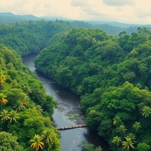
Methane (CH₄) is a powerful greenhouse gas, and its atmospheric concentration has climbed rapidly in recent decades. While human activities account for a large share of global methane, wetlands remain the dominant natural source. Yet pinning down how much methane tropical wetlands emit—and whether those emissions are rising with climate change—has been a stubborn scientific challenge.
A team led by the Max Planck Institute for Chemistry reports that actual methane emissions from the Amazon were substantially higher than values used in climate and Earth system models. In some regions, emissions were found to be up to four times larger than previously calculated. The study, published in Geophysical Research Letters, has direct implications for the accuracy of methane-driven climate projections.
The researchers found that model performance changes with altitude. At roughly six kilometers and above, measured and modeled methane concentrations agree closely. Below that, discrepancies grow: on average, observed methane was about twice as high as model estimates relative to background levels. This altitude-dependent mismatch points to missing or misrepresented processes near the surface.
During December 2022 and January 2023—spanning the transition from the dry to the wet season—the background methane level was about 1,907 parts per billion (ppb). Because methane mixes efficiently at higher altitudes, atmospheric transport and mixing are better captured there. Near the ground, however, the models appear to fail.
By analyzing where methane originated, the team showed that some wetland categories release far more methane than assumed. Emissions were reported as 26% higher at river deltas, 19% higher in reservoir-influenced areas, and 13% higher in regularly flooded river regions.
Measurements were made using the HALO research aircraft with an absorption spectrometer designed for sensitive methane detection under low air pressures. The campaign covered a vast area of the Brazilian rainforest at altitudes from about 200 meters above treetops to above 14 kilometers, yielding more than 7,000 measurement points.
To connect atmospheric observations to ground-based sources, the scientists used an atmospheric transport model to trace air masses backward in time to specific 0.1° × 0.1° grid cells. They then combined this with a NASA ensemble approach, which estimates wetland emissions indirectly from satellite-derived land surface properties such as moisture, vegetation, and temperature.
Overall, the findings suggest that tropical wetlands still contain underestimated methane sources with strong spatial variability. Lead author Linda Ort emphasizes that more measurements are needed to better identify those sources and improve Earth system modeling. Co-author Eric Kort adds that reliable global methane accounting depends on expanding observations beyond the Amazon to other data-poor tropical regions.
Finally, the team’s results reinforce the broader methane budget: about 65% of global emissions are anthropogenic (agriculture, fossil fuels, and waste), while roughly 35% arise from natural processes, including microbial decomposition in wet environments and methane release triggered by flooding.
Cite Scienmag News
Russell Cooper. (July 14, 2026). Amazon Rainforest Waterways: Major but Underestimated Methane Sources. Scienmag. https://scienmag.com/amazon-rainforest-waterways-major-but-underestimated-methane-sources/
Russell Cooper. "Amazon Rainforest Waterways: Major but Underestimated Methane Sources." Scienmag, 14 July 2026, https://scienmag.com/amazon-rainforest-waterways-major-but-underestimated-methane-sources/. Accessed 3 September 2026.
Russell Cooper. "Amazon Rainforest Waterways: Major but Underestimated Methane Sources." Scienmag. July 14, 2026. https://scienmag.com/amazon-rainforest-waterways-major-but-underestimated-methane-sources/


