In the constantly evolving field of environmental science, understanding the dynamics of soil erosion and its broader ecological impacts remains a paramount challenge. Recent investigations led by researchers Koralay and Kara have provided a groundbreaking assessment of soil erosion risks in the Sogutlu Stream Watershed of Trabzon, Turkey. Utilizing advanced modeling techniques paired with geographic information system (GIS) technology, their study intricately maps the spatial variability of erosion and examines the consequential loads of organic carbon and total nitrogen found in suspended sediments. This research not only augments our scientific comprehension of erosion processes but also interlinks soil degradation with nutrient cycling, watershed health, and ultimately, sustainable land management.
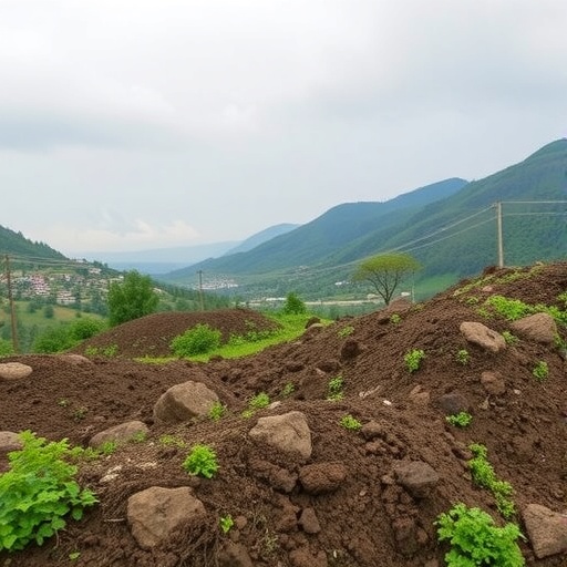
Soil erosion is recognized globally as a primary cause of land degradation with profound implications for food security, natural habitats, and water quality. The Sogutlu Stream Watershed, positioned in the northeastern region of Turkey, features diverse topography and climatic conditions, making it an ideal natural laboratory for such an in-depth investigation. The vulnerability of soils to erosion here is influenced by various factors including slope gradients, land-use patterns, vegetation cover, and rainfall intensity. Koralay and Kara’s work harnesses the Revised Universal Soil Loss Equation (RUSLE), a widely regarded computational model designed to quantify potential soil loss by integrating these critical environmental variables.
The RUSLE framework serves as a cornerstone for erosion risk assessment because it synthesizes complex data inputs—rainfall erosivity, soil erodibility, topographic factors, crop management, and conservation practices—into an integrated prediction model. Koralay and Kara’s application of RUSLE in conjunction with GIS represents a methodological advance; GIS facilitates the processing and visualization of vast, heterogeneous spatial data, enabling a high-resolution analysis of erosion risk across the watershed. This synergy allows researchers and stakeholders to pinpoint erosion hotspots with unprecedented accuracy, fostering targeted soil conservation interventions.
Beyond mere soil loss estimation, the study innovatively evaluates the chemical composition of sediments mobilized by erosion events, focusing on the organic carbon and total nitrogen content embodied within suspended sediment loads. These elements critically influence watershed biogeochemistry and downstream aquatic ecosystems. The transportation of organic carbon and nitrogen through eroded sediments contributes to nutrient enrichment in water bodies, often triggering eutrophication and altering ecological balance. Consequently, understanding these nutrient fluxes is vital for developing integrated watershed management strategies that align soil conservation with water quality preservation.
The findings from the Sogutlu watershed reveal varying erosion intensities distributed spatially, with higher rates occurring predominantly on steep slopes and areas with sparse vegetation cover. This heterogeneity underscores the need for location-specific conservation measures rather than uniform land management policies. The study highlights how land use practices, including agriculture and deforestation, exacerbate erosion risk and nutrient mobilization. These insights stress the critical role of adopting sustainable cultivation techniques and reforestation projects to stabilize soils and mitigate deleterious environmental impacts.
Importantly, the research draws direct correlations between the geographic distribution of erosion risk factors and organic carbon alongside nitrogen loading patterns in the watershed’s sediment flow. Elevated erosion regions correspond to increased suspended sediment concentrations enriched in these key nutrients, illustrating a feedback loop between land degradation and nutrient transport. This nexus implicates soil erosion as a pivotal agent not only of terrestrial degradation but also of aquatic ecosystem alteration, with far-reaching consequences for biodiversity, fisheries, and human health.
Methodologically, the incorporation of remote sensing data, digital elevation models, and soil sampling bolsters the robustness of the study’s erosion risk maps. Remote sensing provides up-to-date land cover and rainfall information, while digital elevation models account for topographic variance critical in erosion modeling. Soil sampling facilitates validation of model predictions and chemical analyses of sediment composition. Together, these techniques exemplify a multidisciplinary approach harnessing contemporary technological advancements to tackle complex environmental problems.
The comprehensive nature of the study extends to temporal considerations, recognizing that erosion and nutrient transport dynamics fluctuate seasonally in response to climatic variability. Periods of intense rainfall, characteristic in the region’s climate regime, markedly increase surface runoff and soil particle detachment, intensifying erosion and sediment-associated nutrient loads. The temporal dimension incorporated into the analysis improves predictive accuracy and assists in planning timely interventions aligned with seasonal risk fluctuations.
Addressing the implications for environmental policy, the study advocates for the integration of GIS-based erosion risk assessments into local and regional land management frameworks. By identifying priority zones where erosion control measures are most urgently needed, this approach enables resource optimization and enhances regulatory effectiveness. Furthermore, incorporating data on nutrient loading helps align soil conservation efforts with goals to reduce pollution in aquatic systems, thereby advancing holistic watershed stewardship.
Koralay and Kara also emphasize the broader climate change context wherein altered precipitation patterns and extreme weather events could exacerbate erosion processes in vulnerable watersheds like Sogutlu Stream. Anticipating these impacts through predictive modeling equips policymakers and conservationists with proactive strategies to enhance landscape resilience. Adopting adaptive land management practices informed by spatial and chemical erosion assessments will be essential to mitigate future environmental risks under a changing climate.
The multidisciplinary insights generated through this study have relevance beyond the immediate geographic focus, serving as a model for erosion and nutrient flux assessments in similar temperate watersheds globally. The fusion of RUSLE modeling, GIS technology, and sediment chemistry analysis illustrates an integrated scientific pathway for confronting soil degradation challenges. This research exemplifies the value of combining traditional environmental science with cutting-edge computational tools to deepen understanding and foster sustainable natural resource management.
Moreover, the visualization capabilities afforded by GIS enable effective communication of complex erosion risk data to stakeholders ranging from farmers to regional planners. Visualization facilitates the translation of scientific findings into actionable knowledge, empowering frontline actors to implement conservation practices tailored to site-specific conditions. Such participatory approaches enhance community engagement and long-term sustainability of soil and water resource interventions.
The implications of organic carbon and nitrogen mobilization highlighted in this research also intersect with global carbon and nitrogen cycling processes. Soil erosion-induced transport of these elements represents a terrestrial source of greenhouse gases and nutrient pollution. By quantifying these fluxes, the study contributes to the broader understanding of how land management influences biogeochemical cycles and climate regulation. This intersection of geomorphology, chemistry, and ecology underscores the complexity of environmental challenges requiring integrated scientific approaches.
In sum, the pioneering work of Koralay and Kara in assessing soil erosion risk using advanced RUSLE-GIS modeling combined with nutrient loading analysis offers profound insights with significant environmental and societal implications. Their research provides a vital scientific foundation for targeted soil conservation and watershed management strategies designed to safeguard ecosystem services, agricultural productivity, and water quality in the Sogutlu Stream Watershed and analogous landscapes worldwide. This study marks a pivotal step forward in comprehensive environmental risk assessment and landscape sustainability science.
Subject of Research: Risk assessment of soil erosion and associated organic carbon and total nitrogen loadings in suspended sediments within the Sogutlu Stream Watershed, using RUSLE and GIS.
Article Title: Risk assessment of soil erosion with RUSLE using geographic information system and organic carbon and total nitrogen loadings of suspended sediment in Sogutlu Stream Watershed of Trabzon, Turkey.
Article References:
KORALAY, N., KARA, Ö. Risk assessment of soil erosion with RUSLE using geographic information system and organic carbon and total nitrogen loadings of suspended sediment in Sogutlu Stream Watershed of Trabzon, Turkey. Environ Earth Sci 84, 258 (2025). https://doi.org/10.1007/s12665-025-12271-8
Image Credits: AI Generated
