
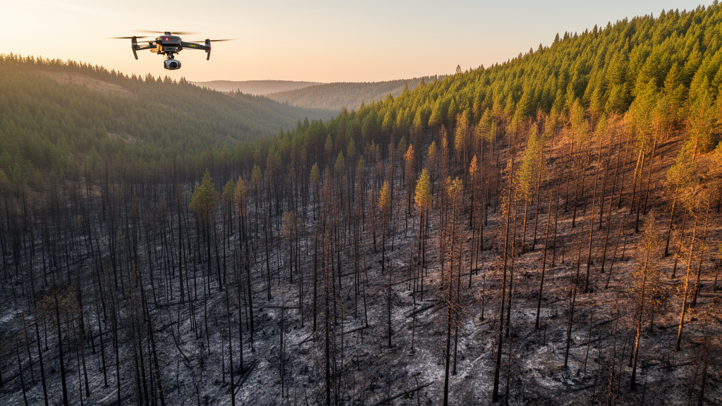
When the Holiday Farm Fire tore through western Oregon in September 2020, it burned roughly 702 square kilometers of predominantly coniferous forest, spreading rapidly under strong easterly winds at the tail end of the region’s dry season. A new case study of that fire, published in the journal Fire Ecology, has now quantified just how much three-dimensional forest structure the blaze removed, and in doing so has exposed a significant blind spot in the way fire scientists and land managers typically measure burn severity. The widely used spectral index known as dNBR, the authors conclude, captures broad gradients of fire effects but fails to fully characterize how much canopy height and biomass were actually lost.
The research team, led by Jiahui Ren and colleagues, integrated data from NASA’s Global Ecosystem Dynamics Investigation, or GEDI, a spaceborne lidar instrument that fires laser pulses at the forest floor and records the returning waveforms to measure vegetation vertical structure. GEDI footprints, each roughly 25 meters in diameter, were combined with imagery from the Sentinel-1 radar and Sentinel-2 optical satellites, along with topographic data from the Shuttle Radar Topography Mission, to build spatially continuous maps of canopy height and aboveground biomass density both before and after the fire. Pre-fire observations came from 1 May to 7 September 2020, while post-fire observations spanned 1 October 2020 to 1 October 2021, a longer window chosen to retain enough valid lidar footprints for model development.
The results document a landscape profoundly reshaped. Mean canopy height fell from 26.7 meters before the fire to 19.5 meters afterward, a 27.0 percent reduction. Mean aboveground biomass density dropped even more dramatically, from 278.6 to 153.7 megagrams per hectare, a loss of 44.8 percent. These losses were not spread evenly across the burned area. Patches of severe structural reduction clustered together rather than distributing uniformly within the fire perimeter, and areas of substantial canopy height reduction generally coincided with areas of high biomass loss.
To assess burn severity, the researchers used the differenced normalized burn ratio, or dNBR, a spectral index calculated from near-infrared and shortwave-infrared reflectance before and after a fire. Vegetation reflects strongly in the near-infrared and weakly in the shortwave-infrared; burning strips away foliage, leaves char and ash, and exposes soil, all of which shift the spectral signature. The dNBR index and its relatives have been staples of burned-area mapping for decades, and the study classified the Holiday Farm Fire landscape using standard Monitoring Trends in Burn Severity thresholds. High-severity fire accounted for 40.70 percent of the burned area, with moderate severity covering 26.93 percent and low severity 26.59 percent.
At the broadest scale, the two perspectives agreed. Median canopy height loss climbed from about 1.4 meters in the unburned-to-low severity class to 10.8 meters in the high-severity class, while median biomass loss rose from roughly 15.0 to 171 megagrams per hectare. Across all spatially matched GEDI footprints, dNBR was positively correlated with canopy height loss, with a correlation coefficient of 0.30, and with biomass loss, at 0.36, both statistically significant. But the agreement ended there. The distributions of structural loss overlapped substantially among severity classes, particularly between the low- and moderate-severity categories, and considerable variability persisted even within the high-severity class.
That overlap matters because it means two locations flagged with the same spectral severity rating could have experienced radically different structural outcomes. Within individual severity classes, the correlation between dNBR and structural loss largely collapsed. For canopy height loss, dNBR was significantly correlated only in the unburned-to-low class, and even there the relationship was negative, at minus 0.35. In the low-, moderate-, and high-severity classes, correlations ranged from minus 0.09 to 0.05 and were not statistically significant. For biomass loss, no significant within-class correlations emerged at all, with coefficients spanning minus 0.21 to 0.12. The authors attribute this mismatch to the physics of what each measurement actually detects: dNBR responds to surface spectral changes such as foliage loss, char, ash, exposed soil, and understory disturbance, so a surface fire can produce a strong spectral signal while the overstory remains largely standing, whereas crown scorch, stem injury, and tree mortality can remove canopy structure and living biomass without a proportional spectral response.
In contrast to the weak within-class performance of dNBR, pre-fire forest structure proved a consistently strong predictor of how much structure was lost. Across all matched footprints, pre-fire canopy height correlated with canopy height loss at 0.57, and pre-fire biomass density correlated with biomass loss at 0.71, both highly significant. These positive relationships held within every severity class, with coefficients ranging from 0.36 to 0.60 for canopy height and 0.37 to 0.77 for biomass. In other words, taller stands with more biomass had more aboveground material available to burn and consequently suffered larger absolute losses, even when compared with neighboring stands assigned the same severity class.
The team reinforced these findings with multiple linear regression models fitted to 10,000 randomly sampled locations from the continuous maps. Separate models for canopy height loss and biomass loss included dNBR, the corresponding pre-fire structural variable, their interaction, slope, elevation, and pre- and post-fire values of the normalized difference vegetation index and the normalized difference moisture index. Pre-fire canopy height and biomass carried larger standardized coefficients than dNBR in their respective models, though dNBR remained significantly positive. Crucially, the interaction term between dNBR and pre-fire structure was positive and significant for both loss metrics, indicating that the relationship between spectral severity and structural loss itself shifted depending on what the forest looked like before it burned. Terrain variables, by comparison, generally contributed smaller standardized coefficients.
The ecological implications extend well beyond mapping methodology. Variation in structural loss produced contrasting post-fire legacies across the landscape: some stands retained substantial overstory and woody biomass, while others experienced pronounced structural reduction. The amount of surviving canopy and woody material influences habitat continuity, seed availability, carbon retention, and the structural template for recovery. The authors suggest that structural maps could help identify stands warranting closer field evaluation, including areas with substantial canopy or biomass loss despite moderate dNBR ratings, and high-severity areas that nonetheless retain considerable overstory. The timing of the observations also warrants caution: the post-fire estimates represent early conditions roughly one year after the fire, and subsequent processes such as delayed mortality, snag dynamics, and vegetation regeneration may further alter canopy structure and biomass, with spectral and structural recovery potentially proceeding at different rates.
Several uncertainties temper the conclusions. The continuous canopy height and biomass surfaces are model-based estimates rather than direct measurements at every location, and retrieval performance was lower after the fire than before it. GEDI geolocation uncertainty and scale mismatches between the 25-meter footprints and the 30-meter prediction grid may introduce errors, particularly in heterogeneous or steep terrain, and footprints on slopes exceeding 30 degrees were excluded to limit terrain-induced waveform broadening. The Holiday Farm Fire’s rapid spread under strong easterly winds also means that meteorological forcing may have interacted with, or partly overridden, local vegetation controls on fire effects. Even so, the study’s central message stands: spectral burn severity and three-dimensional structural change are complementary dimensions of fire effects, and combining dNBR with pre-fire structural information yields a more ecologically informative picture of post-fire forest condition than either measurement alone.
Subject of Research: The relationship between spectral burn severity and post-fire forest structural loss in the 2020 Holiday Farm Fire in Oregon
Article Title: Spectral burn severity does not fully capture post-fire forest structural loss: a case study of the 2020 Holiday Farm Fire
Article References: Ren, J., Song, J., Xiao, Z., & Yang, H. (2026). Spectral burn severity does not fully capture post-fire forest structural loss: a case study of the 2020 Holiday Farm Fire. Fire Ecology, 22(1), Article 165. https://doi.org/10.1186/s42408-026-00596-z
Image Credits: AI Generated
DOI: 10.1186/s42408-026-00596-z
Keywords: burn severity, dNBR, GEDI lidar, forest structure, canopy height, aboveground biomass, Holiday Farm Fire, Oregon wildfire, remote sensing, Sentinel-1, Sentinel-2, post-fire recovery
Cite Scienmag News
Drew Townsend. (October 28, 2026). Burn severity maps miss real forest structural loss after Oregon fire. Scienmag. https://scienmag.com/burn-severity-maps-miss-real-forest-structural-loss-after-oregon-fire/
Drew Townsend. "Burn severity maps miss real forest structural loss after Oregon fire." Scienmag, 28 October 2026, https://scienmag.com/burn-severity-maps-miss-real-forest-structural-loss-after-oregon-fire/. Accessed 28 October 2026.
Drew Townsend. "Burn severity maps miss real forest structural loss after Oregon fire." Scienmag. October 28, 2026. https://scienmag.com/burn-severity-maps-miss-real-forest-structural-loss-after-oregon-fire/