


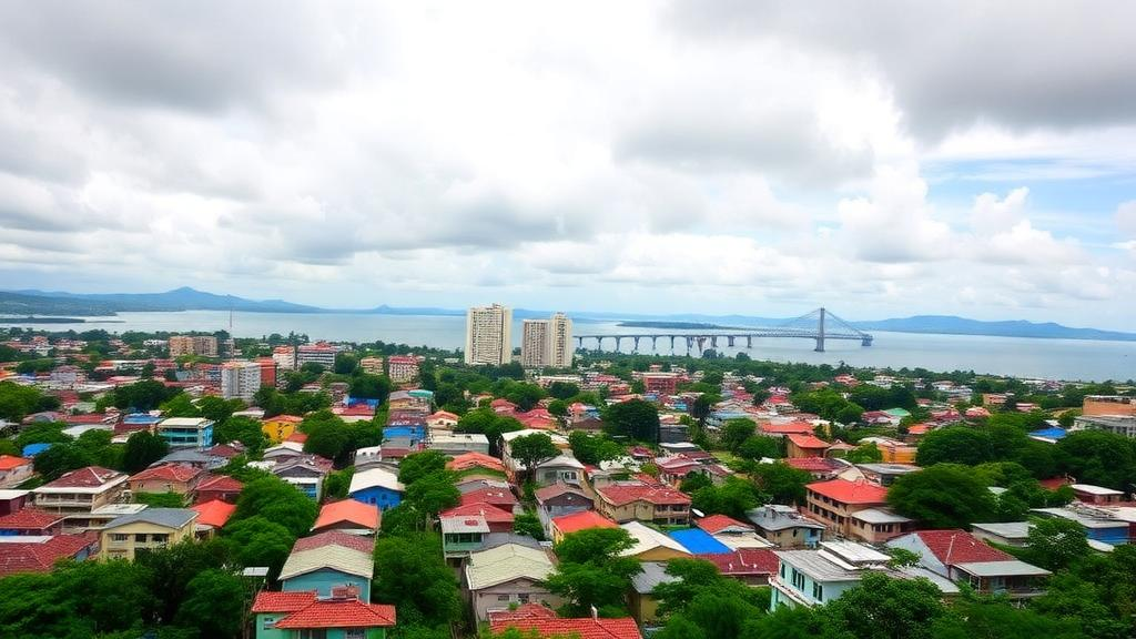
A decade of satellite records has revealed how quickly Port-au-Prince is transforming from a fragmented coastal city into a continuous wall of concrete that stretches from the shores of the Gulf of Gonâve up into the steep ridges of the Massif de la Selle. A new study published in the journal Natural Hazards combined Landsat 8 and Sentinel-2 imagery, terrain analysis, flood-susceptibility modelling, and four decades of precipitation data to quantify what that transformation means for one of the world’s most disaster-exposed metropolitan areas. The headline finding is stark: between 2015 and 2025, the error-adjusted built-up area of the Port-au-Prince Arrondissement grew from 80.79 square kilometres to 335.43 square kilometres, reaching 46.1 percent of the entire 727.64-square-kilometre administrative unit. Over the same period, vegetation declined by 180.91 square kilometres, much of it along the very slopes and valleys that channel storm water toward the city’s most crowded neighborhoods.
The research team, led by Renesky Jean Mary of the Federal University of Latin American Integration in Brazil together with colleagues at the University of São Paulo and the Federal University of Amapá, framed the city not as a set of isolated flood zones but as a single connected hydrogeomorphic system. Water that falls on the high southern uplands near Kenscoff, where elevations climb to roughly 2,159 metres, does not stay there. It moves rapidly through dissected ridges, steep slopes, and confined valleys via rivers such as the Grise and the Froide and the Bois-de-Chêne ravine, arriving within minutes or hours at the low-relief coastal plain occupied by Port-au-Prince, Delmas, Cité Soleil, and Tabarre. Hydrogeological work has already shown that infiltration from these rivers is a principal source of recharge for the Cul-de-Sac alluvial aquifer, confirming that the mountain block and the lowlands function as one hydrological unit.
To capture that connectivity, the researchers used a technique called geomorphon classification, applied to a 30-metre digital elevation model with the r.geomorphon module in GRASS GIS. The algorithm compares terrain visibility in multiple directions and assigns every cell to a local landform class such as ridge, slope, valley, base of slope, or plain. Unlike a simple slope map, this approach distinguishes terrain units associated with runoff generation, transfer, and accumulation. The result is a functional picture of the landscape: ridges and slopes in the south generate runoff, valleys act as transfer corridors, and the flat coastal plain receives and concentrates the flow. When vegetation is stripped from ridges and slopes and replaced with impervious surfaces, the volume and speed of water delivered to the lowlands can increase even if the converted cells themselves are never classified as high-risk terrain.
The land-cover mapping behind the study was unusually rigorous. Landsat 8 classifications for 2015, 2020, and 2025 achieved overall accuracies of 98.44, 95.92, and 94.13 percent, with Kappa coefficients of 0.9704, 0.9362, and 0.9069 respectively. Rather than reporting raw pixel counts, the team applied the area-adjustment method of Olofsson and colleagues, using error matrices to produce corrected class areas with nominal 95 percent confidence intervals. The adjusted built-up estimate rose from 80.79 square kilometres in 2015 to 226.92 square kilometres in 2020, a gain equivalent to 180.9 percent of the starting value, and then to 335.43 square kilometres in 2025, an increase of 315.2 percent over the decade. Vegetation fell from an adjusted 458.08 square kilometres to 277.17 square kilometres, and the remaining green cover became increasingly fragmented along the transition between the coastal plain and the southern uplands.
One of the study’s most technically interesting results concerns the choice of satellite sensor. For 2025, the team produced a parallel classification from Sentinel-2 at 10-metre resolution, which achieved 99.35 percent overall accuracy and a Kappa of 0.9908. Yet the two sensors disagreed dramatically on class shares: Landsat 8 allocated 42.6 percent of the area to built-up land, while Sentinel-2 allocated only 17.9 percent, a ratio of 2.38. The authors are careful to explain that this is not sensor bias but a consequence of spatial support. A single 30-metre Landsat pixel in a dense informal settlement typically mixes rooftops, roads, bare soil, and sparse vegetation, and the whole pixel gets assigned to one class, often built-up. The finer Sentinel-2 grid resolves that sub-pixel structure, separating exposed soil, which received 34.7 percent under Sentinel-2 versus 18.7 percent under Landsat 8, from genuinely impervious surfaces. For planners deciding where drainage investments should go, that distinction matters enormously.
Combining the 2025 Sentinel-2 land cover, slope, and flow accumulation into a weighted flood-susceptibility index, with weights of 40, 25, and 35 percent respectively, the study found that moderate and high susceptibility concentrates overwhelmingly in Tabarre, Delmas, and Cité Soleil. These communes occupy low-relief coastal and alluvial surfaces where modeled flow convergence, extensive urban sealing, and restricted drainage coincide. High susceptibility is not spread evenly but follows drainage axes and geographically confined depressions. Gressier, Kenscoff, and Carrefour show predominantly low susceptibility at the commune scale because of their steeper upland terrain, yet moderate and high classes persist locally along valley bottoms and downslope outlets, a reminder that commune averages can hide sharply confined hazards. An overlay of historical flood and rainfall disaster records from humanitarian and local sources showed broad spatial agreement with the susceptibility map, with the largest documented event counts in Cité Soleil and Port-au-Prince, though the authors stress this comparison is a qualitative plausibility check rather than statistical validation, since official georeferenced disaster records in Haiti remain fragmented.
The precipitation analysis added a troubling temporal dimension. Drawing on five daily gridded products for 1983 to 2024, including CHIRPS, ERA5, ERA5-Land, AgERA5, and PERSIANN-CDR, the team computed standard climate extremes indices and tested trends with the two-sided Mann-Kendall test, complemented by Benjamini-Hochberg and Benjamini-Yekutieli corrections for the many repeated cellwise tests. The most consistent signal across products was an increase in consecutive dry days, the longest run of days with less than one millimetre of rain. During the December-to-February season, the median statistically significant area reached 81.5 percent and was fully retained after false-discovery adjustment, with the strongest drying trends, exceeding 0.40 days per year, in northeastern and eastern cells. Annual total precipitation on wet days showed predominantly negative but non-significant slopes, indicating no uniform wetting or drying tendency.
At the same time, the frequency of very heavy rainfall events showed geographically restricted increases. During June to August, the count of days exceeding 60 and 80 millimetres rose significantly across large portions of the arrondissement, with a median significant area of 70.5 percent that survived Benjamini-Hochberg adjustment almost intact at 69.1 percent. Positive tendencies also appeared in August one-day maximum rainfall and precipitation above the 99th percentile, though little or no significant area remained after conservative multiplicity control. The authors interpret this combination, longer dry spells alongside occasional intense downpours, as greater rainfall irregularity acting on a landscape whose runoff pathways and vulnerable receiving areas are already established. They explicitly caution that the analysis does not show dry spells causing subsequent flooding, and that the absence of a continuous quality-controlled local rain-gauge record prevents direct validation of the gridded products.
Interpreted through the Pressure and Release framework, the study treats urban expansion and vegetation loss as dynamic pressures, occupation of steep terrain and flood-prone plains as unsafe conditions, and intense rainfall as the immediate trigger. That framing keeps the physical susceptibility analysis separate from social vulnerability while allowing both to inform the same risk picture, an important distinction in a city where access to drainage, secure housing, and protective infrastructure is deeply unequal. The authors recommend prioritizing drainage rehabilitation and maintenance in Tabarre, Delmas, Cité Soleil, and coastal Port-au-Prince, protecting and restoring vegetation on ridges, steep slopes, valley margins, and river corridors, using Sentinel-2-class imagery for current planning while retaining Landsat for long-term monitoring, and expanding rain-gauge coverage and georeferenced disaster inventories. The susceptibility map, they emphasize, is a screening tool for field investigation and community-informed planning, not a calibrated prediction of inundation depth. What the evidence supports, cautiously but clearly, is that a decade of breakneck construction across hydrologically connected terrain has raised the potential for rapid runoff delivery toward the densely occupied lowlands, and that greater rainfall irregularity may magnify the consequences of that transformation for millions of residents.
Subject of Research: Urban expansion, flood susceptibility, and precipitation extremes across the mountain-to-coastal gradient of the Port-au-Prince Arrondissement, Haiti
Article Title: Urban expansion across a mountain-to-coastal gradient and its implications for hydrogeomorphic risk in Port-au-Prince, Haiti
Article References: Mary, R. J., de Bodas Terassi, P. M., da Silva Scheer, M. A. P., Palhares, J. M., & Rauber, A. L. (2026). Urban expansion across a mountain-to-coastal gradient and its implications for hydrogeomorphic risk in Port-au-Prince, Haiti. Natural Hazards, 122(18), Article 622. https://doi.org/10.1007/s11069-026-08384-3
Image Credits: AI Generated
DOI: 10.1007/s11069-026-08384-3
Keywords: Port-au-Prince, Haiti, urban expansion, flood susceptibility, land-use change, remote sensing, Landsat 8, Sentinel-2, geomorphons, precipitation extremes, hydrogeomorphic risk, runoff connectivity
Cite Scienmag News
Violet Maxwell. (October 2, 2026). Port-au-Prince’s Breakneck Urban Boom Is Rewiring Flood Risk from Mountain Ridges to the Sea. Scienmag. https://scienmag.com/port-au-princes-breakneck-urban-boom-is-rewiring-flood-risk-from-mountain-ridges-to-the-sea/
Violet Maxwell. "Port-au-Prince’s Breakneck Urban Boom Is Rewiring Flood Risk from Mountain Ridges to the Sea." Scienmag, 2 October 2026, https://scienmag.com/port-au-princes-breakneck-urban-boom-is-rewiring-flood-risk-from-mountain-ridges-to-the-sea/. Accessed 2 October 2026.
Violet Maxwell. "Port-au-Prince’s Breakneck Urban Boom Is Rewiring Flood Risk from Mountain Ridges to the Sea." Scienmag. October 2, 2026. https://scienmag.com/port-au-princes-breakneck-urban-boom-is-rewiring-flood-risk-from-mountain-ridges-to-the-sea/


