

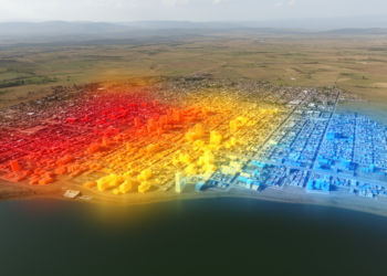
Geospatial models map urban growth and thermal conditions in Bahir Dar
A geospatial study found that built-up land expanded sharply in Bahir Dar between 1992 and 2022, while models projected further ...
A geospatial study found that built-up land expanded sharply in Bahir Dar between 1992 and 2022, while models projected further ...

A multi-model study found that modeled ecological protection constrained urban growth in the Yangtze River Delta through 2035 but left ...
A seven-decade geospatial analysis shows Kano's built-up area grew nearly thirteenfold between 1950 and 2020, with transportation corridors, not formal ...
The distinction between deep water and shallow water classes in the Bahr Al-Najaf classification scheme reflects a challenge familiar to ...
A new GIS-based framework in Saudi Arabia's Al-Qassim region maps where solar, wind, and hybrid renewable energy zones align or ...
A new study combining Landsat imagery and neural network modeling shows that Fiche Town in central Ethiopia more than doubled ...
A survey of 480 households in Northwest Ethiopia finds that while urban expansion brought electricity, piped water, and roads, displaced ...
An ensemble modelling study finds that Lima's Critically Endangered fog-oasis tree Vasconcellea candicans could see urban encroachment on its best ...
Satellite records show Port-au-Prince's built-up area more than quadrupled between 2015 and 2025, converting the vegetated slopes that regulate runoff ...
A two-decade satellite analysis of Ibadan's peri-urban corridor reveals that urban expansion follows a predictable sequence from vegetation to bare ...

Embark on a thrilling journey of discovery with Scienmag.com—your ultimate source for cutting-edge breakthroughs. Immerse yourself in a world where curiosity knows no limits and tomorrow’s possibilities become today’s reality!