


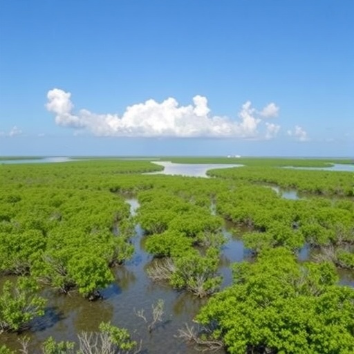
Mangrove forests are often portrayed as ecosystems that survive only when enclosed by legal protection, but a new study points toward a more complicated and potentially more hopeful reality. Published in Communications Earth & Environment, the research by U. Pimple, D. Simonetti, S. Thongdon-um and colleagues examines how mangrove landscapes have changed over multiple decades and how naturally regenerated forests have developed beyond the boundaries of protected areas. The work focuses on a question with major consequences for coastal conservation: can mangroves recover on their own when human pressure declines, even in places without formal protection?
That question matters because mangroves occupy a narrow zone between land and sea, where tides, sediment, freshwater, storms and human activity constantly reshape the landscape. Their tangled root systems trap suspended particles, slow water movement and help build soil. At the same time, roads, aquaculture ponds, ports, agriculture and urban expansion can interrupt tidal flows or remove the conditions required for regeneration. A mangrove forest is therefore not simply a group of trees. It is a dynamic coastal system in which vegetation, water and sediment continuously influence one another.
The study’s emphasis on “multidecadal landscape evolution” places mangrove recovery in a longer time frame than most conservation assessments. Short-term surveys can show whether seedlings are present or whether forest cover has increased in a particular year, but they may miss the deeper trajectory of a coastline. Over several decades, a former mangrove area may pass through multiple stages: clearing, erosion, abandonment, tidal reconnection, colonization by pioneer species and gradual development of a more structurally complex forest. Looking across this timeline allows researchers to distinguish a temporary increase in vegetation from a sustained ecological recovery.
This long view is especially important outside protected areas, where conservation policy often assumes that natural recovery will be limited or unreliable. Protected areas can restrict cutting, land conversion and other direct disturbances, but they cannot always prevent changes in surrounding watersheds, rising seas or altered sediment supply. Conversely, unprotected landscapes may sometimes recover when farms, ponds or other developments are abandoned and tidal water returns. The central insight of the research is not that protection is unnecessary, but that ecological recovery may occur across a broader geography than official conservation maps suggest.
To detect these changes, researchers studying landscape evolution commonly combine historical records with satellite imagery, aerial photographs, field observations and geospatial analysis. Each source reveals a different part of the story. Older maps and photographs can establish what existed before modern satellite monitoring. Multispectral satellite sensors can distinguish mangrove vegetation from open water, mudflats, agricultural land and built surfaces by measuring how Earth’s surface reflects different wavelengths of light. Repeated observations can then be used to reconstruct land-cover transitions, identify expanding or retreating forest patches and track the movement of coastal boundaries.
Those changes are not merely visual. Mangrove recovery depends on physical processes that can determine whether a seedling survives. Tidal inundation must occur often enough to supply moisture and nutrients, but not so intensely that young plants are continuously uprooted. Sediment must accumulate at a rate that allows the forest floor to keep pace with water-level changes. Channels must remain connected so that tides can enter and leave without creating prolonged stagnant conditions. When these relationships are disrupted, planting trees may produce little lasting benefit. When they remain intact, natural regeneration can sometimes spread across broad areas without intensive intervention.
The distinction between planted restoration and natural recovery has become increasingly significant in global climate and biodiversity policy. Mangroves store large quantities of carbon in both living biomass and waterlogged sediments, where decomposition is slowed by oxygen-poor conditions. They also reduce wave energy, stabilize shorelines, provide nursery habitat for fish and crustaceans and support the livelihoods of coastal communities. Yet restoration projects can fail when they prioritize the number of seedlings planted over the hydrological conditions that sustain a functioning ecosystem. Evidence of natural recovery beyond protected areas could help conservation planners direct funding toward removing barriers, restoring tidal exchange and protecting regenerating sites rather than relying exclusively on large planting campaigns.
The research also challenges the way conservation success is measured. A map that labels one zone as protected and another as unprotected may obscure the ecological connections between them. Mangrove propagules can disperse with tides, sediment can move across administrative borders and a restored channel can influence forests many kilometers away. Recovery in an unprotected area may complement conservation inside a reserve, creating a larger and more connected coastal habitat. At the same time, natural expansion should not be interpreted as proof that every damaged mangrove will recover. Severe erosion, pollution, altered river flows, land subsidence and continuing development can push a system beyond its capacity to regenerate.
For scientists and policymakers, the study’s broader message is that mangrove conservation should be designed around landscape processes rather than boundaries alone. Decades of change can reveal where forests are resilient, where recovery is blocked and which physical conditions are associated with long-term persistence. Such information can improve coastal zoning, guide restoration investments and help identify areas where legal protection should be expanded. It may also make conservation more responsive to local realities, recognizing that some forests are rebuilding quietly outside reserves while others require urgent intervention. As coastlines face rising seas and intensifying human pressure, understanding where nature is already repairing itself could become one of the most practical tools in the effort to keep mangrove ecosystems alive.
Cite Scienmag News
Violet Maxwell. (August 18, 2026). Mangrove Landscapes Evolve Over Decades, Recovering Naturally Beyond Protected Areas. Scienmag. https://scienmag.com/mangrove-landscapes-evolve-over-decades-recovering-naturally-beyond-protected-areas/
Violet Maxwell. "Mangrove Landscapes Evolve Over Decades, Recovering Naturally Beyond Protected Areas." Scienmag, 18 August 2026, https://scienmag.com/mangrove-landscapes-evolve-over-decades-recovering-naturally-beyond-protected-areas/. Accessed 4 September 2026.
Violet Maxwell. "Mangrove Landscapes Evolve Over Decades, Recovering Naturally Beyond Protected Areas." Scienmag. August 18, 2026. https://scienmag.com/mangrove-landscapes-evolve-over-decades-recovering-naturally-beyond-protected-areas/


