


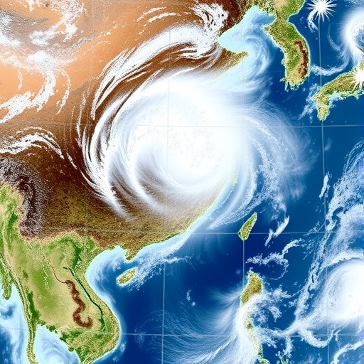
China’s northern provinces were hit by an extraordinary five-day windstorm in April 2025, when gusts exceeded 45 meters per second in some locations—roughly the wind speed associated with a Category 2 hurricane. Unlike a tropical cyclone, however, this event was not confined to a few hours or a narrow coastal track. From April 10 to 15, powerful northerly winds swept across a vast area, causing five deaths and more than $154 million in economic losses, according to China’s Ministry of Emergency Management. A new study now identifies the large-scale atmospheric mechanism that allowed the storm to become so intense, widespread and persistent: two remote Rossby wave trains traveled across Eurasia and converged over Central Asia, reorganizing pressure systems over China and sharply accelerating the flow of cold air toward the south.
The findings, reported by researchers from Sun Yat-sen University in the journal Ocean-Land-Atmosphere Research, offer a deeper explanation for an event that could not be understood fully by examining local weather systems alone. The scientists found that the extreme winds developed within an already unusual circulation pattern over northern China. During April 2025, average wind speeds in northern and northeastern China reached more than 9 meters per second, exceeding the 1979–2024 climatological average for the same dates by more than 4 meters per second. That background anomaly created a favorable environment for strong winds, but it did not explain why the event reached exceptional levels or continued across such a large part of the country. The decisive factor was the arrival and interaction of two planetary-scale disturbances in the upper atmosphere.
Rossby waves are enormous meanders in the mid- and upper-level westerly winds that circle the Northern Hemisphere. They form because Earth rotates and because the atmosphere’s rotation changes with latitude, a property known as the planetary vorticity gradient. These waves can appear as alternating ridges of high pressure and troughs of low pressure, sometimes stretching across entire continents. Although they may be thousands of kilometers from the weather they ultimately influence, Rossby waves can guide the movement of air masses and transfer energy through the jet stream. When their ridges and troughs become arranged in a favorable configuration, they can lock weather patterns in place, strengthen pressure gradients and produce persistent extremes at the surface.
In the Chinese wind event, one wave train originated near the Barents-Kara seas, a high-latitude region north of Siberia. The second developed along a more southerly route extending eastward from the Mediterranean near 40 degrees north. The two pathways were distinct, but they carried anomalous wave activity toward the same broad region of Central Asia. There, their influence combined and helped reinforce a ridge over northwestern China and a trough over northeastern China. In meteorological terms, this arrangement placed northern China between a strong area of relatively high geopotential heights to the west and a region of lower geopotential heights to the east. The resulting horizontal pressure gradient became steep enough to accelerate air rapidly from north to south.
The study team reconstructed the event using hourly data from ERA5, one of the world’s most detailed atmospheric reanalysis datasets. Reanalysis combines observations from weather stations, satellites, aircraft, ships and other sources with numerical weather models to produce a consistent description of the atmosphere through time. The researchers examined the evolution of winds and pressure patterns throughout April 2025 and compared the event with the average atmospheric state during the corresponding calendar period from 1979 to 2024. They also analyzed wave activity flux, a diagnostic that helps reveal how Rossby-wave energy propagates through the atmosphere. At both 500 hectopascals, roughly the level of the middle troposphere, and 200 hectopascals, near the upper-level jet stream, the analysis showed energy moving along the two Eurasian routes before the pathways converged over Central Asia.
This convergence was important because the wave trains did more than simply arrive in the same region. Their ridges and troughs interacted in a way that amplified the pressure pattern already developing over China. The strengthened ridge over the northwest favored sinking air and higher pressure, while the deepened trough over the northeast supported rising motion and lower pressure. Between them, air was forced through an increasingly narrow pressure corridor. Wind speed is strongly influenced by the pressure-gradient force, which accelerates air from high pressure toward low pressure, while the Coriolis effect turns moving air because of Earth’s rotation. In the Northern Hemisphere, the resulting geostrophic flow tends to run parallel to pressure contours, but when those contours are tightly packed, the winds can become exceptionally strong. This configuration produced powerful northerly and northwesterly winds across the country’s northern regions.
At the height of the outbreak, daily maximum wind speeds exceeded 15 meters per second across northern China, while localized gusts surpassed 45 meters per second. The contrast between the daily average and the most intense gusts highlights the event’s turbulent character. Strong winds near the surface can be enhanced when a deep pressure system mixes momentum downward from faster-moving air aloft. Daytime heating, convection and turbulence can help transport high-momentum air from the lower jet stream into the boundary layer, the lowest part of the atmosphere directly affected by Earth’s surface. Over complex terrain, including the mountains and plateaus of northern and northwestern China, channeling and downslope acceleration can further intensify local gusts. These processes help explain why the strongest impacts were concentrated in some areas even though the broader circulation covered much of northern China.
The researchers emphasize that their results connect regional weather consequences to remote atmospheric forcing. Earlier studies had described the local pressure systems and near-surface wind development, but the upstream origin of the pattern remained uncertain. By tracing wave propagation across Eurasia, the new analysis shows how conditions near the Barents-Kara seas and the Mediterranean could influence weather thousands of kilometers away. “Previous studies had explained the regional weather systems, but the upstream, large-scale forcing was still unclear,” said Kaiqiang Deng, the study’s corresponding author and an associate professor of atmospheric sciences at Sun Yat-sen University. The study’s lead author is Jiayi Nie, who worked with Xi Chen, Wentian Qiu and Qinghong Zhao.
The findings may have practical value because Rossby waves can sometimes be detected and tracked before their effects reach a vulnerable region. If forecasters identify the simultaneous development of high-latitude and midlatitude wave trains, and recognize that their propagation paths are likely to converge over Central Asia, they may gain additional lead time for anticipating severe winds in China. Such information could support earlier warnings for aviation, shipping, construction, power transmission, agriculture and emergency services. Forecasting remains challenging, however, because the strength and position of Rossby waves can change as they interact with the jet stream, mountains, land-surface heating and other atmospheric disturbances. Small errors in the predicted location of a ridge or trough can translate into substantial differences in surface wind intensity.
Deng and his colleagues now plan to investigate what initiated the two wave trains and why their paths aligned during April 2025. Possible influences include changes in sea-ice conditions in the Barents-Kara region and variations in sea-surface temperatures that can modify atmospheric circulation. The team also wants to examine how the wave trains and the East Asian cold vortex—a broad upper-air circulation associated with cold outbreaks over East Asia—may respond to continued global warming. A warmer climate does not eliminate the possibility of severe wind events, and changes in Arctic conditions, jet-stream behavior and land-sea temperature contrasts could alter where and when such events occur. By linking remote wave dynamics to local hazards, the researchers hope to turn complex atmospheric signals into more reliable forecasts and earlier warnings for future high-impact windstorms.
News Publication Date: 7-Jul-2026
Web References: https://doi.org/10.34133/olar.0159
References: Nie, J., Chen, X., Qiu, W., Zhao, Q., and Deng, K. “Spatiotemporal Characteristics and Drivers of China’s Record-Breaking Winds in April 2025.” Ocean-Land-Atmosphere Research. DOI: 10.34133/olar.0159
Cite Scienmag News
Violet Maxwell. (August 12, 2026). Global wave trains drove record-breaking winds across northern China in April 2024. Scienmag. https://scienmag.com/global-wave-trains-drove-record-breaking-winds-across-northern-china-in-april-2024/
Violet Maxwell. "Global wave trains drove record-breaking winds across northern China in April 2024." Scienmag, 12 August 2026, https://scienmag.com/global-wave-trains-drove-record-breaking-winds-across-northern-china-in-april-2024/. Accessed 4 September 2026.
Violet Maxwell. "Global wave trains drove record-breaking winds across northern China in April 2024." Scienmag. August 12, 2026. https://scienmag.com/global-wave-trains-drove-record-breaking-winds-across-northern-china-in-april-2024/


