

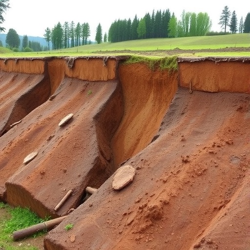
As climate change supercharges rainstorms and seismic activity reshapes landscapes, landslides are striking with greater fury across Japan and beyond. Yet predicting exactly where a slope will give way—and how much earth it will unleash—has remained a notoriously messy affair. The crux of the problem lies just beneath our feet: the thin, unruly blanket of soil and weathered rock that cloaks every hillside. At only a few tens of centimeters to a few meters thick, this shallow subsurface layer is directly responsible for most rainfall-triggered failures, but its capricious nature has long defied simple forecasting. Now, a team led by researchers at the University of Tsukuba has harnessed the astonishing precision of airborne laser scanning to crack a key part of the landslide code, revealing that the depth of a slide is governed far more by the steepness of the slope than by its total area.
The study, published in Scientific Reports, exploits a recent revolution in geodata acquisition. Airborne LiDAR—Light Detection and Ranging—can fire millions of laser pulses per second at the ground, stripping away vegetation to produce bare-earth digital elevation models (DEMs) with centimeter-scale resolution. By flying such surveys before and after catastrophic rainfall events, disaster scientists can now create “DEMs of difference,” subtracting one surface from the other to map the precise three-dimensional geometry of every landslide scar and deposit. For the first time, the shape of shallow failures can be measured not by a handful of field measurements but exhaustively, across entire river catchments.
Uchida Taro, Kudo Yuki, and their colleagues applied this differencing technique to multiple basins in igneous terrains that had been ravaged by past heavy-rain disasters in Japan. They extracted the area, depth, and local slope gradient for thousands of individual landslides. The goal was to test a widely assumed rule of thumb: that the volume and depth of a landslide scale predictably with its footprint. What they found was a striking departure from that assumption. For the shallow soil slips that dominate rainfall-triggered events, the correlation between area and depth was weak, often verging on non-existent. Larger slides did not consistently dig deeper; instead, depth seemed to be singing to a different tune entirely.
That tune, the data showed, is the slope angle. When the team plotted failure depth against gradient, a tight, systematic relationship emerged. On gentler inclines, the sliding mass tended to be thicker, while on steeper slopes, the failed soil layer was consistently thinner. Crucially, the thickness did not wander across a wide spectrum—it clustered within a remarkably narrow envelope that shifted downward as the slope grew steeper. In other words, for a given slope angle, nature imposes a fairly strict ceiling on how deep a rainfall-induced slide can excavate.
This pattern is not a complete surprise to geotechnical engineers. For decades, the infinite slope stability model—a simplified mathematical framework that treats a soil mantle as a uniform slab on an inclined plane—has predicted exactly this kind of slope–depth relationship. The model balances the downslope pull of gravity against the resisting strength of the soil, which depends on friction, cohesion, and pore-water pressure from infiltrating rain. The equations imply that beyond a certain depth, the weight of the soil itself becomes too great for the slope’s internal friction to hold, especially when water pushes the grains apart. But until now, direct empirical confirmation across a large and diverse set of real landslide disasters was missing. The Tsukuba team’s work provides that crucial field validation.
“Our findings mean that the location and magnitude of shallow landslides can be estimated from relatively simple indicators—slope gradient and soil thickness,” the researchers note. Rather than requiring computationally expensive three-dimensional models, hazard mappers can focus on building high-resolution slope maps and measuring the depth of soil cover using probes or geophysical surveys. Where these two variables intersect in a dangerous configuration, the risk of a slide is elevated. The beauty of the approach is its scalability: slope maps can be derived from widely available topographic data, and soil thickness, though harder to obtain, can be estimated from terrain attributes or limited field campaigns.
The implications for disaster risk reduction are profound. Current landslide hazard assessments often rely on historical inventories or complex hydrological triggers. The new framework offers a way to create physically grounded susceptibility maps that explicitly account for the expected increase in extreme rainfall under climate change. If a region is projected to see more intense downpours, the threshold pore-water pressure that destabilizes a given slope can be recalculated using the same simple model, making it possible to update hazard zones dynamically. This could transform how municipalities plan infrastructure, issue early warnings, and design evacuation strategies.
The study also underscores the value of investing in high-resolution topographic baselines before disasters strike. Only with pre-event LiDAR coverage can post-event differencing reveal the true geometry of failures. Japan, with its dense coverage of airborne surveys, is uniquely positioned to lead this effort, but the method is transferable to any landslide-prone region willing to map its terrain in detail. As heavy rains become the new normal in many parts of the world, the Tsukuba team’s confirmation of a simple, elegant rule—that a slope’s steepness tightly constrains the depth of its collapse—could give communities the precious lead time needed to save lives.
Subject of Research: Predicting landslide depth and occurrence using slope gradient and soil thickness, validated by airborne LiDAR DEM of difference analysis
Article Title: Depth of rainfall induced landslides revealed by DEM of difference analysis using airborne LiDAR data in igneous terrains
News Publication Date: 11-Apr-2026
Web References: https://doi.org/10.1038/s41598-026-46714-4; https://www.life.tsukuba.ac.jp/en/; https://trios.tsukuba.ac.jp/en/researcher/0000004314
References: Uchida, T., Kudo, Y. et al. Depth of rainfall induced landslides revealed by DEM of difference analysis using airborne LiDAR data in igneous terrains. Scientific Reports (2026). DOI: 10.1038/s41598-026-46714-4
Image Credits: Not applicable
Keywords: Landslides, slope stability, airborne LiDAR, digital elevation model, infinite slope model, hazard mapping, soil thickness, climate change adaptation, natural disasters


