


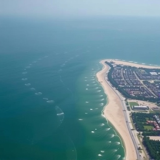
The world’s great coastal cities have long been fixated on the inexorable rise of the oceans, measuring each millimeter of thermal expansion and glacial melt with a mixture of dread and resignation. Yet a groundbreaking study published in Communications Earth & Environment reveals that for one of the planet’s most economically vital and densely populated megaregions, the ocean is not the primary enemy. The land itself is sinking so rapidly due to human activity that it will vastly outpace even the most pessimistic sea-level rise scenarios in the coming decades, fundamentally rewriting the calculus of flood risk for the more than 86 million people who call China’s Greater Bay Area home. The research, led by a team of geoscientists who deployed an arsenal of satellite-based radar interferometry, high-precision GPS measurements, and sophisticated hydrological modeling, demonstrates that the ground beneath the conurbation encompassing Guangzhou, Shenzhen, Hong Kong, Macau, and the Pearl River Delta is collapsing at rates that can only be described as a geological emergency. In many of the region’s most critical economic zones, vertical land motion is lowering the surface by two, three, or even more centimeters per year, a relentless descent that transforms what were once considered moderate sea-level projections into catastrophic multipliers of inundation. The finding shatters the conventional assumption that climate change alone dictates the future of coastal vulnerability, exposing a human-made subsidence crisis that has been largely invisible to the naked eye but is now laid bare with terrifying clarity by orbital sensors hundreds of kilometers above the Earth.
To fully grasp the magnitude of the threat, it is necessary to understand the dual forces that determine a coastline’s actual exposure to the sea. Absolute sea-level rise is a global phenomenon driven by the warming of the ocean and the addition of meltwater from ice sheets and glaciers, a process that is currently progressing at a global average of about 3.7 millimeters per year and accelerating. However, relative sea-level rise—the change in ocean height experienced at any specific point on the coast—is the sum of the rising water and the vertical movement of the land itself. When the land sinks, or subsides, the sea effectively rises much faster, sometimes by an order of magnitude. The new study focused on this second, often overlooked component, using interferometric synthetic aperture radar (InSAR) data from the European Space Agency’s Sentinel-1 satellites, processed with advanced multi-temporal techniques to map surface deformation across the entire Greater Bay Area between 2015 and 2023. The researchers, from institutions in China and the United States, calibrated these satellite observations with a dense network of continuous and campaign Global Navigation Satellite System (GNSS) stations, achieving an unprecedented level of spatial resolution and accuracy. What they discovered was a vast, patchwork landscape of subsidence that is not a natural inheritance but a direct consequence of human decisions, a chronic tectonic motion manufactured by the extraction of groundwater, the consolidation of sediments under the weight of megacities, and the massive reclamation of land from the sea.
The spatial patterns of sinking revealed by the InSAR analysis are as alarming as they are uneven, painting a detailed map of vulnerability that singles out specific urban districts, industrial parks, and newly reclaimed islands as the epicenters of a slow-motion disaster. Areas built on the thick, compressible Quaternary sediments of the Pearl River Delta—some of the youngest and most water-saturated soils on Earth—are subsiding at rates that dwarf the global average for even the most tectonically active plate margins. In parts of the western delta, near Zhongshan and Jiangmen, and in the rapidly urbanizing fringes of Guangzhou and Dongguan, vertical velocities routinely exceed 25 millimeters per year, with localized hotspots plummeting at more than 50 millimeters per year. To put that in perspective, the Intergovernmental Panel on Climate Change’s high-end sea-level rise scenario for the region under strong warming is approximately 10 to 15 millimeters per year by the end of the century. The ground is sinking two to five times faster than the ocean is rising, and in some places, the cumulative subsidence over the past two decades alone has exceeded half a meter. This means that the effective, experienced sea-level rise in these zones is already equivalent to what the rest of the world fears might happen only by 2100, and this relative rise is happening now, invisibly compounding the threat of every typhoon surge, every king tide, and every seasonal monsoon flood.
The driving mechanisms behind this anthropogenic subsidence are as varied as the region’s geology, but they all trace back to the breakneck pace of urbanization and industrialization that has transformed the Pearl River Delta into the world’s largest continuous urban agglomeration. The primary culprit, the study’s authors conclude after integrating groundwater extraction data and land-use records, is the relentless pumping of groundwater from the unconsolidated alluvial aquifers that underlie the delta. When water is removed from the pore spaces of fine-grained sediments like clays and silts, the effective stress on the soil skeleton increases, causing irreversible compaction, a process known as aquifer-system compaction that can persist for decades even after pumping ceases. In the Greater Bay Area, this is compounded by the sheer weight of the built environment: the staggering density of skyscrapers, transport infrastructure, and residential complexes imposes a significant static load on the compressible subsurface, a phenomenon known as geotechnical loading that is particularly acute in the central business districts of Shenzhen and Hong Kong, where land reclamation has placed artificial fill on top of marine muds. The study’s modeling of the deformation sources reveals that while groundwater extraction accounts for the dominant share of the regional subsidence signal, the load-driven consolidation of reclaimed land contributes a substantial, and growing, secondary component, particularly in the coastal megaprojects that have added hundreds of square kilometers to the shoreline over the past three decades.
The research team did not stop at diagnosing the present-day deformation; they projected the future flood exposure using a probabilistic framework that combined the observed subsidence rates with localized sea-level rise projections and high-resolution topographic data from airborne LiDAR surveys. The results are nothing short of a paradigm shift in how we understand coastal risk. By 2050, under a business-as-usual scenario where subsidence continues at its current trajectory, the total area exposed to the 100-year coastal flood—a metric that defines the extent of land inundated by a storm surge with a 1% chance of occurring in any given year—will increase by a staggering 260% to 310% compared to a baseline that ignores subsidence. This means that the relative contribution of sea-level rise alone to the expansion of flood zones is dwarfed by a factor of two to three by the effect of sinking land. The maps published in the paper show that vast swaths of the Greater Bay Area, currently home to millions of people and host to trillions of dollars in economic output, will find themselves below the flood level of a previously rare storm event, not because the sea has risen alarmingly, but because the land has fallen out from under them. The projections for 2100 are even more catastrophic, with the subsidence-driven expansion of the floodplain reaching up to 400% of the static scenario, effectively redrawing the coastline of the entire delta and threatening to submerge significant portions of the region’s most critical infrastructure, including the Hong Kong-Zhuhai-Macau Bridge, Shenzhen Bao’an International Airport, and the Guangzhou South Railway Station.
One of the most sobering aspects of the study is its demonstration that the flood exposure multiplier effect of subsidence is highly non-linear and concentrated in the very areas that have been the focus of the most intense development during the economic miracle of the past forty years. The researchers overlaid their flood hazard maps with detailed population density grids and economic asset databases, revealing a spatial mismatch between risk and the perception of safety. The new coastal development zones, the special economic zones, and the reclaimed technology parks that line the Pearl River estuary are, precisely because of the ground conditions that made them attractive for cheap land, the most susceptible to the combined assault of sinking and storm surge. The population currently residing in the 100-year floodplain, which numbers around 12 million when static topography is considered, balloons to over 35 million by 2050, and the economic assets at risk similarly triple, from approximately 1.5 trillion US dollars to well over 4 trillion. This is not a distant, hypothetical danger; it is a financial and humanitarian time bomb ticking beneath the world’s factory floor, the supply chain nexus that produces a significant fraction of the globe’s consumer electronics, apparel, and industrial machinery. The study’s authors emphasize that the standard flood risk assessments used by insurers, governments, and multilateral development banks rarely incorporate high-resolution, time-varying subsidence data, meaning that the global financial system is systematically underpricing the risk of catastrophic loss in one of its most strategically important regions.
The technical sophistication of the research lies in its ability to separate the various components of vertical land motion and attribute them to specific human activities, a feat achieved through a rigorous integration of geodetic, hydraulic, and geotechnical modeling. The InSAR time series, corrected for atmospheric artifacts and orbital errors using state-of-the-art algorithms, provided a wall-to-wall velocity map with a pixel resolution of roughly 30 meters, which the team then decomposed into linear trends, seasonal oscillations, and non-linear accelerations. The seasonal signals, which correlate with the monsoon-driven recharge and discharge of the shallow aquifer system, provide a direct fingerprint of the hydraulic connection between groundwater extraction and surface deformation. By inverting the deformation field using a model of a poroelastic half-space, the researchers estimated the volume of fluid loss from the deep aquifers, finding a strong spatial correlation with the locations of licensed and unlicensed groundwater wells that supply the region’s insatiable demand for industrial and agricultural water. The load-driven subsidence, meanwhile, was isolated by analyzing the temporal correlation between the construction history of mega-structures and the onset of accelerated sinking in their immediate vicinity, using a robust geotechnical consolidation model that accounts for the creep behavior of the delta’s soft marine clays. This multi-pronged approach leaves little room for doubt: the subsidence is not a natural geological phenomenon but a direct, measurable consequence of the choices made to sustain the region’s hyper-growth.
Perhaps the most disturbing implication of the study is that the subsidence problem is, in theory, entirely preventable, yet it remains largely unaddressed due to the complex political economy of water management and land development in the megalopolis. The authors point out that cities such as Tokyo, Shanghai, and Venice have demonstrated that aggressive regulation of groundwater extraction, coupled with managed aquifer recharge and the use of surface water alternatives, can arrest and even partially reverse subsidence within a few decades. Shanghai, for instance, reduced its maximum subsidence rates from over 100 millimeters per year in the 1960s to less than 10 millimeters per year today through a combination of pumping restrictions, injection wells, and the construction of a comprehensive monitoring network. The Greater Bay Area, however, presents a far more fragmented governance landscape, with the tripartite jurisdictional overlap of Guangdong Province, and the Special Administrative Regions of Hong Kong and Macau, each with different regulatory frameworks, water pricing structures, and historical groundwater rights. The study’s policy analysis suggests that current groundwater extraction regulations are insufficient, poorly enforced, and often undermined by the economic incentives that drive factories and farms to tap the cheapest available water source beneath their feet. The very economic success of the region, built on a model of decentralized, rapid industrialization, has created a tragedy of the commons in the aquifer, where the short-term gains of individual users lead to the long-term destruction of the land’s elevation, a resource that is far more expensive and technologically challenging to restore than to preserve.
The research also highlights a deeply troubling feedback loop between climate change and subsidence that has been almost entirely ignored in the global adaptation discourse. As the region experiences more intense and frequent droughts, a trend that is already being observed and is projected to worsen under climate change, the surface water supply from the Pearl River and its tributaries becomes more unreliable, driving an increased reliance on groundwater extraction. This, in turn, accelerates subsidence precisely when the relative sea-level rise is becoming most dangerous, creating a vicious cycle that amplifies flood risk during the very periods when the region is most vulnerable to typhoons and extreme rainfall events. The authors model this drought-subsidence nexus using a hydrological model forced by downscaled climate projections, showing that the number of drought-induced groundwater pumping episodes is expected to increase by 40% to 60% by mid-century, leading to a non-linear increase in the rate of subsidence in the most sensitive areas. This finding underscores the inadequacy of assessing flood risk as a linear sum of independent hazards; instead, the interaction between climate extremes and human responses to them creates a compounding risk that is far greater than the sum of its parts. It is a stark reminder that the infrastructure and policies designed to cope with water scarcity can inadvertently engineer a far more catastrophic and permanent form of land subsidence that no sea wall or storm barrier can ultimately defend against.
The study’s projections for the end of the century are presented with a range of scenarios, from a best-case where aggressive groundwater regulation and managed aquifer recharge halve the current subsidence rates, to a worst-case where unmitigated extraction and continued massive reclamation projects push the cumulative subsidence in some locations to over two meters. Under the worst-case scenario, the relative sea-level rise experienced by the Greater Bay Area by 2100 would be equivalent to a global sea-level rise of over three meters, a figure that is beyond the upper bound of even the most extreme ice-sheet instability scenarios considered by the IPCC. This effectively means that the region could face a 22nd-century coastline in the lifetime of a child born today, without the world’s oceans having to rise much at all. The maps show that the coastal floodplain would expand inland by tens of kilometers, permanently inundating large areas of Zhongshan, Zhuhai, and the western districts of Guangzhou, and creating a new archipelago of high ground separated by shallow, brackish waters. The economic disruption would be unfathomable, with the potential to displace tens of millions of people, sever the critical transport links that connect the manufacturing heartlands to the ports of Hong Kong and Shenzhen, and trigger a cascade of failures in the global supply chains that depend on the region’s just-in-time production model.
An especially innovative aspect of the research is its use of a dynamic flood model that simulates the propagation of storm surges over the constantly changing topography, rather than the conventional bathtub approach that simply overlays a static flood level on a digital elevation model. The team coupled their subsidence projections with a high-resolution hydrodynamic model of the Pearl River estuary, forced by a statistically downscaled ensemble of tropical cyclone tracks from the latest generation of climate models, to simulate the inundation footprint of the 100-year storm surge at various time horizons. This dynamic approach captures the complex interactions between the surge, the friction of the urban fabric, the drainage network, and the progressive lowering of the land surface, revealing that the flood extents are even larger than the bathtub method would suggest because the subsidence reduces the gradient of the drainage system, causing water to pond for longer and infiltrate further inland. The model also shows that the combination of subsidence and sea-level rise creates a non-linear increase in the probability of compound flooding, where heavy rainfall in the river basin coincides with a storm surge at the coast, an event that has historically been the most deadly and destructive type of flood in the delta. The study’s findings indicate that the joint return period of such compound events shortens dramatically, from a 1-in-100-year event in the present day to a 1-in-5-year event by 2050 under the unmitigated subsidence scenario, a frequency that would make large-scale catastrophic flooding a regular feature of life in the region.
The societal implications of this research are profound and extend far beyond the borders of the Greater Bay Area, as the phenomenon of human-induced subsidence is a global crisis hiding in plain sight. The authors contextualize their findings by comparing the subsidence velocities in the Pearl River Delta with those measured in other sinking megacities, such as Jakarta, where subsidence rates of up to 25 centimeters per year have forced the Indonesian government to relocate the national capital to Borneo, and Mexico City, where parts of the historic center have sunk more than ten meters over the past century. The Greater Bay Area, with its massive economic output and its status as a symbol of China’s economic rise, now joins this list of urban areas where the ground is literally giving way beneath the weight of human ambition. The study’s lead author, in a statement accompanying the paper, notes that the problem is not a lack of technological solutions but a failure of political will and public awareness; the subsidence is invisible to the public, slow enough to be ignored in the short term, but fast enough to lock in centuries of irreversible flood risk. The paper is a clarion call for a new generation of coastal adaptation strategies that treat land subsidence as a primary hazard, on par with sea-level rise, and that require the same level of international coordination, investment, and regulatory intervention.
The research team has made their high-resolution deformation maps and flood exposure datasets publicly available, in a bid to spur the kind of open science that can inform the urgent policy decisions that lie ahead. The data reveal, with an almost surgical precision, the specific neighborhoods, industrial parks, and infrastructure assets that are most at risk, and they provide a baseline against which the effectiveness of any future mitigation measures can be measured. The authors propose a suite of interventions, including the phased closure of all deep groundwater wells in the delta, the large-scale use of managed aquifer recharge using treated wastewater and excess surface water during the wet season, the enforcement of geotechnical standards for land reclamation that require pre-loading and vertical drains to accelerate consolidation before construction, and the development of a sophisticated early warning system that integrates real-time GNSS and InSAR monitoring with storm surge forecasts. The cost of these interventions, while substantial, is estimated to be a fraction of the projected economic losses from a single major flood event under the business-as-usual scenario, a compelling economic argument that the authors hope will resonate with the region’s financial planners and political leaders. The study is a stark reminder that the most dangerous threats to our coastal civilizations are not always the ones that make the headlines; sometimes, the ground beneath our feet is the most treacherous variable of all, and the time to act is before the next storm surge reveals the full extent of our collective negligence.
The implications for global climate policy and the United Nations’ Sustainable Development Goals are equally significant, as the study exposes a critical blind spot in the way we measure and report on vulnerability to climate change. The international community has focused intently on mitigating greenhouse gas emissions and on adapting to the direct impacts of a warming planet, but the subsidence crisis in the Greater Bay Area demonstrates that human activities unrelated to climate change can overwhelm the climate signal and create a risk profile that is entirely disconnected from global emissions trajectories. This means that even if the world were to achieve net-zero emissions tomorrow, the flood exposure in the Pearl River Delta would continue to escalate for decades, as the compaction of the aquifer system is a process with a long memory, driven by past and present extraction. The study’s authors argue that the concept of climate justice must be expanded to include the right to stable land, and that the international funds designated for adaptation in developing countries should be accessible for projects that address subsidence, a hazard that disproportionately affects the poor and marginalized who live in the lowest-lying, most flood-prone neighborhoods. The paper is a landmark contribution to the emerging field of anthropogenic geomorphology, the study of how humans are reshaping the Earth’s surface at a scale and rate that rivals the great forces of nature, and it serves as a cautionary tale for every coastal megacity on the planet that is built on the soft, compressible soils of a river delta.
The story of the Greater Bay Area’s sinking is, at its core, a story about the hubris of building a civilization on a foundation of mud and water without accounting for the fundamental physics of soil mechanics. The ancient cities of the Pearl River Delta understood the rhythms of the river and the sea, building their settlements on the stable bedrock outcrops and the slightly higher natural levees. The modern megacity, in its relentless expansion, has paved over the floodplains, drained the wetlands, and pumped the water from the underground reservoirs, setting in motion a geological process that no amount of hard engineering can easily reverse. The research published in Communications Earth & Environment is not merely an academic exercise; it is a forensic autopsy of a landscape in crisis, and a survival guide for the millions who live upon it. It tells us that the future of the world’s great coastal cities will be written not only in the atmosphere and the oceans but in the pore spaces of the sediments beneath our feet, and that the decisions we make today about groundwater, land reclamation, and urban planning will echo through the topography for centuries to come. The only question that remains is whether the leaders of the Greater Bay Area will heed the warning from the satellites, and begin the difficult work of stabilizing the ground before the sea claims what the sinking has already surrendered.
Cite Scienmag News
Violet Maxwell. (July 6, 2026). Sinking land outruns sea rise in Pearl Delta. Scienmag. https://scienmag.com/sinking-land-outruns-sea-rise-in-pearl-delta/
Violet Maxwell. "Sinking land outruns sea rise in Pearl Delta." Scienmag, 6 July 2026, https://scienmag.com/sinking-land-outruns-sea-rise-in-pearl-delta/. Accessed 4 September 2026.
Violet Maxwell. "Sinking land outruns sea rise in Pearl Delta." Scienmag. July 6, 2026. https://scienmag.com/sinking-land-outruns-sea-rise-in-pearl-delta/


