


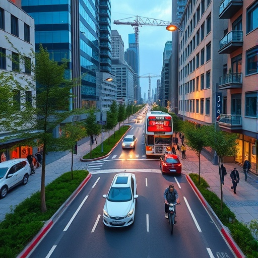
Addressing the escalating challenge of climate change demands innovative strategies to curb greenhouse gas emissions, with urban planning emerging as a pivotal battlefield in this endeavor. A groundbreaking study recently published in Environmental Research Letters spearheaded by the Potsdam Institute for Climate Impact Research (PIK), alongside collaborators from the University of California, Berkeley and the University of Sussex, reveals that reducing both the number and length of car commutes plays a decisive role in slashing urban emissions. The study’s sophisticated analysis emphasizes that the spatial arrangement of homes relative to city centers and workplaces is paramount, overshadowing traditional urban metrics such as overall city-wide population density or transport infrastructure alone.
Harnessing a remarkable dataset of ten million mobility data points across diverse metropolitan contexts—including Berlin, Boston, Los Angeles, the San Francisco Bay Area, Rio de Janeiro, and Bogotá—the researchers applied a pioneering methodological framework integrating GPS tracking, travel pattern analysis, and artificial intelligence algorithms. This approach transcends conventional correlation-based studies by establishing causal relationships, thereby enabling planners to pinpoint precisely where urban densification efforts would most effectively shorten car commute distances and, consequently, decrease carbon emissions.
Felix Wagner, who conducted the research as part of his PhD at PIK in 2025, highlights a paradigm shift this study introduces. Wagner explains that their model uniquely reveals the interdependencies among urban design factors—such as how urban density interacts with connectivity and accessibility—and stresses the critical influence of the spatial relationship between residential locations and employment hubs. This challenges the predominant siloed approach in urban analysis, suggesting that to unlock emission reductions, policymakers must understand these interconnected dynamics rather than focusing on any single urban parameter in isolation.
One of the most striking findings pertains to monocentric metropolitan regions exemplified by Berlin and Boston. Contrary to notions that densifying the urban core is always best, the research indicates that infill development in a “ring-shaped corridor” surrounding the city center yields the greatest benefits. For Boston, this ideal densification belt lies roughly between 10 and 21 kilometers from downtown. In Rio de Janeiro, this zone expands outward up to 40 kilometers. This region strikes an optimal balance: the areas are less densely built-up yet maintain convenient accessibility to central business districts, thereby minimizing the need for long car commutes. In contrast, for polycentric urban environments such as Los Angeles and the greater San Francisco Bay Area, emission reductions correlate strongly with densifying neighborhoods characterized by high job concentrations, underscoring the necessity of tailored urban strategies respecting local economic geographies.
The investigation further dismantles the long-standing practice in urban science of treating structural variables independently. Through robust causal analysis, the team demonstrates significant linkages—for example, a strong coupling between population density and road connectivity which has rarely been quantitatively elucidated previously. Additionally, socioeconomic factors such as income indirectly shape driving habits mainly by influencing residential location choices. This nuanced understanding builds on prior 2023 research published in Nature Communications that illuminated the overlooked importance of the built environment in shaping carbon emissions, an aspect often neglected in mainstream economic models addressing climate impacts.
Delving deeper into spatial heterogeneity, the study underscores the peril of blanket densification policies, offering compelling evidence that their effectiveness varies dramatically even within short geographic distances, sometimes just a few kilometers apart. Felix Creutzig of PIK, a co-author, notes that in Berlin alone, per-commute emissions fluctuate between reductions of 0.8 kilograms and increases of 2.9 kilograms of CO₂ compared to city averages depending on neighborhood context. This heterogeneity signals the urgency for hyper-localized urban planning interventions, moving away from one-size-fits-all policy prescriptions toward precision strategies tailored to neighborhood-scale characteristics.
However, the research also candidly acknowledges the constraints of densification in suburban or peri-urban zones distant from employment centers. For such areas, urban planning alone cannot substantially curtail commuting-related emissions. Instead, integrated approaches combining transit-oriented development, stringent limits on greenfield expansion, carpooling incentives, and the normalization of telecommuting are recommended. These complementary strategies illustrate the multifaceted nature of decarbonizing urban mobility systems, recognizing that built form alteration must be coupled with behavioral and systemic shifts.
The innovative analytical framework developed by the team leverages the latest advances in artificial intelligence and big data analytics. By synthesizing massive mobility datasets with urban form metrics across multiple international metropolises, the model offers emergent planners a powerful decision-support tool to identify priority zones for intervention. Importantly, the researchers have made their source code publicly available on GitHub, encouraging transparency and fostering a collaborative scientific culture whereby future studies can refine and extend these causal insights.
This study emerges from the CircEUlar project, funded by the European Union’s Horizon Europe programme, which aims to enhance urban sustainability through circular economy principles. Its findings carry profound implications for global cities grappling with the twin imperatives of accommodating growing populations while rigorously reducing their carbon footprints. Given that transport emissions are among the largest contributors to urban greenhouse gases, these granular revelations provide a timely and actionable blueprint for cities worldwide.
In conclusion, this groundbreaking research decisively elevates the role of spatial proximity—particularly the relative location of homes to city centers and workplaces—as the cornerstone for meaningful emission reductions achieved through urban densification. By unpacking the complex causal web connecting urban morphology, mobility behavior, and emissions, it equips urban planners, policymakers, and environmental scientists with evidence-based insights to craft geographically precise, effective climate mitigation policies. This represents a pivotal advancement toward sustainable, low-carbon cities that not only meet mobility needs but also align with broader planetary health goals.
News Publication Date: 28-May-2026
Web References:
Study DOI
GitHub Source Code
Cite Scienmag News
Sloane Callahan. (May 28, 2026). Innovative Urban Planning Strategy Reduces Car Traffic and Cuts Carbon Emissions. Scienmag. https://scienmag.com/innovative-urban-planning-strategy-reduces-car-traffic-and-cuts-carbon-emissions/
Sloane Callahan. "Innovative Urban Planning Strategy Reduces Car Traffic and Cuts Carbon Emissions." Scienmag, 28 May 2026, https://scienmag.com/innovative-urban-planning-strategy-reduces-car-traffic-and-cuts-carbon-emissions/. Accessed 7 September 2026.
Sloane Callahan. "Innovative Urban Planning Strategy Reduces Car Traffic and Cuts Carbon Emissions." Scienmag. May 28, 2026. https://scienmag.com/innovative-urban-planning-strategy-reduces-car-traffic-and-cuts-carbon-emissions/


