


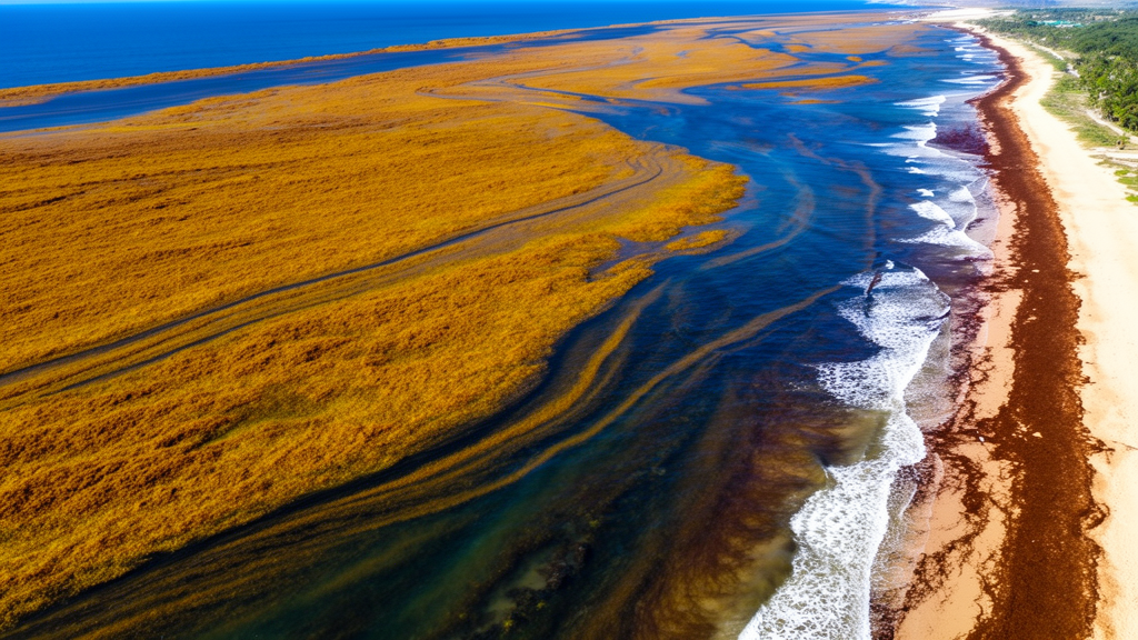
Every year, floating mats of golden-brown Sargassum seaweed sweep across the tropical Atlantic and pile up on the beaches of West Africa, clogging fishing nets, fouling tourist coastlines and releasing foul-smelling gases as they rot. A new study published in the journal Ocean Science has now untangled when and why these inundations strike the northern Gulf of Guinea, the stretch of coast running from Liberia through Côte d’Ivoire, Ghana, Togo, Benin and Nigeria. By combining fifteen years of satellite observations with sophisticated ocean simulations and particle-tracking experiments, researchers Clovis Thouvenin-Masson and Julien Jouanno of IRD and LEGOS in Toulouse have produced the most complete process-based picture yet of a hazard that has battered Atlantic shorelines since 2011.
The central finding is that coastal arrivals follow a strikingly regular semiannual rhythm. Rather than a single annual peak, the northern Gulf of Guinea experiences two distinct influx seasons: one in boreal spring, between March and May, and a second, often larger, wave in autumn, between September and November. Both satellite-derived measurements of Sargassum coverage and the NEMO-Sarg computer model, which simulates the transport, growth and beaching of the seaweed, reveal this double-peaked cycle. The pattern contrasts sharply with the well-documented spring-summer maximum seen on the far side of the Atlantic, where Caribbean islands have endured recurrent golden tides since the emergence of the Great Atlantic Sargassum Belt, a vast expanse of floating algae stretching from West Africa to the Gulf of Mexico.
Crucially, the study shows that the seaweed arriving on West African beaches is not grown locally. Backward particle-tracking experiments, in which virtual drifters were released from Sargassum-rich coastal waters and traced upstream for 120 days, reveal a dominant west-to-east transport corridor. Biomass is supplied mainly from the eastern tropical Atlantic, funnelled toward the coast by the North Equatorial Countercurrent and the Guinea Current, a coastal flow that runs along the West African margin. The journey from the open eastern tropical Atlantic to the northern Gulf of Guinea takes roughly two to three months, while the final leg past the Cape Palmas gateway, at the Liberia-Côte d’Ivoire border, takes about a month.
The two seasonal peaks arise from different upstream configurations. Spring arrivals draw on biomass retained offshore of Guinea and Sierra Leone during the winter months, which is then carried southeastward by the Guinea Current, supplemented in some years by a second pool of seaweed sitting closer to the Equator. Autumn arrivals, by contrast, are fed by a much larger upstream accumulation that forms near the Intertropical Convergence Zone, the cloudy equatorial rain belt, during late summer, when strengthened trade winds and the monsoon push the North Equatorial Countercurrent to its annual maximum. Because of the two-to-three-month transit time, the autumn glut on the coast reflects transport conditions established weeks earlier far out at sea.
Winds emerge as the decisive force shaping what happens once the seaweed rounds Cape Palmas. Southerly winds, acting through direct wind drag on the floating mats and through Stokes drift, the wave-induced surface motion, push the biomass northward against the coastline and keep it trapped north of the Equator. Sensitivity experiments in which wind forcing was switched off paint a dramatically different picture: without winds, Sargassum shifts about two degrees of latitude southward, remains embedded in the core of the Guinea Current, spreads far more widely across the Gulf, and even finds a pathway southward along the Gulf margin toward the Southern Hemisphere, where it could potentially proliferate. Winds therefore perform three roles at once: they position the seaweed latitudinally, they drive it into the coastal accumulation zone off Côte d’Ivoire and Ghana, and they prevent leakage into the southern Gulf.
Beaching itself turns out to be a powerful regulator. In a companion experiment with stranding disabled, coastal Sargassum cover stayed high for much longer after the seasonal peaks, with the largest anomalies concentrated in nearshore waters between Côte d’Ivoire and Nigeria. Stranding, implemented in the model as a removal rate of 0.08 per day in coastal cells, acts as a sink that strips biomass from the floating pool and limits how long each influx lingers along the shore. The researchers tested several stranding rates before settling on the value that best matched the observed seasonal and spatial distribution of coastal coverage.
Year-to-year variability in the inundations is governed by the Atlantic Meridional Mode, a coupled ocean-atmosphere climate pattern defined by a north-south sea surface temperature gradient across the tropical Atlantic. In autumn, the link is remarkably strong, with the AMM index explaining 83 percent of the variance in coastal Sargassum cover. Negative AMM phases, marked by cooler waters in the tropical North Atlantic and warmer waters to the south, shift the Intertropical Convergence Zone and the seaweed band southward, closer to the latitude of Cape Palmas, while simultaneously strengthening the North Equatorial Countercurrent. Both effects favour eastward delivery of biomass into the Gulf. In spring, the AMM explains about 54 percent of the variance, with high-Sargassum years again showing a more southerly upstream distribution and a stronger countercurrent.
The study confronts real observational hurdles. Persistent cloud cover beneath the Intertropical Convergence Zone means that along much of the northern Gulf coast, fewer than fifteen valid satellite observations per month are available on average, and the satellite product measures areal coverage rather than biomass volume. The model was therefore nudged toward weekly satellite averages west of 15 degrees west, leaving the eastern tropical Atlantic and the Gulf free to evolve dynamically. Published stranding records, though sparse and uneven across countries, broadly corroborate the simulated timing, with documented events in Ghana, Côte d’Ivoire and Nigeria matching the spring and autumn peaks. Only 3.4 percent of research records on Sargassum since 2010 concern West Africa, underscoring how little studied this coastline has been compared with the Caribbean.
For coastal communities and governments, the findings offer a practical framework for seasonal risk assessment. Upstream Sargassum cover in the eastern tropical Atlantic, biomass approaching the Cape Palmas gateway, and the preceding state of the Atlantic Meridional Mode could together serve as early indicators of impending inundations, giving fisheries and cleanup operations weeks to months of lead time. The study also flags longer-term questions: the tropical Atlantic Sargassum baseline has remained elevated since 2011, and future shifts in the Intertropical Convergence Zone, regional winds or the Atlantic Meridional Overturning Circulation could either amplify or suppress the seaweed delivery to West Africa. A conditional southern export pathway, active only under unusual biomass surpluses or anomalous winds, could further reorganize the basin-wide distribution. What is certain is that the golden tides of the northern Gulf of Guinea are not random; they are the predictable product of currents, winds and Atlantic climate, now finally mapped.
Subject of Research: Seasonal and interannual drivers of pelagic Sargassum inundations along the northern Gulf of Guinea coast of West Africa
Article Title: Seasonal and interannual drivers of Sargassum inundations in the Northern Gulf of Guinea
Article References: Thouvenin-Masson, C., & Jouanno, J. (2026). Seasonal and interannual drivers of Sargassum inundations in the Northern Gulf of Guinea. Ocean Science, 22(5), 2835-2862. https://doi.org/10.5194/os-22-2835-2026
Image Credits: AI Generated
Keywords: Sargassum, Gulf of Guinea, West Africa, ocean currents, North Equatorial Countercurrent, Guinea Current, Atlantic Meridional Mode, satellite observations, Lagrangian transport, coastal inundations, Great Atlantic Sargassum Belt, seasonal forecasting
Cite Scienmag News
Violet Maxwell. (October 9, 2026). Winds, Currents and Climate Mode Drive Twice-Yearly Sargassum Waves onto West African Shores. Scienmag. https://scienmag.com/winds-currents-and-climate-mode-drive-twice-yearly-sargassum-waves-onto-west-african-shores/
Violet Maxwell. "Winds, Currents and Climate Mode Drive Twice-Yearly Sargassum Waves onto West African Shores." Scienmag, 9 October 2026, https://scienmag.com/winds-currents-and-climate-mode-drive-twice-yearly-sargassum-waves-onto-west-african-shores/. Accessed 9 October 2026.
Violet Maxwell. "Winds, Currents and Climate Mode Drive Twice-Yearly Sargassum Waves onto West African Shores." Scienmag. October 9, 2026. https://scienmag.com/winds-currents-and-climate-mode-drive-twice-yearly-sargassum-waves-onto-west-african-shores/


