
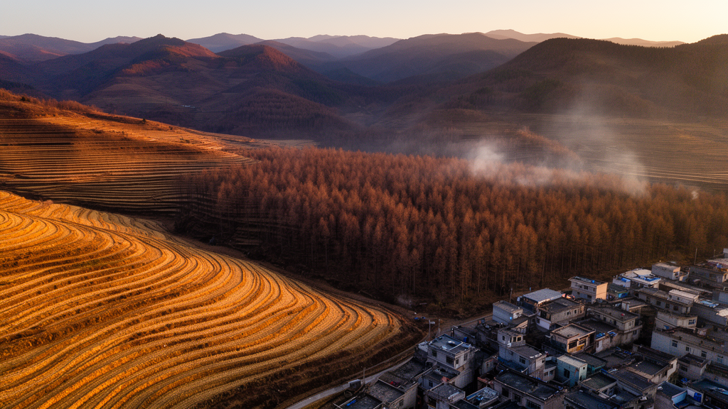
Wildfire on the Central Yunnan Plateau reached a decisive turning point around 2010, and the two kinds of landscapes where fires burn most often have moved in opposite directions ever since. Using Landsat-based burned-area records from 1990 to 2023, the researchers found that burned area rose in both interface types before 2010, then fell sharply in the cropland interfaces while remaining comparatively persistent in the urban interfaces, which steadily gained relative importance in the region’s fire regime.
The Central Yunnan Plateau is the most fire-prone part of Yunnan Province, which itself sits at the core of a high-fire belt extending across the Indochina Peninsula. The region also carries Yunnan’s highest population density and its most intensive agriculture, and it has urbanized rapidly in recent decades, so wildland–urban and wildland–cropland interfaces coexist there in increasingly complex spatial configurations.
To delineate the interfaces, the team used 30-meter land-cover data from the China Land Cover Dataset for every year from 1990 to 2023, processed on the Google Earth Engine platform. Urban interfaces were drawn by placing a 2,400-meter buffer around built-up land and extracting its overlap with forests, grasslands and shrublands, following conventions from global WUI mapping. Cropland interfaces used a narrower 500-meter buffer around farmland, reflecting the steeper, more topographically constrained cropland–vegetation edges typical of the plateau. Sensitivity tests with alternative buffer distances of 1,200 and 4,800 meters for WUI and 250 and 1,000 meters for WCI produced highly consistent temporal patterns, supporting the chosen baselines. Because the two interface definitions can overlap, the authors also ran an overlap sensitivity analysis comparing original series with WUI-only and WCI-only series.
The fire data came from a monthly Landsat 30-meter burned-area product for 1990–2023, generated by training a Random Forest model on filtered MODIS and VIIRS active fire detections together with pre- and post-fire spectral changes in Landsat imagery. Burned pixels were identified at a probability threshold of 0.90, with water bodies and built-up surfaces masked out. The product reported an overall accuracy of 0.970, and the team independently validated it against 166 ground-surveyed fire records from the local forestry department for 2016–2020, counting an event as detected when a burned pixel fell within 3 kilometers of its recorded location.
The temporal analysis identified a breakpoint around 2010 using continuous segmented regression with Bayesian information criterion model selection. Regional fire activity peaked in 2010, when burned area across the plateau reached 715 square kilometers, or 0.64 percent of the regional area, a year the authors link to the historic extreme drought that struck Yunnan. After 2010, the annual mean burned area in the WCI was 136.26 square kilometers, lower than the 1990s mean of 149.64 square kilometers. The WUI moved the other way: burned area there averaged 64.55 square kilometers in the 2010s, nearly double the 1990s mean of 32.88 square kilometers. An area-normalized metric, the percentage of interface area burned, declined significantly in the WCI after 2010 but showed no significant trend in the WUI.
Seasonality told a parallel story of divergence. Fire activity across the plateau is strongly unimodal, concentrated in the dry season from November to April and peaking in March, after which activity drops sharply through the summer and autumn. Summer fires increased across the study area over the three decades, although their absolute contribution remained small. In the WUI, the seasonal center of gravity shifted toward spring: after 2000, the proportion of spring fires increased with fluctuations while the winter share declined. In the WCI, winter and spring remained dominant and the seasonal structure changed little, which the authors suggest reflects the periodic inertia of agricultural fire-use habits. Spatially, WCI fires clustered in large continuous zones in Honghe Prefecture in the south, whereas WUI hotspots were dispersed and polycentric around urbanized areas including Kunming, Yuxi, Qujing and Honghe.
To probe the underlying drivers, the researchers divided the plateau into 1-by-1-kilometer grid cells and modeled two annual response variables: fire occurrence, whether a cell burned in a given year, and burned-area percentage, the proportion of each cell that burned. Random Forest models with partial dependence analysis showed that climate dominated both responses. Climatic variables accounted for about 44 percent of total importance for fire occurrence, with dry-season mean temperature the most important predictor; fire probability rose sharply once mean dry-season temperature exceeded about 12 degrees Celsius. For burned-area percentage, dry-season relative humidity was the top predictor in all domains, contributing 18.6 percent in the full plateau, 24.5 percent in the WCI and 14.4 percent in the WUI, with burned fraction high when humidity fell below 60 percent and declining rapidly above that threshold.
Beneath that shared climatic background, the two interfaces diverged in instructive ways. Fire occurrence in the WCI was more strongly associated with population density, which ranked second with 8.9 percent importance and showed elevated fire probabilities at both very low and very high densities. WUI fire occurrence, by contrast, was more constrained by topographic relief, increasing with terrain complexity. Burned-area percentage in the WCI remained overwhelmingly climate-dominated, with climatic factors contributing a cumulative 57.4 percent, consistent with crop residues and herbaceous fuels that dry rapidly in open, unsheltered farmland. In the WUI, burned-area percentage was jointly shaped by fuel structure and human activity: coniferous forest proportion contributed 9.9 percent, with burned fraction rising sharply once coniferous cover exceeded about 20 percent, and population density contributed 9.7 percent, with burned fraction climbing rapidly above roughly 300 to 400 persons per square kilometer as ignition sources overwhelmed the fragmenting barriers that sparse development provides.
Vegetation and topography added further texture. Warm-temperate coniferous forests dominated by Pinus yunnanensis, together with shrublands and savannas, were the main fire-carrying vegetation types, and burned area changed in stages around 2010 across all categories, rising before the breakpoint and declining after. Along elevation gradients, burned area concentrated at mid-elevations, with the 1,600–2,000-meter band contributing the largest share; WCI fires were proportionally more frequent below 1,200 meters, while WUI fires concentrated at 1,600–2,400 meters. Burned-area proportions increased with slope, peaking on slopes steeper than 25 degrees. County- and town-level units emerged as the main locations of fire occurrence, with WUI shares higher around prefecture-level capitals and WCI shares higher at county and town levels.
The authors attribute the post-2010 decline in WCI burning partly to strengthened fire governance, noting that China’s revised Forest Fire Prevention Regulations took effect in 2009 and that Yunnan issues annual fire-prevention orders restricting field fire use and agricultural burning. Because precipitation stayed relatively low and temperatures continued rising after 2010, they argue the WCI decline cannot be explained by more favorable climate, while continued urban expansion kept extending WUI contact zones and sustaining fire activity there. The team is careful to frame its driver findings as broad-scale associations rather than deterministic controls, and to note limitations: wind speed, soil moisture and vapor pressure deficit were not included, the monthly analysis cannot capture individual fire-event triggers, and interface thresholds remain operational definitions. Still, the practical implication is clear. Cropland-interface management should prioritize regulating the timing and conditions of agricultural burning, especially during high-risk periods, while urban-interface management should emphasize fuel reduction, control of coniferous fuel continuity, community preparedness and risk mitigation in mountainous terrain. The two interfaces, the study concludes, host genuinely different fire regimes rather than variants of a single process, and they demand differentiated strategies.
Subject of Research: Comparative study of wildfire regimes and their drivers in wildland–cropland versus wildland–urban interfaces on the Central Yunnan Plateau from 1990 to 2023
Article Title: The temporal trajectories and driving forces of wildfire regimes differing between wildland–cropland and wildland–urban interfaces on the Central Yunnan Plateau
Article References: Lin, Y., Xiahou, M., Rao, J., Luo, C., Yang, T., & Shen, Z. (2026). The temporal trajectories and driving forces of wildfire regimes differing between wildland–cropland and wildland–urban interfaces on the Central Yunnan Plateau. Ecological Processes, 15(1), Article 89. https://doi.org/10.1186/s13717-026-00745-x
Image Credits: AI Generated
DOI: 10.1186/s13717-026-00745-x
Keywords: wildfire, Central Yunnan Plateau, wildland–urban interface, wildland–cropland interface, fire regime, burned area, Landsat, Random Forest, fire seasonality, Yunnan China, fire management, drought
Cite Scienmag News
Drew Townsend. (October 29, 2026). Wildfire Regimes Split Between Cropland and Urban Interfaces on Yunnan Plateau. Scienmag. https://scienmag.com/wildfire-regimes-split-between-cropland-and-urban-interfaces-on-yunnan-plateau/
Drew Townsend. "Wildfire Regimes Split Between Cropland and Urban Interfaces on Yunnan Plateau." Scienmag, 29 October 2026, https://scienmag.com/wildfire-regimes-split-between-cropland-and-urban-interfaces-on-yunnan-plateau/. Accessed 30 October 2026.
Drew Townsend. "Wildfire Regimes Split Between Cropland and Urban Interfaces on Yunnan Plateau." Scienmag. October 29, 2026. https://scienmag.com/wildfire-regimes-split-between-cropland-and-urban-interfaces-on-yunnan-plateau/