


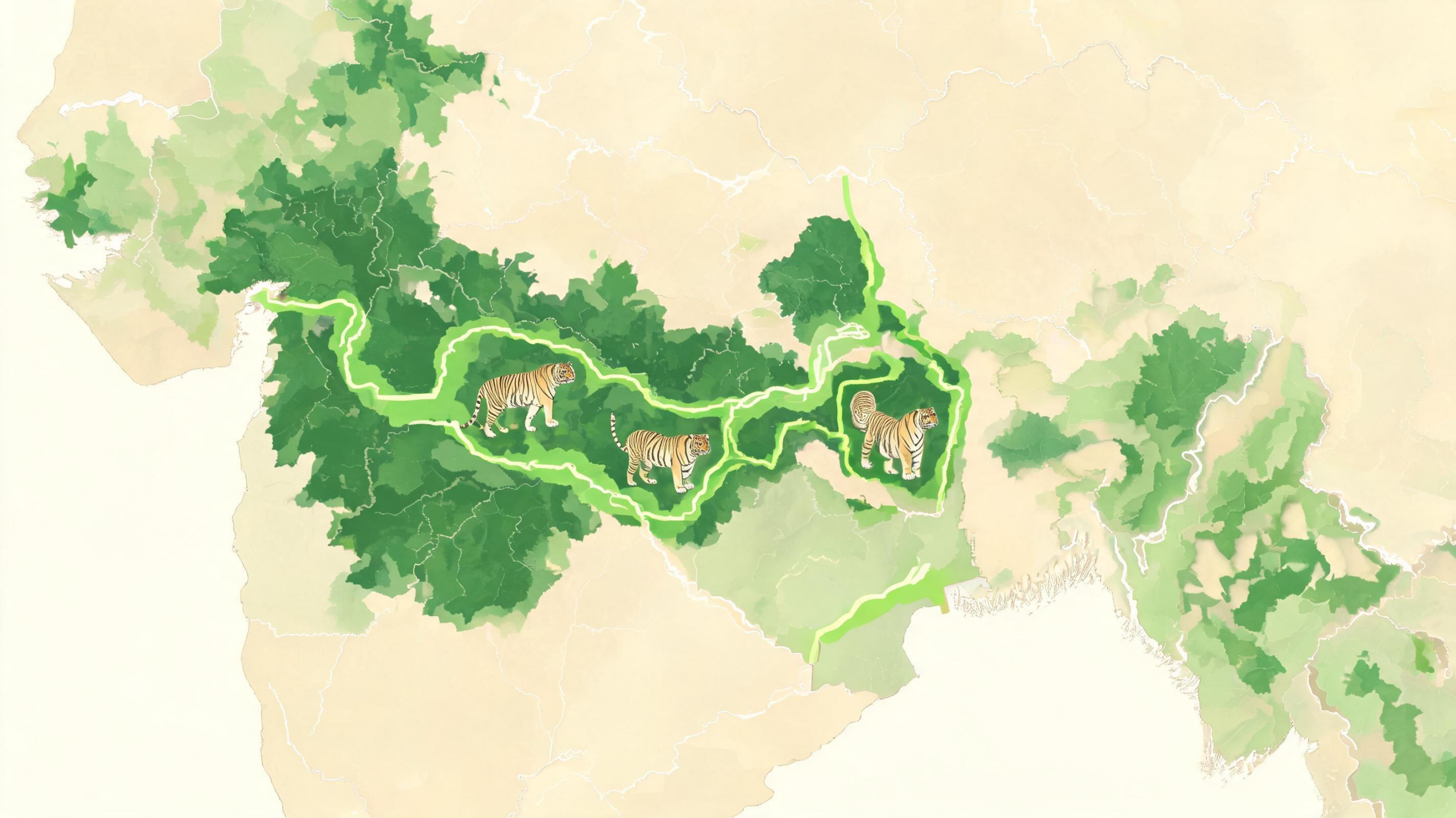
A new landscape-scale analysis has identified the forested routes and habitat conditions most likely to support Bengal tigers across a rapidly changing region of Central India. The study focuses on the Ratapani–Kheoni–Singhori landscape in Madhya Pradesh, a dry deciduous forest system where protected areas are interwoven with farms, settlements, roads and other human pressures. Rather than treating Ratapani Tiger Reserve, Kheoni Wildlife Sanctuary and Singhori Wildlife Sanctuary as isolated conservation islands, the researchers mapped them as parts of a potentially connected ecological unit. Their results indicate that tiger habitat is concentrated in a broad belt running through these areas, with prey availability, reliable water and low human disturbance emerging as the strongest influences on suitability. The findings provide a spatial framework for strengthening corridors before further fragmentation makes tiger movement more difficult.
India is central to the future of the Bengal tiger, supporting nearly three-quarters of the world’s population of the subspecies. The Central Indian Highlands are particularly important because their forests can support dispersal between populations, genetic exchange and the recolonization of areas where tigers have disappeared. But the landscape is not uniformly wild. Agricultural expansion, infrastructure, quarrying and settlement growth are transforming the matrix between protected areas. For a wide-ranging predator, those changes can matter even when the core of a reserve remains intact. A road, village or heavily disturbed forest edge may reduce the permeability of the wider landscape, preventing tigers from reaching otherwise suitable habitat. The Ratapani–Kheoni–Singhori complex, located within the Vindhyan hill ranges and less than 55 kilometres from Bhopal, therefore represents both an opportunity and a warning: extensive forest remains, but its continuity cannot be assumed.
To estimate where tigers are most likely to find suitable conditions, Mayank Makrand Verma and Satyadeep Nag combined field observations with an ensemble species distribution model. Their tiger records came from intensive sign-based surveys conducted in 2018 and 2019 under the Ratapani Tiger Project. Trained field teams recorded georeferenced pugmarks, scrapes, scats, claw marks and scent marks while walking at least 15 kilometres along animal trails and natural movement routes in each surveyed forest beat. Local forest personnel also contributed observations about vegetation, prey, water and human disturbance. Because these surveys documented presence rather than confirmed absence, the researchers generated 1,000 pseudo-absence or background points across accessible parts of the landscape, excluding large water bodies and urban patches. This allowed the models to compare known tiger locations with environmental conditions available elsewhere.
The analysis began with 24 spatial predictors covering the physical and biological features that can shape tiger space use. These included elevation, slope, aspect and terrain ruggedness; forest cover, vegetation greenness, bamboo distribution and distance to forest edges; climatic variables; distances to perennial and seasonal water; pre-summer water persistence; and measures of population density, village density, settlement proximity and human footprint. The researchers also incorporated habitat-suitability layers for several potential prey species, including sambar, chital, nilgai, barking deer and cattle. Before modelling, they used variance inflation factor screening to remove strongly correlated variables. Predictors with a variance inflation factor above 10 were discarded, leaving 22 variables intended to provide more independent ecological information. This step is important because highly correlated predictors can make it difficult to determine which environmental factor is actually associated with a predicted pattern.
Five modelling methods were then used: generalized linear models, Random Forest, Support Vector Machine, Boosted Regression Trees and MaxEnt. Each method represents species–environment relationships differently. A generalized linear model can describe broad, comparatively smooth trends, whereas machine-learning approaches can identify nonlinear responses, interactions and abrupt thresholds. The models were calibrated repeatedly using 75 percent of the records for training and 25 percent for testing, with 15 replicates per algorithm. Their performance was evaluated with the area under the receiver operating characteristic curve, the True Skill Statistic, correlation, sensitivity and specificity. AUC values ranged from 0.89 to 0.93, while TSS values ranged from 0.67 to 0.72. Random Forest performed best overall, with an AUC of 0.918 and a TSS of 0.707. The similar results across the different algorithms suggested that the major habitat signals were not artifacts of one statistical technique.
The individual models also converged on a recognizable geography. They repeatedly identified forest interiors within Ratapani Tiger Reserve, Singhori Wildlife Sanctuary and the northern part of Kheoni Wildlife Sanctuary as areas of high suitability. These zones combined relatively continuous forest, abundant prey and lower levels of human disturbance. The ensemble prediction, created by averaging model outputs with weighting based on AUC performance, produced a more stable consensus map. The study’s abstract reports approximately 2,006.20 square kilometres of suitable tiger habitat, while the results section reports an ensemble estimate of approximately 2,352.6 square kilometres. Both accounts describe the same central pattern: suitable habitat is concentrated in the protected forest blocks and in the forest corridor linking them, rather than being evenly distributed throughout the broader landscape.
The map divided the landscape into areas of low, medium and high suitability after applying a threshold based on the maximum combined sensitivity and specificity. High-suitability zones represented core habitat where several models agreed most strongly. Medium-suitability areas occurred along forest edges, intervening forest blocks and portions of the human-modified matrix. These locations may not support permanent tiger occupancy as reliably as the core, but they could function as stepping stones for dispersal, seasonal movement or exploratory range expansion. Agricultural areas, settlement-dominated patches and quarry-affected zones were generally associated with low suitability. The result challenges the idea that a wildlife corridor must be a narrow, clearly defined strip. In this landscape, connectivity appears to operate as a gradient, depending on whether prey-rich forest, dependable water and manageable disturbance align across space.
Variable-importance analysis reinforced that interpretation. Human population density, village density and proximity to settlements ranked among the most influential predictors, indicating that disturbance can impose sharp limits on tiger habitat use. Among ecological variables, prey suitability—especially for nilgai and sambar—was consistently important. Cattle presence also ranked among the strongest predictors in most models, reflecting the complicated relationship between livestock, human activity and tiger space use. Proximity to perennial water was particularly influential in machine-learning models, consistent with the seasonal demands of dry deciduous forests, where water can affect ungulate movements and concentrations. Forest cover and vegetation greenness contributed moderately, while elevation and slope helped shape broad patterns but were less dominant. Together, the results suggest that forest cover alone is not enough: tiger habitat depends on the interaction of food, water and disturbance.
For conservation planners, the implications extend beyond drawing a line around existing reserves. Ratapani and Singhori contain core areas that require continued protection, prey-base maintenance and safeguards against infrastructure and intensive extraction. The medium-suitability belt connecting Ratapani, Singhori and Kheoni may deserve equally focused attention because damage there could interrupt movement even if the reserves themselves remain intact. The study points to restoration, quarry regulation, careful management of roads and other linear infrastructure, improved water planning and conflict-mitigation measures as possible ways to increase landscape permeability. It also emphasizes the value of managing village fringes, grazing and resource extraction rather than concentrating exclusively on forest interiors. The researchers acknowledge that their projections are based on presence-only surveys, proxy measures of prey distribution and disturbance, and a limited time window. Future camera-trap occupancy studies, multi-season surveys, genetic data and dynamic connectivity models could refine the picture. Even with those limits, the analysis establishes a quantitative baseline and shows how combining several modelling approaches can turn scattered field signs into a practical map of where tiger persistence may depend most urgently on connected habitat.
The modelling framework is most useful when its map is interpreted as a hypothesis about environmental support for tiger use, rather than as a direct census of animals. A high-suitability pixel indicates that its measured conditions resemble those associated with field signs; it does not by itself establish that tigers occupy the area continuously, reproduce there or can move through it safely. This distinction matters in a landscape where seasonal water, prey movements and human activity may change rapidly. The reported influence of perennial water and prey-related variables therefore provides an ecological explanation for the spatial pattern, while also indicating which conditions should be monitored through time.
The study’s use of locally collected disturbance observations adds detail that broad remotely sensed layers can miss. Records of dung presence and illicit felling, together with information on June water availability and bamboo, allow the analysis to represent some ground-level features of tiger habitat use. At the same time, these variables are snapshots of a particular survey period. Their relationships with tiger signs could differ between seasons or years, especially if rainfall changes water persistence or alters the distribution of ungulates. Repeated surveys would help determine whether the identified priorities are stable features of the landscape or responses to temporary conditions.
A practical next step would be to test the predicted corridor network independently with camera traps, track surveys or genetic sampling. Such validation could distinguish areas used mainly for passage from those supporting regular residence, and could reveal barriers that are not fully captured by the predictor layers. Monitoring should also examine whether improvements in water management, prey protection or disturbance reduction produce measurable changes in tiger detections and prey activity. Because the landscape functions across administrative boundaries, comparable surveys and shared spatial data would make it possible to join this site-specific assessment with neighbouring analyses. That staged approach—intensive local modelling followed by consistent regional integration—could improve confidence in conservation decisions without sacrificing the ecological detail obtained from field-based studies.
Subject of Research: Landscape-scale modelling of Bengal tiger habitat suitability and connectivity in Central India
Article Title: Landscape-scale identification of tiger habitat priorities in Central India using ensemble species distribution modelling
Article References: Verma, M. M., & Nag, S. (2026). Landscape-scale identification of tiger habitat priorities in Central India using ensemble species distribution modelling. Discover Ecology, 2(1), Article 21. https://doi.org/10.1007/s44396-026-00038-9
Image Credits: AI Generated
DOI: 10.1007/s44396-026-00038-9
Keywords: Bengal tigers, Central India, habitat suitability, wildlife corridors, ensemble modelling, species distribution models, Ratapani Tiger Reserve, prey availability, human disturbance, Landscape-scale, identification, tiger
Cite Scienmag News
Margaret Porter. (August 28, 2026). Tiger Conservation Map Reveals Central India’s Critical Forest Corridors. Scienmag. https://scienmag.com/tiger-conservation-map-reveals-central-indias-critical-forest-corridors/
Margaret Porter. "Tiger Conservation Map Reveals Central India’s Critical Forest Corridors." Scienmag, 28 August 2026, https://scienmag.com/tiger-conservation-map-reveals-central-indias-critical-forest-corridors/. Accessed 5 October 2026.
Margaret Porter. "Tiger Conservation Map Reveals Central India’s Critical Forest Corridors." Scienmag. August 28, 2026. https://scienmag.com/tiger-conservation-map-reveals-central-indias-critical-forest-corridors/


