


Air pollution forecasts are often limited by an inconvenient reality: fixed air-quality monitoring stations are sparse and unevenly distributed. In many regions, that leaves large gaps in the data needed to understand where fine particulate matter—especially PM2.5—concentrations rise and fall. While official monitors are reliable, their geography can blur local pollution hotspots that matter for public health.
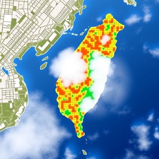
A new study addresses this blind spot by blending multiple data sources, including low-cost air quality sensors and satellite observations, to build a higher-resolution picture of PM2.5 across Taiwan. The approach is designed to complement traditional networks rather than replace them, using inexpensive instruments to expand spatial coverage where conventional monitors are lacking.
The researchers focus on integrating sensor measurements with satellite-derived aerosol information. Satellites can observe broad areas, but translating their signals into ground-level PM2.5 requires careful modeling to account for atmospheric conditions and calibration differences. Low-cost sensors, meanwhile, can capture local variation but may drift or underperform in complex environments unless corrected.
To overcome these limitations, the team developed a high-resolution PM2.5 model that fuses data streams into a unified framework. The method leverages the satellites’ wide-area perspective while using ground-based low-cost sensors to anchor predictions at finer spatial scales. By doing so, the model aims to reduce uncertainty caused by both monitoring gaps and satellite retrieval biases.
High resolution matters because urban pollution patterns can change dramatically over short distances due to traffic, industry, and meteorology. Capturing that variability can improve exposure assessment, helping researchers and decision-makers identify areas at greater health risk rather than relying on citywide averages.
Importantly, the study highlights a practical path for countries with limited monitoring infrastructure. As low-cost sensing networks become more common, their value increases when paired with satellite data and robust statistical correction. The result is a modeling system that is both data-rich and scalable.
With PM2.5 linked to respiratory and cardiovascular outcomes, better spatial accuracy could support earlier warnings and more targeted interventions. The framework demonstrated in Taiwan may offer a template for other regions facing similar constraints in monitoring coverage.
Cite Scienmag News
Russell Cooper. (July 27, 2026). Taiwan Develops High-Resolution PM2.5 Model Using Low-Cost Sensors and Satellites. Scienmag. https://scienmag.com/taiwan-develops-high-resolution-pm2-5-model-using-low-cost-sensors-and-satellites/
Russell Cooper. "Taiwan Develops High-Resolution PM2.5 Model Using Low-Cost Sensors and Satellites." Scienmag, 27 July 2026, https://scienmag.com/taiwan-develops-high-resolution-pm2-5-model-using-low-cost-sensors-and-satellites/. Accessed 3 September 2026.
Russell Cooper. "Taiwan Develops High-Resolution PM2.5 Model Using Low-Cost Sensors and Satellites." Scienmag. July 27, 2026. https://scienmag.com/taiwan-develops-high-resolution-pm2-5-model-using-low-cost-sensors-and-satellites/


