

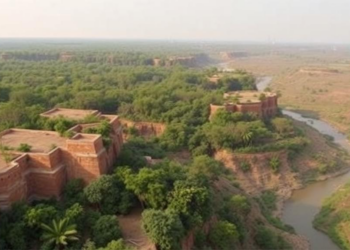
Satellites Reveal India’s Chambal Ravines Are Healing While Its Forests Quietly Deteriorate
A 32-year satellite study combining remote sensing indices and multivariate statistics shows high-risk land degradation in India's Chambal region has ...
A 32-year satellite study combining remote sensing indices and multivariate statistics shows high-risk land degradation in India's Chambal region has ...

A new critical review finds that drone-based photogrammetry reliably measures soil-surface geometry and topographic change, but turning those measurements into ...
The University of Tennessee AgResearch has appointed 30-year veteran Jason Williams as permanent director of the AgResearch and Education Center ...
A factorial field study in Ethiopia's Tigray highlands shows that integrated soil and water conservation measures significantly reduce compaction, boost ...
A 120-year analysis of Kerala's rainfall shows that the erosive power of the state's rain has become progressively decoupled from ...
The first complete morphometric survey of the Pabbar River Basin shows a Himalayan watershed in delicate geomorphic equilibrium, with low ...
Researchers in India have developed a single satellite-based index, GEMI, that simultaneously predicts nine grassland ecosystem services, outperforming traditional vegetation ...
Dated sediment cores from Kenya's Winam Gulf reveal that sedimentation in Lake Victoria has surged up to seven-fold since the ...
Researchers have developed an accounting method for nitrogen trading that accounts for the different aquatic environmental impacts of nitrogen from ...
A two-year field experiment in Benin shows that farmers' traditional honeycomb stone arrangements cut soil loss by up to 52 ...

Embark on a thrilling journey of discovery with Scienmag.com—your ultimate source for cutting-edge breakthroughs. Immerse yourself in a world where curiosity knows no limits and tomorrow’s possibilities become today’s reality!