

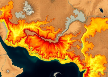
Satellites and Machine Learning Map Soil Erosion Hotspots in a Drought-Hit Indian River Basin
A new RUSLE-GIS study maps soil erosion across India's drought-prone Jonk River Basin with 97 percent accuracy, identifying steep, unprotected ...
A new RUSLE-GIS study maps soil erosion across India's drought-prone Jonk River Basin with 97 percent accuracy, identifying steep, unprotected ...

A new satellite-based modeling study shows that widespread soil and water conservation could nearly halve severe soil loss in Ethiopia's ...
A detailed study of twelve benchmark soil series on the Meghalaya Plateau reveals that organic matter, critical shear stress and ...
A new study shows that grass roots and their biochemical products dramatically reduce erosion in compacted sandy soils, and introduces ...
A coupled RUSLE-SWPT modeling study shows soil loss in Ethiopia's Upper Omo Gibe Basin rose 44 percent over three decades, ...
Researchers in northern Iran combined satellite-derived terrain attributes with a support vector machine and factor analysis to map soil quality, ...
A field trial on Sri Lanka's steep tea slopes shows that stone terraces combined with vetiver grass cut dissolved nutrient ...
A physics-based erosion model applied to a sandy southern Brazilian watershed reveals that subsurface processes, not surface runoff, drive the ...
A new field study in Ethiopia's central Gondar highlands finds that widely implemented soil and water conservation structures consistently fall ...
A new geospatial study finds that about 80 percent of Kabul is exposed to three or more overlapping environmental hazards, ...

Embark on a thrilling journey of discovery with Scienmag.com—your ultimate source for cutting-edge breakthroughs. Immerse yourself in a world where curiosity knows no limits and tomorrow’s possibilities become today’s reality!