


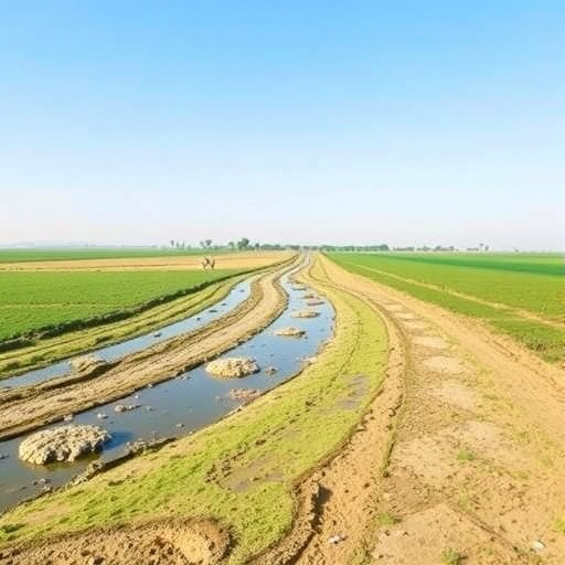
In Iran’s semi-arid Eghlid agricultural valleys, the water beneath farmers’ fields is quietly shaping the future of the soil above them. A new study published in Environmental Geochemistry and Health has linked groundwater chemistry directly to soil salinity, identifying electrical conductivity as the strongest measurable driver of soil degradation in irrigated farmland. The finding carries significance far beyond one basin. Across dry regions where rainfall is scarce and groundwater supplies most irrigation, every watering event can deliver dissolved salts into the root zone. If those salts are not removed by sufficient drainage or rainfall, they accumulate, reducing crop productivity and gradually changing the physical structure of the soil. The Iranian researchers say their integrated approach could help farmers and water managers identify vulnerable areas before salinization becomes irreversible.
The investigation focused on irrigated fields distributed across two contrasting hydrological units, designated HU-A and HU-B. The units are separated by mountainous terrain, a landscape feature that can divide groundwater systems and produce sharply different chemical conditions over relatively short distances. The researchers collected groundwater and soil samples from agricultural areas and analyzed major dissolved ions alongside indicators used to judge irrigation suitability. Soil electrical conductivity, or soil EC, was used as the principal field-scale signal of salinity. In practical terms, EC measures how readily a solution conducts electricity, which increases with the concentration of dissolved ions. It does not identify every salt individually, but it provides a powerful overall measure of salinity in irrigation water and soil extracts.
The distinction between salinity and sodicity is central to the study. Salinity refers mainly to the buildup of soluble salts that make it harder for plants to absorb water, even when the soil appears moist. This occurs because salts lower the soil-water potential, forcing roots to expend more energy to take up water and potentially causing physiological drought. Sodicity, by contrast, involves an excessive proportion of sodium relative to calcium and magnesium. High sodium levels can disperse clay particles, clog soil pores, reduce infiltration and cause surface sealing. To capture these risks, the researchers examined indices such as sodium adsorption ratio, or SAR, and other sodicity-related measures, while also considering the broader hydrochemical composition of the groundwater. Their results indicated that these sodium-related indicators mattered, but played a secondary role compared with total groundwater salinity.
The most consistent relationship observed in both hydrological units was between groundwater EC and soil EC. Where irrigation water had higher conductivity, the associated soils generally showed stronger salinity signals. This pattern is scientifically expected but agriculturally consequential: the concentration of salts entering a field is one of the most direct controls on how quickly salts can accumulate when irrigation exceeds the soil’s natural capacity to flush them downward. Evaporation intensifies the process. In a semi-arid climate, water is removed from the soil through evaporation and plant transpiration, while many dissolved minerals remain behind. Repeated irrigation can therefore create a slow “salt pump,” moving salts toward the surface and concentrating them in the root zone. Without adequate leaching, drainage and careful irrigation scheduling, even groundwater that appears usable in the short term may contribute to long-term soil decline.
To distinguish genuine environmental patterns from simple visual associations, the researchers combined conventional statistics with machine-learning analysis. Spearman’s rank correlation was used to test whether groundwater variables and soil EC changed together in a consistent, non-linear manner. Multiple linear regression then estimated how several groundwater parameters collectively related to soil salinity. Random forest analysis provided a different perspective by constructing an ensemble of decision trees and ranking the relative importance of individual predictors. Because random forests can capture complex interactions and do not require the relationship between variables to be strictly linear, they are increasingly used in environmental studies where water chemistry, geology, irrigation intensity and landscape position interact. In this case, the different analytical tools converged on the same broad conclusion: groundwater EC was the dominant predictor of soil EC, while sodicity indicators contributed less to the observed degradation pattern.
The study also used cluster analysis to reveal distinct hydrochemical regimes within the agricultural landscape. Clustering groups sampling locations according to similarities in their chemical characteristics, allowing researchers to identify water types that may reflect different recharge sources, water-rock interactions, flow paths or degrees of evaporation and agricultural influence. The resulting groups were associated with broadly consistent soil salinity responses, although the strength and spatial uniformity of those responses differed between the two hydrological units. HU-B showed greater spatial heterogeneity, meaning that neighboring fields could experience substantially different combinations of groundwater quality and soil salinity. Such variation is particularly important for agricultural decision-making. A single irrigation recommendation for an entire basin may overlook local hotspots where saline water, shallow groundwater, poor drainage or intensive pumping is accelerating soil deterioration.
By contrast, HU-A was predominantly associated with favorable groundwater chemistry and low soil degradation risk. The researchers found that localized moderate-risk zones were more evident in HU-B, where higher salinity inputs coincided with intensive irrigation. The risk framework developed in the study integrated groundwater quality indicators with measured soil EC conditions, producing a spatial assessment of where degradation is currently limited and where management attention is most urgent. The approach does not treat irrigation suitability as a fixed label attached permanently to a well or aquifer. Instead, it recognizes that suitability depends on the interaction between water chemistry, soil properties, drainage, climate and irrigation practices. Water that is acceptable for a salt-tolerant crop on a well-drained soil may pose a serious hazard when applied repeatedly to a fine-textured soil with restricted drainage.
The practical implications are immediate. Monitoring groundwater EC could provide a relatively rapid and economical early-warning system for farms dependent on wells. A rise in conductivity would not automatically mean that irrigation must stop, but it would signal the need to reassess crop choice, irrigation frequency, leaching requirements and drainage conditions. Farmers may reduce risk by improving application efficiency, preventing excessive evaporation, maintaining drainage pathways and periodically applying sufficient low-salinity water to move accumulated salts below the root zone where feasible. However, leaching itself requires careful design: if salts are flushed downward but groundwater is shallow or drainage is blocked, they may return to the root zone. Sodium hazards also cannot be ignored, because a water source with moderate overall salinity may still damage soil structure if its sodium proportion is high. The Iranian study therefore supports a tiered management strategy in which salinity is treated as the primary screening factor, followed by a detailed evaluation of sodicity and site-specific soil response.
The researchers emphasize that their framework is intended as a decision-support tool rather than a substitute for field monitoring. Its predictive value depends on the quality, timing and spatial coverage of groundwater and soil sampling, as well as on local knowledge of irrigation intensity and drainage. The data were made available on reasonable request, and the study’s authors recommend continued observation of both water and soil conditions. Long-term monitoring would help determine whether the observed relationships remain stable through wet and dry years, changing groundwater levels and shifts in cropping patterns. Even with those limitations, the study delivers a message that is easy to understand and difficult to ignore: in semi-arid agriculture, the invisible chemistry of irrigation water can become the visible chemistry of the soil. By placing groundwater EC at the center of salinity-risk assessment, the research offers farmers and water managers a way to act before salt accumulation turns productive land into a costly environmental liability.
Cite Scienmag News
Alan Morgan. (August 26, 2026). Study links groundwater quality and soil salinity to irrigation suitability in Iran. Scienmag. https://scienmag.com/study-links-groundwater-quality-and-soil-salinity-to-irrigation-suitability-in-iran/
Alan Morgan. "Study links groundwater quality and soil salinity to irrigation suitability in Iran." Scienmag, 26 August 2026, https://scienmag.com/study-links-groundwater-quality-and-soil-salinity-to-irrigation-suitability-in-iran/. Accessed 4 September 2026.
Alan Morgan. "Study links groundwater quality and soil salinity to irrigation suitability in Iran." Scienmag. August 26, 2026. https://scienmag.com/study-links-groundwater-quality-and-soil-salinity-to-irrigation-suitability-in-iran/


