


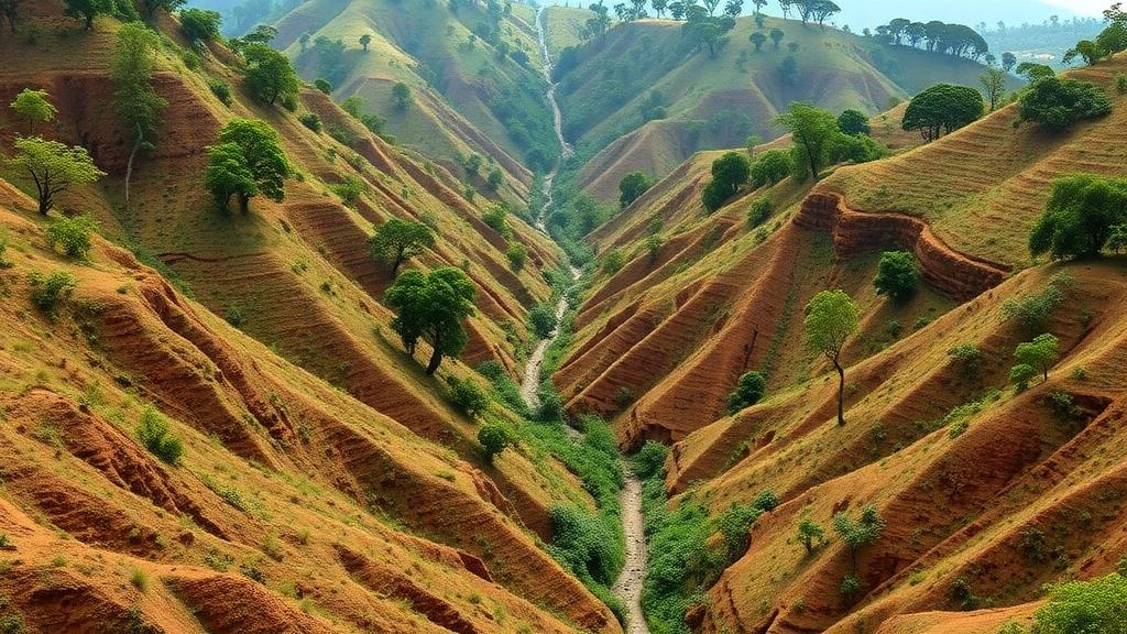
Deep, branching scars are cutting through the farmed hillsides of eastern Uganda, and a new study shows they are growing on both fronts that matter most: the land area they consume and the volume of soil they remove. In the Lwakhakha sub-catchment, a steep Afromontane agroecosystem on the slopes of Mount Elgon, riverine gully erosion has carved out a combined footprint of 209,116 square metres, and the gullies are still actively expanding. The research, published in Discover Sustainability, combines precise field measurements, statistical susceptibility modelling, temporal change analysis, and interviews with hundreds of households to build one of the most complete catchment-scale pictures of gully erosion assembled for the region.
The team, led by Claire Nabatta of Uganda Martyrs University and Kyambogo University, together with Bernard Barasa, Cosmas Wacal, and Abubaker Mugirya, measured the geometries of 25 gullies using Real-Time Kinematic positioning, a satellite-based technique that delivers centimetre-level accuracy in three dimensions. This level of precision matters because gully morphology, including depth, width, and cross-sectional shape, determines how much soil has been lost and how quickly the channels will continue to enlarge. The geocoded gully locations were then integrated with datasets on soil characteristics, slope, elevation, geology, rainfall, and the Normalised Difference Vegetation Index, a satellite-derived measure of vegetation greenness and density.
The analysis revealed that gully erosion in the sub-catchment falls into three severity classes: high, moderate, and low. The total gully volume was recorded at 260 cubic metres, a figure that represents soil physically removed from the landscape. When the researchers modelled which environmental variables best predicted where gullies occur and how severe they become, three predictors stood out: slope, elevation, and NDVI. Steeper terrain at particular elevations, combined with sparse vegetation cover, creates the hydrological conditions in which concentrated runoff gains enough energy to cut into the soil and carve channels that deepen with every storm.
Temporal change analysis showed that the gullies are actively increasing in both area and volume, confirming that this is not a legacy problem frozen in the landscape but an ongoing geomorphic process. The channels enlarge through a combination of surface scouring, bank collapse, and headward migration, in which the gully tip cuts upslope into previously intact land. Each rainfall event delivers pulses of water that concentrate in the channel network, and the resulting shear stresses exceed the resistance of the soil, detaching particles and transporting them downslope into the river system.
To understand why farmers believe the gullies are forming, the team randomly selected and interviewed 380 households using semi-structured questionnaires. The community-perceived drivers that emerged as statistically significant, with P values below 0.05, included slope steepness, erratic rainfall, soil type, weak underlying geology, absence of vegetation cover, deforestation, poorly constructed roads, and the land tenure system. These responses identified interacting physical, economic, and social forces, particularly intense rainfall, soil and geological conditions, vegetation loss, road drainage, poverty, and land-tenure constraints.
The convergence between measured environmental predictors and community-perceived drivers is striking. Slope and vegetation cover appear on both sides of the evidence, confirming that the biophysical controls identified by the statistical models align with what farmers observe on the ground. But the household interviews also surfaced drivers that field measurements alone would miss, including the role of unpaved roads that concentrate runoff, the influence of poverty that limits investment in soil conservation, and tenure arrangements that reduce incentives for long-term land stewardship.
The combined evidence indicates that gully erosion in the Lwakhakha sub-catchment is a coupled hydro-geomorphic and socio-environmental process. Water moving across steep slopes under erratic rainfall regimes interacts with erodible soils and weak geology, but the intensity and location of that interaction are shaped by human decisions about deforestation, road construction, land management, and livelihoods. This framing matters because interventions that address only the physical drivers, such as check dams or terracing, will fail if the social and economic forces that accelerate erosion remain untouched.
The researchers recommend that interventions prioritise the upper and middle sub-catchments, where susceptibility is highest, and combine runoff control, vegetation restoration, road drainage management, sustainable land management, and locally appropriate livelihood and tenure measures. Runoff control might include grassed waterways, infiltration ditches, and contour bunds that slow and disperse concentrated flow before it gains erosive power. Vegetation restoration addresses the NDVI signal directly, stabilising soil with root networks and intercepting rainfall before it hits the ground.
Road drainage management is an often-overlooked lever. Unpaved roads act as linear catchments that collect and concentrate water, then deliver it to adjacent farmland at velocities high enough to initiate gully incision. Redirecting this flow through properly designed culverts, cut-off drains, and vegetated buffers can reduce the hydrological connectivity between road networks and vulnerable slopes. Sustainable land management practices, including conservation tillage, cover cropping, and agroforestry, build soil structure and resilience over time.
The livelihood and tenure dimensions are equally important. Poverty constrains the capacity of smallholder farmers to invest in conservation structures, and insecure land tenure reduces the incentive to protect a resource that may not remain under one’s control. Locally appropriate measures might include community-based labour arrangements, secure or long-term use agreements, and alternative income sources that reduce pressure on marginal land. The study received funding from the Regional Universities Forum for Capacity Building in Agriculture and the African Centre of Excellence in Agroecology and Livelihood Systems, and was approved by the Uganda Christian University Research Ethics Committee. The work was published as an open access article in Discover Sustainability on 17 October 2026, with the DOI 10.1007/s43621-026-04931-x.
Subject of Research: Susceptibility, change and drivers of riverine gullies in an Afromontane agroecosystem
Article Title: Susceptibility, change and drivers of riverine gullies in an Afromontane agroecosystem
Article References: Nabatta, C., Barasa, B., Wacal, C., & Mugirya, A. (2026). Susceptibility, change and drivers of riverine gullies in an Afromontane agroecosystem. Discover Sustainability. https://doi.org/10.1007/s43621-026-04931-x
Image Credits: AI Generated
DOI: 10.1007/s43621-026-04931-x
Keywords: Susceptibility, change, drivers, riverine, gullies, Afromontane, agroecosystem, scientific research
Cite Scienmag News
Violet Maxwell. (October 17, 2026). Steep slopes and vanishing trees drive runaway gullies in Uganda’s Afromontane farmland. Scienmag. https://scienmag.com/steep-slopes-and-vanishing-trees-drive-runaway-gullies-in-ugandas-afromontane-farmland/
Violet Maxwell. "Steep slopes and vanishing trees drive runaway gullies in Uganda’s Afromontane farmland." Scienmag, 17 October 2026, https://scienmag.com/steep-slopes-and-vanishing-trees-drive-runaway-gullies-in-ugandas-afromontane-farmland/. Accessed 17 October 2026.
Violet Maxwell. "Steep slopes and vanishing trees drive runaway gullies in Uganda’s Afromontane farmland." Scienmag. October 17, 2026. https://scienmag.com/steep-slopes-and-vanishing-trees-drive-runaway-gullies-in-ugandas-afromontane-farmland/


