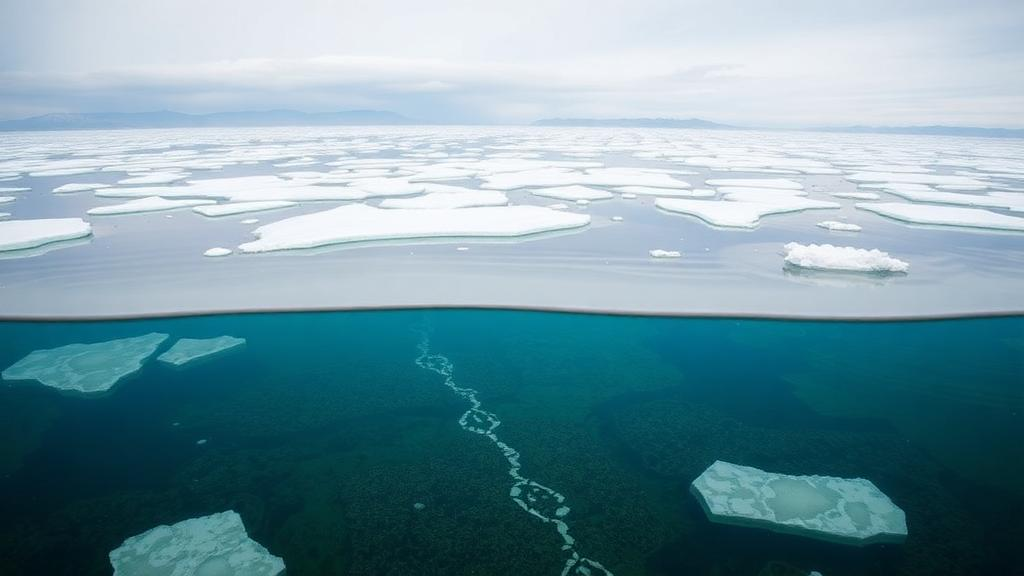
Beneath the waves of the southeastern North Sea, between the islands of Amrum and Heligoland, lies a hidden reservoir of brackish to nearly fresh groundwater that was emplaced tens of thousands of years ago by meltwater flowing under Pleistocene ice sheets. A research team led by Arne Lohrberg of Kiel University has now mapped this offshore freshened groundwater in unprecedented detail and shown that it is not confined to buried glacial channels but forms a laterally continuous body spanning tens of kilometres. Their work, published in Communications Earth & Environment, establishes a striking new link between the geomorphic scars left by ancient ice and the location of vast freshwater reserves under the seafloor, a connection that could transform how scientists search for offshore water resources around the world.
Offshore freshened groundwater is subsurface porewater whose salinity falls below that of ambient seawater, occurring in sediments and rocks beneath or seaward of the shoreline. The term describes a salinity state rather than an ongoing process, a distinction that recently prompted proposals to rename the phenomenon offshore relatively fresh groundwater. Whatever it is called, the resource has emerged as a significant yet poorly constrained component of the global hydrological cycle, with reservoirs now identified along continental margins worldwide. As water stress grows, particularly in densely populated coastal regions, understanding where these reserves sit, how they were emplaced, and how stable they are has become urgent. Beyond its resource value, offshore freshened groundwater matters for geohazard assessment, biogeochemical cycling, subseafloor microbiology and even the preservation of submerged archaeological records.
The conventional explanation for these reserves has long been meteoric recharge during sea-level lowstands. When continental shelves were exposed as dry land during glacial periods, rainwater could infiltrate sediments and displace saline porewater. Glacial processes offer a second, more dramatic emplacement route: meltwater generated at the bed of an ice sheet, pressurized by the sheer weight of ice potentially hundreds of metres thick, can be driven deep into underlying sediments with enormous hydraulic force. Numerical models show that hydraulic heads beneath Pleistocene ice sheets reached values equivalent to roughly 72 percent of the ice sheet height, imposing gradients far beyond anything achievable under a modern water table. Which of these two mechanisms dominated on formerly glaciated shelves has remained an open question, largely because mapping porewater salinity at regional scales offshore requires geophysical techniques that few studies have deployed.
The southeastern North Sea provided an ideal laboratory. The region is criss-crossed by extensive networks of tunnel valleys, large subglacial channels incised by high-pressure meltwater beneath ice sheets that repeatedly covered northern Europe during the Pleistocene. These valleys, typically showing an upper U-shaped and lower V-shaped cross-section, can cut through Miocene and Eocene strata deformed by salt tectonics and penetrate as deep as several hundred metres. Their fills generally comprise fine-grained glaciomarine silts and clays above coarse-grained basal gravels and sands that may enhance hydraulic permeability. Previous seismic surveys had documented the morphology of these landforms in exquisite detail, but lacked the complementary geophysical data needed to explicitly map freshwater distributions and infer emplacement mechanisms over regional scales.
To close that gap, the team acquired 320 kilometres of surface-towed time-domain controlled-source electromagnetic data along ten profiles in a 35 by 25 kilometre study area, using a modified modular system called SWAN. The setup consisted of a 100 metre horizontal electric dipole transmitter and two inline electric field receivers towed at optimized offsets, with positions logged by autonomous GPS units on surface buoys. The transmitter produced an optimized square waveform at 36 volts and up to 25 amperes, yielding an electric dipole moment of 2500 ampere-metres, with a 50 percent duty cycle at a period of two seconds. Data quality was consistently high, with 45 transients stacked per station and a relative noise floor of just 0.5 percent. Because electrical resistivity is highly sensitive to porewater salinity, the method can differentiate freshened pore fluids from seawater-saturated sediments when integrated with high-resolution seismic reflection profiles that constrain the stratigraphy.
The resistivity models revealed a remarkable feature: across all surveyed lines, a laterally extensive band of elevated resistivity, between 8 and 14 ohm-metres, crossing multiple stratigraphic units from the Pleistocene down to the Eocene. The band typically occurs between roughly 100 and 250 metres below seafloor, with a thickness of 50 to 150 metres, and locally extends deeper where tunnel valleys incised deepest. Representative profile P4 shows resistivities of 8 to 14 ohm-metres laterally continuous over more than 10 kilometres, with peaks near 16 ohm-metres mainly in Plio-Pleistocene sediments above the mid-Miocene unconformity. Profile P8, aligned along a tunnel valley axis, shows very low resistivities below 0.5 ohm-metres throughout its fine-grained upper fill, which dramatically emphasizes the contrast with the resistive band beneath. Bayesian statistical one-dimensional inversions at selected stations reproduced the principal features of the regularized two-dimensional models, confirming that the elevated-resistivity band is robust and not an artefact of inversion strategy.
Converting resistivity to salinity requires accounting for porosity, and here the team applied Archie’s law rigorously. For typical Pleistocene to Neogene porosity values of 20 to 50 percent, even the lower end of that range would require pore-fluid salinities of 3.5 to 16.3 practical salinity units to produce the observed resistivities, well below the roughly 35 PSU of seawater and corresponding to brackish to near-freshwater conditions. Alternative explanations were systematically ruled out. A porosity-driven explanation alone would demand an abrupt and regionally uniform porosity reduction at depths of 100 to 250 metres across multiple stratigraphic units, for which no independent geological or seismic evidence exists. Clay-bound water and mineral-surface conduction act to lower rather than raise bulk resistivity, an effect evident in the clay-rich upper valley fills that recorded the lowest resistivities of the entire survey. Diagenetic cementation is likewise not viable, since any accessory phase abundant enough to raise bulk resistivity would have to displace porewater, which the depth-bounded geometry of the band argues against.
With salinity established as the dominant control, the team turned to the mechanism. Meteoric recharge during sea-level lowstands cannot be entirely excluded, since the shelf was repeatedly exposed during ice-free intervals. But two quantitative arguments make it unlikely to be the dominant process. First, diffuse recharge from above must pass through overlying fine-grained intervals whose effective vertical permeability of 10 to the power of minus 18 to minus 17 square metres implies 10,000 to 100,000 years for one pore volume to traverse 250 metres even under a unit gravity gradient, longer than individual lowstand exposure windows. Second, areally distributed meteoric infiltration driven by a water-table gradient of order 10 to the power of minus 4 on this low-relief shelf would produce a freshened zone following the shallowest permeable units, whereas the observed band cuts across stratigraphy at a consistent depth. Subglacial meltwater flushing, by contrast, fits every observed characteristic. Pressurized meltwater entering at the ice bed follows laterally continuous coarser units governed by permeabilities of 10 to the power of minus 14 to minus 12 square metres, so flushing one pore volume over 100 to 250 metres requires between less than a decade and roughly 3,000 years, far shorter than the 10,000 to 100,000 year duration of a glacial stage. An independent check using modelled subglacial recharge rates of up to 6 millimetres per year shows pore-volume replacement within 3,000 to 13,000 years, achievable within a single glacial stage.
Preservation after deglaciation is equally well explained. Density contrasts between overlying freshwater and underlying saline formation waters limit vertical mixing, and fine-grained glaciomarine deposits deposited during interglacials seal the system from above, restricting seawater infiltration. Empirical evidence supports this stability: a hydrogeological study in Denmark showed that Pleistocene freshwaters in Miocene aquifers have persisted beneath marine confining layers despite Holocene marine inundation, while a recent Norwegian shelf study combining porewater profiles with reaction-transport modelling demonstrated that freshened zones emplaced by subglacial flushing can persist for millennia. Borehole data from IODP Expedition 347, specifically site M0060 near Anholt in the Baltic Sea, sampled two buried tunnel valleys and revealed markedly elevated electrical resistivities of roughly 30 to 50 ohm-metres at depths corresponding to measured interstitial water salinities between 2 and 10 PSU. Complementary data from more than 50 sediment samples in offshore wind-farm site surveys, accessible through the Federal Maritime and Hydrographic Agency PINTA data hub, show low salinities below 5 PSU at depths matching the top of the elevated resistivity band in the North Sea.
Tunnel valleys themselves add hydrogeological complexity. Where they intersect deeper Neogene or Paleogene units, they may act as pathways for localized saline intrusion, expressed as low-resistivity anomalies in the data. Their hydraulic role is thus twofold: they operated as meltwater conduits during glaciations, a palaeo-hydraulic function, whereas today they may channel localized saline intrusion, a present-day function. At the same time, their morphology and distribution provide clear geomorphic evidence of past subglacial meltwater pathways under high hydraulic heads, making them valuable predictive proxies for regionally extensive freshened groundwater bodies. Because these landforms are routinely mapped in seismic archives already collected across formerly glaciated shelves, the relationship provides a directly testable, cost-effective screening criterion: existing high-resolution seismic datasets can identify priority areas for more detailed electromagnetic surveys and scientific drilling. The framework depends on four boundary conditions that may differ between margins: ice thickness and advance rates controlling hydraulic head magnitude, shelf sediment architecture and permeability governing flushing depth and extent, post-glacial sea-level history and confining layers determining preservation, and local structural complexity such as salt tectonics disrupting regional flow. Regions broadly comparable to the North Sea, including the Skagerrak-Kattegat region, the Baltic Sea and the Barents Sea shelf, are prime candidates. Similar resistive features on the U.S. Atlantic shelf off New Jersey and New England suggest comparable systems likely occur beneath other formerly glaciated and ice-marginal continental shelves. The southeastern North Sea likely hosts substantial freshened groundwater bodies that may extend throughout much of the shelf, adding a hidden glacial legacy to the global water cycle and reframing offshore freshened groundwater from isolated anomalies into regionally extensive systems written by the ice sheets of the Pleistocene.
Subject of Research: Subglacial landforms as proxy for offshore freshened groundwater in formerly glaciated margins
Article Title: Subglacial landforms as proxy for offshore freshened groundwater in formerly glaciated margins
Article References: Lohrberg, A., Haroon, A., Moosdorf, N., Grob, H., Hadré, E., Wallmeier, C., Pastoressa, A. E., Micallef, A., & Krastel, S. (2026). Subglacial landforms as proxy for offshore freshened groundwater in formerly glaciated margins. Communications Earth & Environment, 7(1), Article 832. https://doi.org/10.1038/s43247-026-04149-9
Image Credits: AI Generated
DOI: 10.1038/s43247-026-04149-9
Keywords: Subglacial, landforms, proxy, offshore, freshened, groundwater, formerly, glaciated, margins, scientific research
Cite Scienmag News
Violet Maxwell. (October 17, 2026). Ancient Ice Age Rivers Left Vast Freshwater Reserves Beneath the North Sea. Scienmag. https://scienmag.com/ancient-ice-age-rivers-left-vast-freshwater-reserves-beneath-the-north-sea/
Violet Maxwell. "Ancient Ice Age Rivers Left Vast Freshwater Reserves Beneath the North Sea." Scienmag, 17 October 2026, https://scienmag.com/ancient-ice-age-rivers-left-vast-freshwater-reserves-beneath-the-north-sea/. Accessed 17 October 2026.
Violet Maxwell. "Ancient Ice Age Rivers Left Vast Freshwater Reserves Beneath the North Sea." Scienmag. October 17, 2026. https://scienmag.com/ancient-ice-age-rivers-left-vast-freshwater-reserves-beneath-the-north-sea/