


Researchers in South China have unveiled a new data-driven framework that promises to transform how explorers hunt for deeply buried uranium deposits hidden within granite terrains. In a study published in Earth Science Informatics, a team led by Jianan Zhao of the Guangdong Provincial Institute of Mineral Resources Exploration, together with Yingru Pei of the Institute of Geomechanics at the Chinese Academy of Geological Sciences and Chonghao Liu of the Chinese Academy of Geological Sciences, combined an empirical law from structural geology with multivariate spatial statistics to build a quantitative “Tectonic Control Index” for targeting concealed hydrothermal mineralization. Applied to the granite-hosted uranium field of the southern Zhuguang Mountain region in Northern Guangdong, the method achieved an area under the receiver operating characteristic curve (AUC) of 0.81 and captured 75 percent of known uranium deposits within just 30 percent of the study area — a performance that could reshape exploration strategy in structurally complex terrains worldwide.
The fundamental challenge the researchers set out to solve is one that has long frustrated mineral explorers. Structural fault frameworks exert a decisive control on hydrothermal uranium metallogenic systems: fluids carrying dissolved uranium migrate through permeable fault zones and fracture networks, precipitating ore where temperature, pressure and chemistry align. Yet conventional prospectivity assessments rely largely on qualitative or semi-quantitative analyses of fault traces exposed at the surface, and they say little about how deep those structures actually penetrate into the crust. Because granite-hosted uranium deposits typically form at depth along deeply rooted fluid conduits, a surface trace that dies out a few hundred meters down is of far less exploration value than one that connects to deep-seated structural architectures. Moreover, when explorers attempt to combine multiple lines of geological evidence — fault density, fault intersections, distance measures — they often resort to subjective weighting schemes that introduce bias into the final prospectivity map.
The first pillar of the new framework addresses the depth problem using the empirical displacement-length (D-L) scaling law, one of the most robust relationships in structural geology. Decades of field and geodetic observations have shown that the maximum displacement accumulated along a fault scales approximately linearly with its mapped trace length: D = γL, where γ is a proportionality constant typically on the order of 10⁻² for crustal faults. Because fault displacement also relates to fault growth and dimensions in three dimensions, the D-L relationship allows geologists to estimate a fault’s vertical extension — how deep it reaches beneath the surface — from measurements made entirely at the surface. In the Zhuguang Mountain study, the team applied this scaling law to the mapped fault inventory as an a priori “architectural filter,” estimating each fault’s probable downward reach and using those estimates to verify which surface traces possess genuine deep connectivity to the plumbing system that feeds hydrothermal mineralization. Faults whose calculated extensions were too shallow to tap the deep fluid reservoirs could be down-weighted, while deeply penetrating structures were elevated as candidate ore-conduit pathways.
The second pillar confronts the statistical problem of combining multiple spatial parameters without letting arbitrary choices corrupt the result. The researchers selected four key spatial descriptors computed within a geographic information system environment: fault linear density (LD), which quantifies the total fault trace length per unit area; fault intersection kernel density (KD), which highlights zones where faults cross and interact — locations widely recognized as preferentially permeable and favorable for fluid focusing; and two Euclidean distance (ED) rasters measuring proximity to faults and proximity to fault intersections, respectively. These variables are notoriously spatially multicollinear: areas of high fault density tend also to be close to faults and to contain many intersections, so naively summing them double-counts the same structural signal. To resolve this, the team applied Principal Component Analysis (PCA), a classical dimensionality-reduction technique that transforms correlated variables into a set of orthogonal components. Each principal component captures an independent axis of structural variation, and the component loadings reveal the intrinsic correlations among the original variables. Crucially, PCA also yields an objective basis for weighting: the variance explained by each component provides a data-derived factor weight, replacing subjective expert judgment with a transparent statistical criterion.
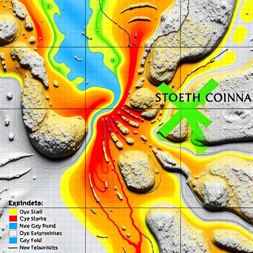
The product of this analysis is the Tectonic Control Index (TCI), a single, continuous spatial layer that synthesizes the multidimensional fault-architecture information into one depth-calibrated prospectivity proxy. High TCI values mark locations where dense, deeply connected, densely intersecting fault networks converge — precisely the environments in which hydrothermal fluids are channeled, mixed, cooled and chemically triggered to deposit uranium. The granite batholiths of the southern Zhuguang Mountains, part of the Nanling belt that hosts some of China’s most important granite-related uranium ore fields, provided an ideal natural laboratory. The region’s uranium deposits are of hydrothermal origin, precipitated from hot fluids circulating through structurally controlled conduits within the granites, and previous research has documented that fault intersections and damage zones serve as the primary siting controls for orebodies.
One of the study’s most elegant technical contributions lies in how the researchers defined “favorable” ground statistically rather than arbitrarily. When the distribution of TCI values across the study area was examined, it displayed a right-skewed, outlier-rich character — exactly the behavior predicted by the Central Limit Theorem (CLT) for a composite index built from many quasi-independent spatial variables. Because the TCI is effectively a weighted summation of multiple spatial proxies, its background behavior tends toward normality, and anomalously high values stand out as statistical outliers above that background. The team exploited this by applying a threshold of μ + 2σ — the regional mean plus two standard deviations — to objectively delineate high-potential zones. Locations exceeding this threshold are statistically improbable under the background model, and their spatial correspondence with inferred fluid pathways and known ore deposits provided a rigorous, reproducible criterion for exploration targeting rather than a hand-drawn favorability contour.
Validation was performed using receiver operating characteristic (ROC) analysis, the standard technique for evaluating binary predictive models. By plotting the true positive rate against the false positive rate as the TCI threshold is varied, the researchers quantified how effectively the index discriminates between ground that hosts known deposits and ground that does not. The resulting AUC of 0.81 indicates substantial discriminatory power — well above the 0.5 of random guessing and comfortably within the range considered useful for prospectivity mapping. Perhaps more compelling for practical exploration is the success-rate statistic: 75 percent of the known uranium deposits in the southern Zhuguang field fall within the top 30 percent of the area ranked by TCI. In an industry where drilling a single deep granite hole can cost hundreds of thousands of dollars, concentrating three-quarters of known mineralization into less than a third of the mapped terrain represents a meaningful reduction in exploration risk.
The geological logic underlying the model aligns closely with what is known about granite-hosted uranium systems in South China and internationally. Fault zone architecture controls permeability structure: fault cores may seal, but damage zones surrounding them remain fractured and transmissive, and intersections between faults create nodal zones of enhanced connectivity where fluids converge. Uranium, transported in oxidizing hydrothermal fluids, is reduced and precipitated when fluids interact with reducing host rocks or mix with chemically distinct waters — processes most likely to occur along these deeply penetrating structural conduits. By calibrating the depth dimension through D-L scaling and the spatial dimension through statistically weighted fault geometry, the TCI captures the two ingredients that matter most for hydrothermal ore formation: a connected pathway from fluid source to deposition site, and a locus of focused flow where deposition is likely.
The implications extend well beyond uranium in South China. As shallow, easily discovered deposits are progressively exhausted, the global mining industry is pivoting toward deep and concealed resources, and prospectivity modeling has become a core tool of modern exploration geology. Yet many contemporary approaches lean heavily on machine learning, which, while powerful, can behave as a black box and is vulnerable to exploration bias — the distortion that arises because known deposits cluster in areas that were drilled first. The framework of Zhao, Pei and Liu offers a complementary middle path: it is quantitative and data-driven, but every step remains geologically interpretable, from the scaling-law depth filter to the PCA loadings to the CLT-based threshold. Its architecture could be adapted to other structurally controlled hydrothermal systems — granite-related tin and tungsten, orogenic gold, epithermal precious metals — wherever fault connectivity governs mineralization.
For a world increasingly dependent on nuclear energy as a low-carbon power source, secure and expandable uranium supply chains carry strategic weight, and new exploration tools that lower the cost and risk of discovery are timely. The study, funded by the Beijing Research Institute of Uranium Geology, the Guangdong Provincial Geological Joint Fund and the China Geological Survey, demonstrates that careful integration of classical structural geology with rigorous spatial statistics can outperform intuition-based approaches in some of the most geologically challenging terrains on Earth. As exploration frontiers push deeper beneath cover, the lesson from the Zhuguang Mountains is clear: the geometry of buried fault networks can be quantified, weighted and thresholded with statistical confidence — and the ore follows the structure.
Cite Scienmag News
Violet Maxwell. (September 6, 2026). Spatial statistics refine granite-hosted uranium exploration models. Scienmag. https://scienmag.com/spatial-statistics-refine-granite-hosted-uranium-exploration-models/
Violet Maxwell. "Spatial statistics refine granite-hosted uranium exploration models." Scienmag, 6 September 2026, https://scienmag.com/spatial-statistics-refine-granite-hosted-uranium-exploration-models/. Accessed 6 September 2026.
Violet Maxwell. "Spatial statistics refine granite-hosted uranium exploration models." Scienmag. September 6, 2026. https://scienmag.com/spatial-statistics-refine-granite-hosted-uranium-exploration-models/


